Hoddøya
Hoddøya is an island in the municipality of Namsos in Trøndelag county, Norway. It lies in the Namsenfjorden, about 12 kilometres (7.5 mi) west of the town of Namsos. The island is located between the island of Otterøya (to the north and east) and the mainland of Namdalseid municipality (to the south and west).[1] The highest point on the 10.3-square-kilometre (4.0 sq mi) island is the 207-metre (679 ft) tall mountain Vattafjellet.
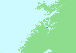 | |
 Hoddøya Location of the island  Hoddøya Hoddøya (Norway) | |
| Geography | |
|---|---|
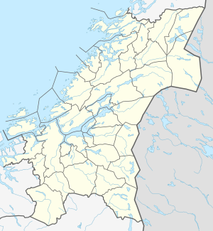
| Location | Trøndelag, Norway |
| Coordinates | 64.4822°N 11.2140°E |
| Area | 10.3 km2 (4.0 sq mi) |
| Length | 5.5 km (3.42 mi) |
| Width | 3.5 km (2.17 mi) |
| Coastline | 25 km (15.5 mi) |
| Highest elevation | 207 m (679 ft) |
| Highest point | Vattafjellet |
| Administration | |
Norway | |
| County | Trøndelag |
| Municipality | Namsos |
See also
This article is issued from Wikipedia. The text is licensed under Creative Commons - Attribution - Sharealike. Additional terms may apply for the media files.