Hjelmelandsvågen
Hjelmelandsvågen is the administrative centre of Hjelmeland municipality, Norway. The village is located on the south side of the mouth of the Jøsenfjorden. The 0.67-square-kilometre (170-acre) village has a population (2015) of 558, giving the village a population density of 833 inhabitants per square kilometre (2,160/sq mi).[1]
Hjelmelandsvågen | |
|---|---|
Village | |
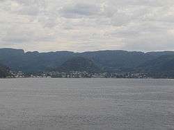 View of the village | |
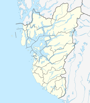 Hjelmelandsvågen Location in Rogaland county  Hjelmelandsvågen Hjelmelandsvågen (Norway) | |
| Coordinates: 59°14′11″N 06°10′38″E | |
| Country | Norway |
| Region | Western Norway |
| County | Rogaland |
| District | Ryfylke |
| Municipality | Hjelmeland |
| Area | |
| • Total | 0.67 km2 (0.26 sq mi) |
| Elevation | 2 m (7 ft) |
| Population (2015)[1] | |
| • Total | 558 |
| • Density | 833/km2 (2,160/sq mi) |
| Time zone | UTC+01:00 (CET) |
| • Summer (DST) | UTC+02:00 (CEST) |
| Post Code | 4130 Hjelmeland |
The Norwegian National Road 13 runs through the village, with a ferry connection across the Jøsenfjorden and to the nearby island of Ombo. The village sits about 10 kilometres (6.2 mi) northeast of the village of Fister and about the same distance north of the village of Årdal. Hjelmeland Church is located in the village.[3]
References
- Statistisk sentralbyrå (1 January 2015). "Urban settlements. Population and area, by municipality".
- "Hjelmelandsvågen, Hjelmeland (Rogaland)" (in Norwegian). yr.no. Retrieved 2016-01-26.
- Store norske leksikon. "Hjelmelandsvågen" (in Norwegian). Retrieved 2016-01-26.
This article is issued from Wikipedia. The text is licensed under Creative Commons - Attribution - Sharealike. Additional terms may apply for the media files.