Hillsborough, Auckland
Hillsborough is suburb of Auckland, New Zealand. It is under the local governance of the Auckland Council.
Hillsborough | |
|---|---|
Suburb | |

| |
| Country | New Zealand |
| Local authority | Auckland Council |
| Electoral ward | Albert-Eden-Puketāpapa Ward |
| Population (2018) | |
| • Total | 12,489 |
| Mount Roskill | Three Kings | Royal Oak |
| Waikowhai |
|
Onehunga |
| Manukau Harbour |
Hillsborough is a leafy suburb of 20th-century houses. The area is serviced by two shopping areas; Onehunga and Three Kings. The area is served by secondary schools Mount Roskill Grammar School and Marcellin College.
Demographics
| Year | Pop. | ±% p.a. |
|---|---|---|
| 2006 | 10,575 | — |
| 2013 | 11,118 | +0.72% |
| 2018 | 12,489 | +2.35% |
| Source: [1] | ||
Hillsborough, comprising the statistical areas of Hillsborough North (Auckland), Hillsborough West (Auckland), Hillsborough East (Auckland) and Hillsborough South (Auckland), had a population of 12,489 at the 2018 New Zealand census, an increase of 1,371 people (12.3%) since the 2013 census, and an increase of 1,914 people (18.1%) since the 2006 census. There were 3,870 households. There were 6,171 males and 6,315 females, giving a sex ratio of 0.98 males per female, with 1,965 people (15.7%) aged under 15 years, 3,252 (26.0%) aged 15 to 29, 5,478 (43.9%) aged 30 to 64, and 1,791 (14.3%) aged 65 or older.
Ethnicities were 38.4% European/Pākehā, 5.3% Māori, 8.1% Pacific peoples, 52.7% Asian, and 3.5% other ethnicities (totals add to more than 100% since people could identify with multiple ethnicities).
The proportion of people born overseas was 52.9%, compared with 27.1% nationally.
Although some people objected to giving their religion, 34.1% had no religion, 35.9% were Christian, and 25.7% had other religions.
Of those at least 15 years old, 3,885 (36.9%) people had a bachelor or higher degree, and 1,029 (9.8%) people had no formal qualifications. The employment status of those at least 15 was that 5,325 (50.6%) people were employed full-time, 1,521 (14.5%) were part-time, and 330 (3.1%) were unemployed.[1]
History
The suburb was named for James Carlton Hill who left land to the City for use as public domains in his 1858 will.
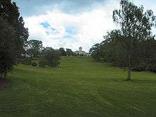
The most interesting building in the area is Pah Homestead (or The Pah). This building was constructed for James Williamson by Thomas Mahoney on the 313 acre estate Pah Farm in 1877-9. Of plastered brick in the Italianate style it is based upon Queen Victoria & Prince Albert's house Osbourne House in the Isle of Wight. It was allegedly the largest house ever built in New Zealand and certainly one of the most expensive.[2]
Following the failure of Williamson's business concerns after the stockmarket crash of 1886, the estate was progressively broken up and sold off. Various organisations established facilities on the smaller but still spacious properties that resulted from the subdivision; a Franciscan Friary, Marcellin College for boys, Roskill Masonic Hospital, and Liston Village (a residential home which includes the historic Pah Stable Block). Other parts of the property were purchased by the Hillsborough Bowling Club, The Church of Jesus Christ of Latter-day Saints who built a church on Pah Road, Sanitarium Wholefoods and Holeproof Enterprises who built factories on Pah Road and Auckland City Council who created Seymour Park. The rest of the extensive farmland was redeveloped as suburban housing although a portion to the south of Herd Road is still utilised for grazing land probably because it is very steep. The two storied Farm Managers House still stands at 1 Warren Avenue.
The Pah Mansion was eventually purchased by the Roman Catholic Church in 1913 and renamed Monte Cecilia. Part of the remaining land close to the house was developed as Monte Cecilia Primary School, and the house itself was used as emergency housing for many years. The Auckland City Council purchased the property in 2002. Its magnificent grounds contain a number of interesting specimen trees and is now part of a public park named Monte Cecilia Park which will eventually include the site of Monte Cecilia Primary School which will be relocated elsewhere in the area. The house has been renovated and is now being used to display Sir James Wallace's extensive collection of New Zealand Modern art.[3]
Education
Hillsborough School is a coeducational contributing primary school (years 1-6) with a roll of 413 as of March 2020.[4][5]
References
- Colonial Architecture In New Zealand. John Stacpoole. A.H & A.W. Reed 1976, ISBN 0589009303.
- "Statistical area 1 dataset for 2018 Census". Statistics New Zealand. March 2020. Hillsborough North (Auckland) (142000), Hillsborough West (Auckland) (142100), Hillsborough East (Auckland) (142900) and Hillsborough South (Auckland) (143600). 2018 Census place summary: Hillsborough North (Auckland) 2018 Census place summary: Hillsborough West (Auckland) 2018 Census place summary: Hillsborough East (Auckland) 2018 Census place summary: Hillsborough South (Auckland)
- Stone, R. C. J. "Williamson, James - Biography". Dictionary of New Zealand Biography. Ministry for Culture and Heritage. Retrieved 31 March 2012.
- "Archived copy". Archived from the original on 22 April 2006. Retrieved 23 April 2006.CS1 maint: archived copy as title (link)
- "New Zealand Schools Directory". New Zealand Ministry of Education. Retrieved 26 April 2020.
- Education Counts: Hillsborough School
External links
- Photographs of Hillsborough held in Auckland Libraries' heritage collections.