Gurua
Gurua is a community development block that forms an administrative division in Gaya district, Bihar state, India.
Gurua | |
|---|---|
Community development block | |
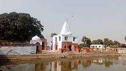 Gurua surya mandir | |
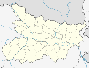 Gurua Location in Bihar, India | |
| Coordinates: 24.668643°N 84.772342°E | |
| Country | |
| State | Bihar |
| District | Gaya |
| CD block | Gurua |
| Time zone | UTC+5:30 (IST) |
| PIN | 824205(Gurua) |
| Telephone/STD code | +91631 |
| Vehicle registration | BR 02 |
| Lok Sabha constituency | Aurangabad |
| Vidhan Sabha constituency | Gurua |
| Website | gaya |
Geography
Gurua is located at 24°40′07″N 84°46′20″E.[1]
Literacy
As per 2011 census, literacy in Dhanbad district was 72.52. Literacy in Bihar (for population over 7 years) was 60.41% in 2011. Literacy in India in 2011 was 74.04%.[2]
References
- "Gaya, India Page". fallingrain.com. Retrieved 23 December 2015.
- "Villages & Towns in Gurua Block of Gaya, Bihar". census2011.co.in. Archived from the original on 12 January 2017. Retrieved 13 September 2016.
This article is issued from Wikipedia. The text is licensed under Creative Commons - Attribution - Sharealike. Additional terms may apply for the media files.