Gulliver Nunatak
Gulliver Nunatak (66°12′S 62°40′W) is a nunatak with a flat, ice-free summit, 575 metres (1,890 ft) high, at the north side of Adie Inlet, on the east coast of Graham Land, Antarctica. It was charted by the Falkland Islands Dependencies Survey (FIDS) and photographed from the air by the Ronne Antarctic Research Expedition (RARE) in 1947. It was named by the FIDS for the fictional character in Jonathan Swift's Gulliver's Travels, because when viewed from the southeast its appearance is suggestive of a man lying on his back with his head toward the south.[1]
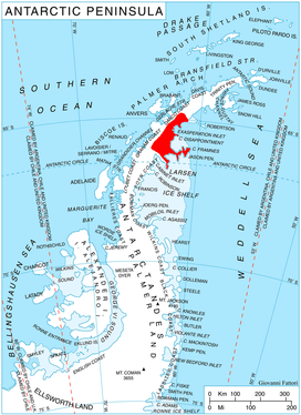
Location of Oscar II Coast on Antarctic Peninsula.
References
- "Gulliver Nunatak". Geographic Names Information System. United States Geological Survey. Retrieved 2012-05-11.
![]()
This article is issued from Wikipedia. The text is licensed under Creative Commons - Attribution - Sharealike. Additional terms may apply for the media files.