Gullfjellet
Gullfjellet or Gulfjellet is a 987-metre (3,238 ft) tall mountain in Vestland county, Norway. It is situated on the border between the municipalities of Bergen and Samnanger, and it is the highest mountain in the municipality of Bergen. The name "Gul" is an old name for a strong wind, so the old name - Gulfjellet - means "the mountain with strong wind".
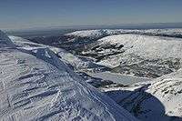
View from Gullfjellet.
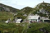
Redningshytten at Gullfjellet.
| Gullfjellet | |
|---|---|
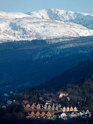 Gullfjellet in the horizon. Garnes in front. | |
| Highest point | |
| Elevation | 987 m (3,238 ft) |
| Prominence | 714 m (2,343 ft) [1] |
| Coordinates | 60.3731°N 5.5804°E[2] |
| Geography | |
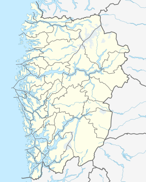 Gullfjellet Location of the mountain  Gullfjellet Gullfjellet (Norway) | |
| Location | Vestland, Norway |
| Topo map | 1215 IV Samnanger |
| Climbing | |
| Easiest route | Hiking along cairns |
Due to its importance as a hiking attraction, and much bad weather, large and numerous cairns have been put up ("Varderekka") to guide hikers from both sides of the mountain. The watercourses on Gullfjellet supports large parts of the Bergen region with piped water.
Svartavatnet is situated 400 metres (1,300 ft) to the west of the mountain.[3]
See also
- List of mountains of Norway
References
- "Fjellforum". Archived from the original on 2007-09-27.
- "Gullfjellet, Bergen (Vestland)" (in Norwegian). yr.no. Retrieved 2020-03-01.
- Her er Bergens nye vannreserve
This article is issued from Wikipedia. The text is licensed under Creative Commons - Attribution - Sharealike. Additional terms may apply for the media files.