Guadiela
The Guadiela is a river in the Iberian Peninsula, a left-bank tributary of the Tagus and the latter's major upper-course tributary.[1][2]
| Guadiela | |
|---|---|
 | |
| Location | |
| Country | Spain |
| Region | Castilla–La Mancha |
| Physical characteristics | |
| Source | |
| • location | Fuente Pinilla (Serranía de Cuenca) |
| Mouth | Tagus |
• coordinates | 40°21′45″N 2°48′58″W |
| Length | 117 kilometres (73 mi) |
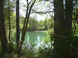
The Guadiela has its source in the Serranía de Cuenca, near Cueva del Hierro,[3] at the Fuente Pinilla site.[4] It flows from East to West for 117 kilometres (73 mi),[2] passing through the Spanish province of Cuenca, emptying into the Tagus at the Bolarque reservoir,[5] on the border between the provinces of Cuenca and Guadalajara. It is dammed upstream by the Buendía reservoir.[1]
It receives the waters from the Cuervo, Guadamejud, Mayor and Trabaque.[2]
The hydronym Guadiela is formed by 'Guad' (of Arabic origin, conveying the meaning of "river") and the '-iela' suffix (a diminutive).[6]
References
- Jiménez Aparicio, Benito (1947). "Los pantanos de Entrepeñas y Buendía y su túnel de enlace" (PDF). Revista de Obras Públicas. XCV (2784): 147.
- "Datos geográficos y toponimia". Instituto Geográfico Nacional.
- Gómez de Arteche, José (1859). Geografía histórico-militar de España y Portugal (PDF). 2. Madrid: Establecimiento Tipográfico de Don Francisco de P. Mellado. p. 316.
- Cava Marco, Maximiliano (2014). "Escaños y fuentes de antaño" (PDF). Revista Mansiegona: 18.
- "Page visita este lunes el lugar donde empieza el trasvase Tajo-Segura". Guadalajara Diario. 22 April 2018.
- López de los Mozos Jiménez, José Ramón; Ranz Yubero, José Antonio (2003). "La toponimia en el viaje a la Alcarria y estudio de algunos topónimos menores". Revista de Folklore. pp. 55–72. ISSN 0211-1810 – via Biblioteca Virtual Miguel de Cervantes.
This article is issued from Wikipedia. The text is licensed under Creative Commons - Attribution - Sharealike. Additional terms may apply for the media files.