Glaze Brook
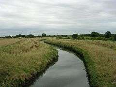
The Glaze Brook, or River Glaze, is a minor river in Greater Manchester, England. From Lately Common (south of Leigh) to the River Mersey it forms the county boundary with Cheshire.[1] It is about 22 miles (35 km) long and its main tributaries are the Astley, Bedford, Hey, Pennington, Shaw and Westleigh Brooks.[2]
| Glaze Brook | |
|---|---|
 The Glaze Brook | |
| Location | |
| Country | England |
| Region | North West England |
| District | Wigan, Greater Manchester, Warrington, Cheshire |
| Physical characteristics | |
| Source | |
| • location | Pennington Flash |
| Mouth | |
• location | River Mersey |
The Glaze Brook drains a large area around Leigh and is formed at the outflow of Pennington Flash 53°29′06″N 2°32′07″W close to Aspull Common. Pennington Flash is fed by Hey Brook, a continuation of Borsdane Brook, which runs southwards from Blackrod.
After picking up the waters of Bedford Brook, which runs southward from Leigh and the Black or Moss Brook coming west from Worsley via Chat Moss, the brook turns southward, ultimately draining into the River Mersey section of the Manchester Ship Canal near Cadishead.
The Glaze Brook's catchment drains the flat lowland around Leigh which reaches a maximum altitude of 158 mAOD. The brook flows through largely agricultural land. Its tributaries extend into former mining and industrial areas in which mining subsidence has created flashes (lakes) at Pennington and Westleigh. The underlying geology is the sandstone and coal measures of the Lancashire Coalfield.[3]
Etymology
Tributaries
- Willow Brook
- Jibcroft Brook
- Carr Brook
- Black/Moss Brook
- Bedford Brook
- Lilford Park Brook
- Atherton Lake Brook
- Atherton Brook
- Collier Brook
- Hindsford Brook
- Shakerley Brook
- Old Mill Brook
- Cutacre Brook
- Old Mill Brook
- Chanters Brook
- Carr Brook
- Shakerley Brook
- Atherton Brook
- Atherton Lake Brook
- Pen Leach Brook
- Lilford Park Brook
- Town Brook
- Astley Brook
- Elennor Brook
- Honksford Brook
- Elennor Brook
- Astley Brook
- Whitehead Brook
- Stirrup Brook
- Ellen Brook
- Stirrup Brook
- Shaw Brook
- Bedford Brook
- Pennington Brook
- Hey Brook
- Westleigh Brook
- Small Brook
- Marsh Brook
- Cunningham Brook
- Pennington Brook (Westhoughton)
- Cunningham Brook
- Hall Lee Brook
- Windy Bank Brook
- Nan Holes Brook
- Coffin Lane Brook
- Borsdane Brook
- Dog Pool Brook
- Westleigh Brook
- Hey Brook
References
- Landscape Character Assessment Chapter 7: Type 5. River flood plain, Warrington Borough Council, 12 December 2011, archived from the original on 26 July 2013, retrieved 4 May 2013
- Glaze - Summary, Environment Agency, retrieved 2 January 2015
- Glaze Brook at Little Woolden Hall (69005), Environment Agency, retrieved 27 January 2013