Georgia State Route 301
State Route 301 (SR 301) is a south-north state highway located in the northwestern corner of the U.S. state of Georgia. Its route is entirely within Dade County.
| ||||
|---|---|---|---|---|
 | ||||
| Route information | ||||
| Maintained by GDOT | ||||
| Length | 10.3 mi[1] (16.6 km) | |||
| Major junctions | ||||
| South end | ||||
| North end | ||||
| Location | ||||
| Counties | Dade | |||
| Highway system | ||||
| ||||

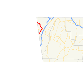
Route description
SR 301 begins at the Alabama state line southwest of Trenton, where the roadway continues as Alabama State Route 75. The route heads northeast to an intersection with SR 136 west of Trenton. The highway continues heading northeast, before curving back to the northwest. It continues heading northwest, until it meets its northern terminus, a second encounter with the Alabama state line, where the roadway continues as Jackson County Road 90. The route's entire length is atop Sand Mountain.
History
Major intersections
The entire route is in Dade County.
| Location | mi[1] | km | Destinations | Notes | |
|---|---|---|---|---|---|
| | 0.0 | 0.0 | Continuation beyond Alabama state line | ||
| | 3.2 | 5.1 | |||
| | 10.3 | 16.6 | Continuation beyond Alabama state line | ||
| 1.000 mi = 1.609 km; 1.000 km = 0.621 mi | |||||
See also
.svg.png)

References
- Google (February 9, 2013). "Route of SR 301" (Map). Google Maps. Google. Retrieved February 9, 2013.
External links
This article is issued from Wikipedia. The text is licensed under Creative Commons - Attribution - Sharealike. Additional terms may apply for the media files.