Georgia State Route 202
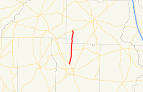
State Route 202 (SR 202) is a south–north state highway in the southern part of the U.S. state of Georgia. Its routing lies within portions of Thomas and Colquitt counties.
| ||||
|---|---|---|---|---|
 | ||||
| Route information | ||||
| Maintained by GDOT | ||||
| Length | 15.6 mi[1] (25.1 km) | |||
| Major junctions | ||||
| South end | ||||
| North end | ||||
| Location | ||||
| Counties | Thomas, Colquitt | |||
| Highway system | ||||
| ||||

Route description
The route begins at an intersection with US 19/SR 3/SR 300 north of Thomasville, in Thomas County. It heads due north to a short concurrency with SR 188. A little ways north of the end of the concurrency, the route enters Colquitt County. It continues heading north until it meets its northern terminus, and intersection with SR 111 southwest of Moultrie.
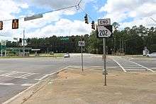
SR 202 end, Thomas County
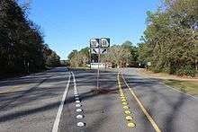
SR 188 202 split, Thomas County
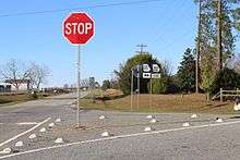
SR 202 end, Colquitt County
Major intersections
| County | Location | mi[1] | km | Destinations | Notes |
|---|---|---|---|---|---|
| Thomas | | 0.0 | 0.0 | Southern terminus | |
| | 5.2 | 8.4 | Southern end of SR 188 concurrency | ||
| | 6.6 | 10.6 | Northern end of SR 188 concurrency | ||
| Colquitt | | 15.6 | 25.1 | Northern terminus | |
1.000 mi = 1.609 km; 1.000 km = 0.621 mi
| |||||
See also
.svg.png)

References
- Google (June 9, 2013). "Route of SR 202" (Map). Google Maps. Google. Retrieved June 9, 2013.
External links

- Georgia Roads (Routes 201 - 220)
This article is issued from Wikipedia. The text is licensed under Creative Commons - Attribution - Sharealike. Additional terms may apply for the media files.