Gambier (commune)
Gambier is a commune of French Polynesia in the archipelago of the Tuamotu Islands. The commune includes the Gambier Islands and several nearby groups of islands, including the Acteon Group, and the nearby atolls of Maria Est, Morane, Marutea Sud and Temoe (23°20′46″S 134°28′28″W), mostly uninhabited, and are sometimes mistakenly included among the Gambier Islands themselves. Its population was 1,535 at the 2017 census.[1] Its total land area is 46.0 km2.[2]
Gambier | |
|---|---|
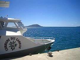 A ship from Gambier | |
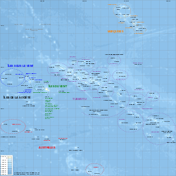 Location of Gambier in the Tuamotu Archipelago | |
Location of Gambier %26groups%3D_714fb89d85bb94d7e6d07ef20a5dedaba661e1e5.svg)
| |
| Coordinates: 23°08′S 134°56′W | |
| Country | France |
| Overseas collectivity | French Polynesia |
| Subdivision | Îles Tuamotu-Gambier |
| Government | |
| • Mayor (2008–2014) | Monique Labbeyi-Richeton |
| Area 1 | 46.0 km2 (17.8 sq mi) |
| Population (2017) | 1,535 |
| • Density | 33/km2 (86/sq mi) |
| Time zone | UTC−09:00 |
| INSEE/Postal code | 98719 /98755 |
| Elevation | 0–441 m (0–1,447 ft) |
| 1 French Land Register data, which excludes lakes, ponds, glaciers > 1 km2 (0.386 sq mi or 247 acres) and river estuaries. | |
Administration
The commune of Gambier is made up of the following islands:[1][3]
The chef-lieu of the commune is the village Rikitea[3] on the island of Mangareva.
Together with the Tuamotus, the Gambier Islands form the administrative subdivision Îles Tuamotu-Gambier (French officially: la subdivision administrative des îles Tuamotu-Gambier), one of the five primary administrative divisions of French Polynesia.[4]
The commune Gambier, together with the communes in the eastern part of the Tuamotus (Anaa, Fangatau, Hao, Hikueru, Makemo, Napuka, Nukutavake, Puka-Puka, Reao, Tatakoto and Tureia), forms Îles Gambier et Tuamotu de l'Est, one of the 8 electoral sections for the Assembly of French Polynesia (Assemblée de la Polynésie française).[5]
History
see Gambier Islands
See also
- Communes of French Polynesia
References
- Répartition de la population en Polynésie française en 2017, Institut de la statistique de la Polynésie française
- "R1- Population sans doubles comptes, des subdivisions, communes et communes associées de Polynésie française, de 1971 à 1996". Institut de la statistique de la Polynésie française. Retrieved 2019-03-14.
- Décret n°72-407 du 17 mai 1972 portant création de communes dans le territoire de la Polynésie française, Légifrance
- Décret n° 2005-1611 du 20 décembre 2005 pris pour l'application du statut d'autonomie de la Polynésie française, Légifrance
- Loi organique n° 2011-918 du 1er août 2011 relative au fonctionnement des institutions de la Polynésie française (1), Légifrance