Fisher River (North Carolina)
The Fisher River is a tributary of the Yadkin River in northwestern North Carolina in the United States, also draining a very small portion of southwestern Virginia.[6] Via the Yadkin it is part of the watershed of the Pee Dee River, which flows to the Atlantic Ocean. According to the Geographic Names Information System, it has also been known historically as "Big Fishers River," "Fish River" and "Fishe River."[7]
| Fisher River Tributary to Yadkin River | |
|---|---|
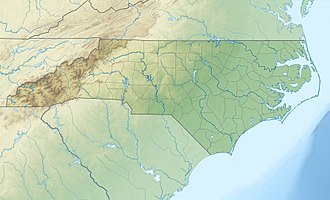 Location of Fisher River mouth | |
| Location | |
| Country | United States |
| State | North Carolina Virginia |
| Counties | Surry (NC) Grayson (VA) |
| Physical characteristics | |
| Source | divide between Fisher River and New River |
| • location | about 1 mile east of Low Gap, Virginia |
| • coordinates | 36°34′13″N 080°52′03″W[1] |
| • elevation | 2,640 ft (800 m)[2] |
| Mouth | Yadkin River |
• location | Crutchfield, North Carolina[3] |
• coordinates | 36°16′02″N 080°41′33″W[1] |
• elevation | 840 ft (260 m)[2] |
| Length | 43.0 mi (69.2 km)[4] |
| Basin size | 164.27 square miles (425.5 km2) |
| Discharge | |
| • location | Yadkin River |
| • average | 238.53 cu ft/s (6.754 m3/s) at mouth with Yadkin River[5] |
| Basin features | |
| Progression | generally south |
| River system | Yadkin River |
| Tributaries | |
| • left | Little Fisher Creek Jackson Creek Beaver Creek Little Beaver Creek Dunagan Creek Davenport Creek |
| • right | Gully Creek Roaring Fork Endicott Creek Hill Creek Cody Creek Bear Creek Pheasant Creek |
The Fisher River rises in the Blue Ridge Mountains in the southeastern extremity of Grayson County, Virginia, but flows for nearly all of its length in Surry County, North Carolina, initially southeastwardly. Near Dobson, it collects the short Little Fisher River[8] and turns southward to its confluence with the Yadkin River, about 3 mi (5 km) north-northeast of Boonville.[6]
See also
- List of North Carolina rivers
- List of Virginia rivers
References
- "GNIS Detail - Fisher River". geonames.usgs.gov. US Geological Survey. Retrieved 25 July 2019.
- "Fisher River Topo Map, Surry County NC (Copeland Area)". TopoZone. Locality, LLC. Retrieved 31 July 2019.
- "Fisher River Topo Map, Surry County NC (Copeland Area)". TopoZone. Locality, LLC. Retrieved 25 July 2019.
- "ArcGIS Web Application". epa.maps.arcgis.com. US EPA. Retrieved 25 July 2019.
- "Fisher River Watershed Report". Waters Geoviewer. US EPA. Retrieved 25 July 2019.
- DeLorme (2001). North Carolina Atlas & Gazetteer. Yarmouth, Maine: DeLorme. ISBN 0-89933-277-3
- U.S. Geological Survey Geographic Names Information System: Fisher River
- U.S. Geological Survey Geographic Names Information System: Little Fisher River
| Authority control |
|
|---|