Fann Mountains
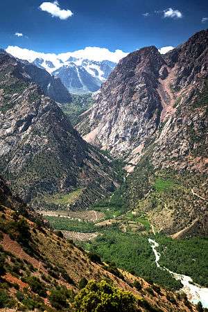
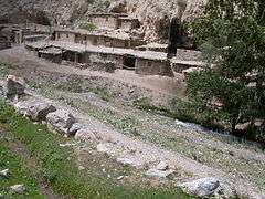
Fann Mountains (Tajik: Кӯҳҳои Фон, Uzbek: Fon togʻlari; also known as the Fanns) are part of the western Pamir-Alay mountain system and are primarily located in Tajikistan's Sughd Province between the Zarafshan Range to the north and the Gissar Range to the south.[1] In the east-west direction they extend from Fandarya River to Archimaydan River, and the cluster of Marguzor lakes known as the 7 lakes west of Archimaydan is also included in the Fanns.
| Fann Mountains | |
|---|---|
 | |
| Highest point | |
| Elevation | 5,489 m (18,009 ft) |
| Parent peak | Chimtarga Peak |
| Coordinates | 39°10′00.0″N 68°15′00.0″E |
| Naming | |
| Native name | Кӯҳҳои Фон / Fon togʻlari |
| Geography | |
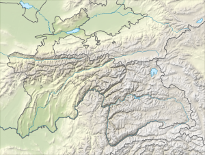 Location in Western Tajikistan | |
| Location | Tajikistan and Uzbekistan |
| Parent range | Pamir-Alay |
Peaks, lakes and access
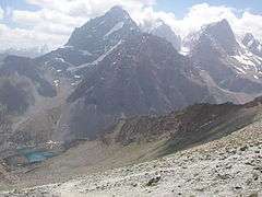
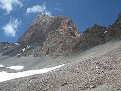
The Fanns boast about a hundred peaks, with several rising to altitudes of more than 5,000 meters and relative elevations of up to 1,500 meters.[2] The highest point in Fann Mountains is Chimtarga peak (5,489 m). Other 5,000-meter peaks are Bodkhona (5,138 m), Chapdara (5,050 m), Big Hansa, Little Hansa (5,031 m), Zamok ('5,070 m), Mirali (5,132 m), and Energia (5,120 m).
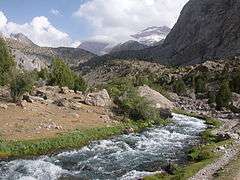
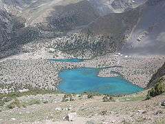
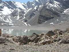
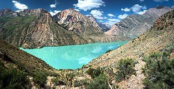
There are many lakes in the Fanns.The best known are Alaudin lakes in the Chapdara River valley, Kulikalon Lakes on the northern slope of Chimtarga peak, Big Allo Lake and Iskanderkul Lake.
The best time for visiting is late June–mid-September for trekking and July–August for mountaineering, when the weather is usually at its best. Access is generally from Panjakent, which can be reached either from Dushanbe or Samarkand.[3]
|
See also
- Alay Mountains
- Pamir Mountains
References
- Latombe, Jean-Claude. "Zigzagging in the Fann Mountains". Stanford University.
- "Fann mountains". TravelTajikistan.net. Retrieved 15 September 2015.
- "Fann mountains trekking: a guide". Caravanistan. Retrieved 2020-02-26.
External links
| Wikimedia Commons has media related to Fann Mountains. |