Elmley Lovett
Elmley Lovett in Worcestershire, England is a civil parish whose residents' homes are quite loosely clustered east of its Hartlebury Trading Estate as well as in minor neighbourhood Cutnall Green to the near south-east. The latter is a loosely linear settlement that includes a pub-restaurant and farm shop on the Elmley Lovett side of the boundaries; it continues passing its near-square public green into the parish of Elmbridge, a similarly sized parish over to the east.[2][3] Its old stone parish church, much restored, has four very tall lancet windows to each side of the nave and a modest belltower topped by a tall stone spire. It is flanked by a scattering of tall trees.[4] The village is 5 miles (8.0 km) NNW of Droitwich but Cutnall Green is closer to 4 miles.[5]
| Elmley Lovett | |
|---|---|
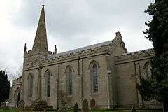 St Michael's church is a grand and medievalesque reconstruction of a much earlier church, such as its centuries-old spire | |
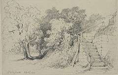 Steps and trees at Elmley Lovett, sketched in 1850 | |
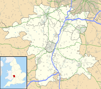 Elmley Lovett Location within Worcestershire | |
| Area | 7.82 km2 (3.02 sq mi) |
| Population | 314 (2011 census)[1] |
| • Density | 40/km2 (100/sq mi) |
| Civil parish |
|
| District | |
| Shire county | |
| Region | |
| Country | England |
| Sovereign state | United Kingdom |
| Wikimedia Commons has media related to Elmley Lovett. |
History
The Moule family of Snead's Green House were among the most prominent local landowners from the 1620s until the late nineteenth century, when the family died out in the male line.[5]

References
- Nomis Web - UK Government - KS101EW - Usual resident population (2011 census) Retrieved 2019-05-04.
- "Parish web-site". Archived from the original on 12 June 2012. Retrieved 30 December 2012.
- Ecclesiastical parish map
- Geograph
- British history on-line