Diana's Peak
Diana's Peak is the highest point, at 818 metres (2,684 ft), on the island of Saint Helena, a British overseas territory in the South Atlantic Ocean.[1] It is of volcanic origin. The mountain and its surroundings with a total area of 81 ha were proclaimed a national park in March 1996, the first on the island.[2] It is a preserve of several endangered endemic species, including tree fern, he cabbage and black cabbage trees, and whitewood.[3] The park contains walking paths connecting the peaks - Mt. Actaeon (814m), Diana's Peak and Cuckold's Point (815m). The two shorter peaks are topped by large Norfolk pines. On the northern slopes there is a nursery for endemic species.
| Diana's Peak | |
|---|---|
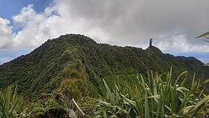 Diana's Peak and Cuckold's Point | |
| Highest point | |
| Elevation | 818 m (2,684 ft) |
| Prominence | 818 m (2,684 ft) |
| Coordinates | 15°57′35″S 5°41′29″W |
| Geography | |
| Location | Saint Helena, South Atlantic Ocean |
The peak is located at the tripoint where the districts of Sandy Bay (southwest), Levelwood (east) and Longwood (north) meet. The closest settlements are Bamboo Hedge (the main settlement of Sandy Bay District), Hutt's Gate (in Longwood District) and Levelwood Village.
Gallery
 Sign at the beginning of the path
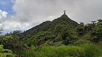 Mount Actaeon, topped by a Norfolk pine
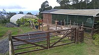 The endemic plant nursery
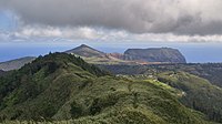 path to Halley's Observatory from below Mt. Actaeon
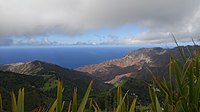 view of Sandy Bay from below Mt. Actaeon
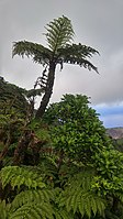 Tree fern and black cabbage tree
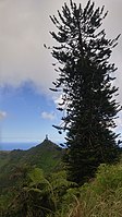 Norfolk Pines on Cuckhold's Point and Mt. Actaeon
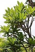 Cabbage trees
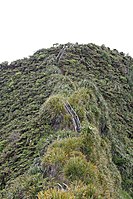 Stairs to Diana's Peak
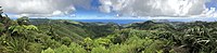 Panoramic view from Diana's Peak
See also
References
- EPIC. "Homepage". Botanic Gardens Conservation International. Retrieved 2019-11-01.
- "St Helena - the Grand Tour - Diana's Peak". Sthelena. Retrieved 2019-11-01.
- EPIC. "Homepage". Botanic Gardens Conservation International. Retrieved 2019-11-01.