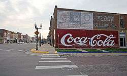
Council Grove Downtown Historic District
The Council Grove Downtown Historic District is a 25.8 acres (10.4 ha) historic district which was listed on the National Register of Historic Places in 2010.[1]
Council Grove Downtown Historic District | |
 | |
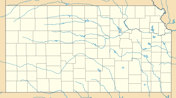 | |
| Location | Generally spanning from Neosho River to Belfry on W Main and extending N to Columbia between Neosho and Mission, Council Grove, Kansas |
|---|---|
| Coordinates | 38.661111°N 96.492222°W |
| Area | 25.8 acres (10.4 ha) |
| Architect | Louis Simon, C.W. Squires |
| Architectural style | Early Commercial, Late Victorian |
| NRHP reference No. | 10000519[1] |
| Added to NRHP | July 30, 2010 |
The historic district contains seventy-one buildings dating from the mid and late 19th and early 20th century. The earliest building is Conn Mercantile constructed in 1853 and used as a general store and way station for travelers on the Santa Fe Trail. Forty-three of the buildings were deemed contributing.[2]
The district extends from the Neosho River on W. Main St. to Belfry St. and extends north to Columbia St. between Neosho and Mission Streets.
Architect: Simon, Louis; Squires, C.W. Architecture: Early Commercial, Late Victorian Historic function: Domestic; Commerce/trade; Social; Government; Health Care; Transportation; Recreation And Culture Historic subfunction: Single Dwelling; Business; Meeting Hall; Government Office; Medical Business/office; Road-related; Theater Criteria: event, event, architecture/engineering, architecture/engineering
See also
References
- "National Register Information System". National Register of Historic Places. National Park Service. November 2, 2013.
- Christy Davis; Wendy Spencer (January 20, 2009). "National Register of Historic Places Registration: Council Grove Downtown Historic District / 127-564" (PDF). National Park Service. Retrieved March 3, 2019.
| Topics | |
|---|---|
| Lists by state |
|
| Lists by insular areas | |
| Lists by associated state | |
| Other areas | |
| Related | |
| |