Coulman Island
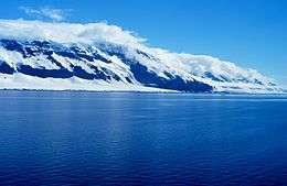
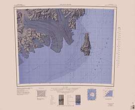
Coulman Island is an ice-covered island in the Ross Sea, located 14 km (8.7 mi) southeast of Cape Jones, Victoria Land, Antarctica. It is 33.3 km (20.7 mi) long, 14.8 km (9.2 mi) wide and 1,998 m (6,555 ft) in elevation. Emperor penguins inhabit this island. Coulman Island lies within the boundaries of Ross Dependency, which is claimed by New Zealand; a claim unrecognized by most other states. It was discovered in 1841 by Sir James Clark Ross who named it for his father-in-law, Thomas Coulman.[1] A notable landmark of this island is Cape Anne, the south-easternmost point of the island, so named by Sir James Clark Ross for his wife. Cape Wadworth is the northernmost point of the island.
 | |
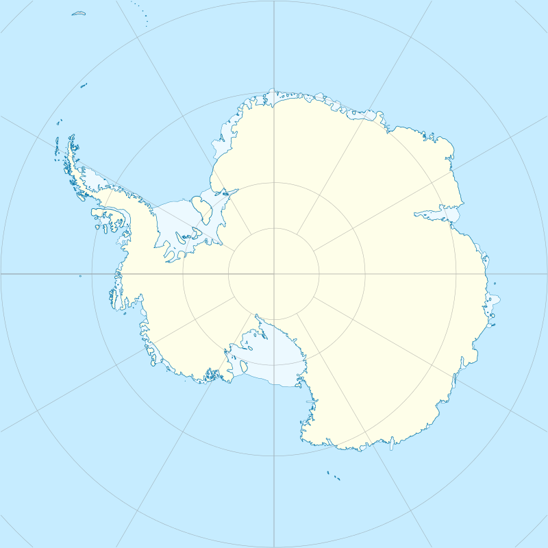 Coulman Island Location in Antarctica | |
| Geography | |
|---|---|
| Location | Antarctica |
| Coordinates | 73°29′S 169°45′E |
| Length | 33.3 km (20.69 mi) |
| Width | 14.8 km (9.2 mi) |
| Highest elevation | 1,998 m (6,555 ft) |
| Administration | |
| Administered under the Antarctic Treaty System | |
| Demographics | |
| Population | Uninhabited |
The island is composed of several connected shield volcanoes that form part of the Hallett Volcanic Province of the McMurdo Volcanic Group.[2] A 5 km (3.1 mi) wide and 700 m (2,300 ft) deep caldera called the Hawkes Heights can be found on the south end of the island.
See also
- Composite Antarctic Gazetteer
- List of Antarctic islands south of 60° S
- List of volcanoes in Antarctica
- Scientific Committee on Antarctic Research (SCAR)
- Territorial claims in Antarctica
References
- U.S. Geological Survey Geographic Names Information System: Coulman Island
- Riffenburgh, Beau (2007). Encyclopedia of the Antarctic. 1. Taylor & Francis. p. 639. ISBN 0-415-97024-5.
External links
![]()