Coeur d'Alene River
The Coeur d'Alene River flows 37 miles (60 km)[4] from the Silver Valley into Lake Coeur d'Alene in the U.S. state of Idaho. The stream continues out of Lake Coeur d'Alene as the Spokane River.
| Coeur d'Alene River | |
|---|---|
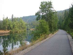 The Trail of the Coeur d'Alenes follows the Coeur d'Alene River for several miles. | |
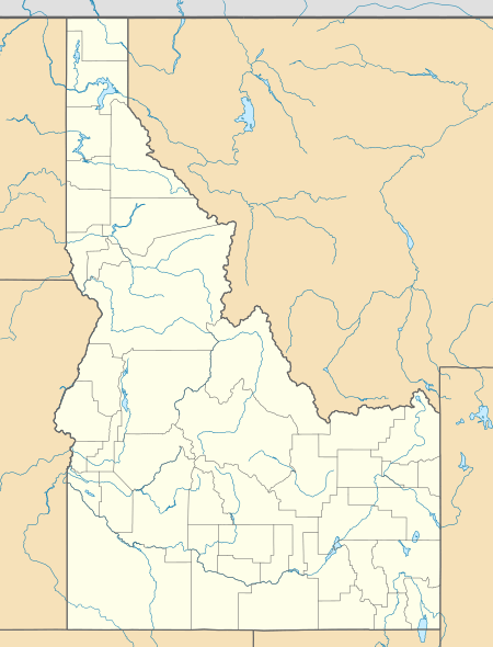 Location of the mouth of the Coeur d'Alene River in Idaho  Coeur d'Alene River (the United States) | |
| Location | |
| Country | United States |
| State | Idaho |
| Physical characteristics | |
| Source | Confluence of North and South Forks |
| • location | Pinehurst, Shoshone County |
| • coordinates | 47°33′26″N 116°15′22″W[1] |
| • elevation | 2,172 ft (662 m) |
| Mouth | Coeur d'Alene Lake |
• location | Harrison, Kootenai County |
• coordinates | 47°27′43″N 116°47′40″W[1] |
• elevation | 2,129 ft (649 m) |
| Length | 37 mi (60 km) |
| Basin size | 1,453 sq mi (3,760 km2) |
| Discharge | |
| • location | river mile 2.5 (RKM 4.0)[2] |
| • average | 2,521 cu ft/s (71.4 m3/s)[3] |
| • minimum | 230 cu ft/s (6.5 m3/s) |
| • maximum | 27,300 cu ft/s (770 m3/s) |
| Basin features | |
| Tributaries | |
| • left | South Fork Coeur d'Alene River, Latour Creek |
| • right | North Fork Coeur d'Alene River |
Before the Bunker Hill Smelter in the Kellogg area, which mined lead and silver, was forced to adopt environmental controls in the 1970s, there was so much lead in the river in the Kellogg area the locals called the stream "Lead Creek."
Salmon levels continue to remain high in the area (needs reference) and it is a popular destination for water-skiing, tubing, and swimming for locals.
All of the real bodies of water in the film Dante's Peak were either the Coeur d'Alene River or one of its tributaries, as Wallace, Idaho, where the movie was filmed, is in the Silver Valley.
References
- "Coeur d'Alene River". Geographic Names Information System. United States Geological Survey. 1992-12-31. Retrieved 2011-12-21.
- "USGS Gage #12413860 on the Coeur d'Alene River near Harrison, ID" (PDF). National Water Information System. U.S. Geological Survey. 2010. Retrieved 2011-12-21.
- "USGS Gage #12413860 on the Coeur d'Alene River near Harrison, ID" (PDF). National Water Information System. U.S. Geological Survey. 2010. Retrieved 2011-12-21.
- "The National Map". U.S. Geological Survey. Archived from the original on 2012-04-05. Retrieved Feb 17, 2011.
External links
| Authority control |
|
|---|