Clachaig
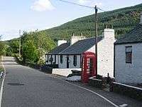
Clachaig; (Scottish Gaelic: Clachaig) is a small settlement, on the Cowal peninsula in Argyll and Bute, Scotland.[1][2] It is located on the B836 road between the Holy Loch and Loch Striven, the hamlet is just over a mile long.[3] Clachaig is a Gaelic word meaning 'stone place'.[4]
Clachaig
| |
|---|---|
 Clachaig Village | |
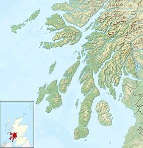 Clachaig Location within Argyll and Bute | |
| OS grid reference | NS 12100 81400 |
| Council area |
|
| Lieutenancy area |
|
| Country | Scotland |
| Sovereign state | United Kingdom |
| Post town | DUNOON, ARGYLL |
| Postcode district | PA23 |
| Dialling code | 01369 |
| UK Parliament |
|
| Scottish Parliament |
|
The Hamlet consists of twenty-two houses and was built for accommodation for the workers of the powder mill. The mill manufactured gunpowder.[5]
The river at the bottom of the glen is the Blackcraig Burn that joins the Little Eachaig River, then joining the River Eachaig and flowing into the Holy Loch.
Gallery
Clachaig
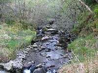 Blackcraig Burn, Clachaig. - geograph.org.uk - 1299974
References
- name=OS63>Ordnance Survey: Landranger map sheet 63 Firth of Clyde (Greenock & Rothesay) (Map). Ordnance Survey. 2014. ISBN 9780319229699.
- "Ordnance Survey: 1:50,000 Scale Gazetteer" (csv (download)). www.ordnancesurvey.co.uk. Ordnance Survey. 1 January 2016. Retrieved 18 February 2016.
- "B836 - Roader's Digest: The SABRE Wiki". Sabre-roads.org.uk. 18 November 2016. Retrieved 15 December 2016.
- Gaelic place names of Scotland
- http://www.scotlandsplaces.gov.uk/record/rcahms/40783/clachaig-glenlean-blackpowder-works/rcahms |title=Clachaig, Glenlean Blackpowder Works |publisher=ScotlandsPlaces |date= |accessdate=2016-12-14
This article is issued from Wikipedia. The text is licensed under Creative Commons - Attribution - Sharealike. Additional terms may apply for the media files.