Chief Ladiga Trail
The Chief Ladiga Trail /ləˈdaɪɡə/ is a rail trail in Alabama that stretches for 33 miles (53 km) from Anniston to the Alabama-Georgia state line . It is the state's first rail trail project.
| Chief Ladiga Trail | |
|---|---|
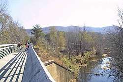 Trail section in Cleburne County | |
| Length | 33 mi (53 km) |
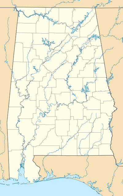
| Location | Calhoun / Cleburne counties, Alabama, USA |
| Designation | Piedmont and Jacksonville sections are National Recreation Trail designated[1] |
| Trailheads | Alabama-Georgia state line (33°57′1″N 85°23′46″W); Anniston, Alabama (33°44′16″N 85°49′5″W) |
| Use | Hiking, biking |
| Elevation | |
| Highest point | About 950 ft (290 m) near the Alabama-Georgia state line [2] |
| Lowest point | About 650 ft (198 m) in Jacksonville[2] |
| Hiking details | |
| Right of way | Former Seaboard Air Line and Norfolk Southern RR |
| Website | Chief Ladiga Trail
 Anniston State line West and east ends of the trail in Alabama |
History
Trail background
The Chief Ladiga is on the same rail corridor as the Silver Comet Trail in Georgia as far as Piedmont, Alabama. From there it parallels an abandoned Southern Railway line for a few miles west of town until it leaves the old Seaboard rail line, heading south on the Norfolk Southern Railway route until the trail ends just north of Anniston. In 2008, the Ladiga and Silver Comet trail were connected.[3] A new gateway marks the connecting point at the state line. Now that the Chief Ladiga and the Silver Comet trails are connected, there is a 90-mile (145 km) paved corridor for non-motorized travel from just west of Atlanta, Georgia to Anniston, making it the 2nd longest paved trail in the U.S (the longest being the Paul Bunyan State Trail in Minnesota).[4]
Chief Ladiga
Chief Ladiga was a Muscogee chief who relinquished his tribe's lands when he signed the Treaty of Cusseta in 1832. The Treaty was part of a broader policy of indian removal perpetrated by the Jackson Administration. Ladiga sold half his land (which would later become Jacksonville) to speculators for $2000.
Route
The Chief Ladiga Trail starts at the Alabama-Georgia state line. At about mile marker 7.0, the trail crosses the Pinhoti National Recreation Trail.[5] It travels west to Piedmont then on to Jacksonville and Weaver and finally ending at Mike Tucker Park in north Anniston. It travels through wetlands, across streams, through forests and farmlands, and includes a horizon view of the Talladega Mountains. There are several bridges and both new and restored railroad trestles.
See also
- Silver Comet Trail
- List of Hiking Trails in Alabama
References
- Chief Ladiga National Recreation Trail. American Trails. June 2, 2011 Accessed March 14, 2019.
- Blalock, Clarence. Chief Ladiga Trail Map. Trail Elevation Profile. 2005. Hosted on the Jacksonville State University website. Accesses 2011-06-15.
- "Chief Ladiga Trail". Jacksonville State University, Environmental Policy and Information Center. 2019-01-19. Archived from the original on 2010-11-06. Retrieved 2010-12-28.
- "Longest Trails: Longest Paved Trail and Longest Ice Skating Trail". American Trails. 2018-09-09.
- Chief Ladiga Trail. TrailsNet. Picture caption. Image date: 2008-01-28. While riding the Chief Ladiga Trail in Alabama, you will come to junction for the Pinhoti Trail, an Alabama hiking trail. The turnoff is located between two river/bridge crossings very near mile marker 7.0. Accessed 2011-06-14.
External links
| 🌍 |
| Wikimedia Commons has media related to Chief Ladiga Trail. |
- Chief Ladiga Trail Jacksonville State Environmental Policy Information Center (EPIC)
- Chief Ladiga Trail Map (google mashup)
- Chief Ladiga Trail RailsToTrails.us
- Chief Ladiga Trail Traillink