Charlesville, Nova Scotia
Charlesville is a community in the Canadian province of Nova Scotia, located in the Municipality of the District of Barrington of Shelburne County.[2]
Charlesville | |
|---|---|
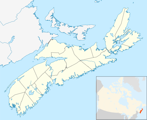 Location of Charlesville, Nova Scotia | |
| Coordinates: 43.5825°N 65.778889°W[1] | |
| Country | |
| Province | |
| County | Shelburne |
| Municipal district | Barrington |
| Time zone | UTC-4 (AST) |
| • Summer (DST) | UTC-3 (ADT) |
| Area code(s) | 902 |
| Access Routes | |
Climate
Charlesville experiences an oceanic climate (Köppen: Cfb) with cold, snowy winters and mild summers.
| Climate data for Charlesville (1981–2010) | |||||||||||||
|---|---|---|---|---|---|---|---|---|---|---|---|---|---|
| Month | Jan | Feb | Mar | Apr | May | Jun | Jul | Aug | Sep | Oct | Nov | Dec | Year |
| Record high °C (°F) | 14.0 (57.2) |
12.5 (54.5) |
16.5 (61.7) |
23.5 (74.3) |
25.0 (77.0) |
29.0 (84.2) |
30.0 (86.0) |
29.0 (84.2) |
27.0 (80.6) |
27.5 (81.5) |
18.5 (65.3) |
15.5 (59.9) |
30.0 (86.0) |
| Average high °C (°F) | 1.7 (35.1) |
1.9 (35.4) |
4.2 (39.6) |
8.2 (46.8) |
12.4 (54.3) |
16.3 (61.3) |
18.5 (65.3) |
19.3 (66.7) |
17.7 (63.9) |
13.5 (56.3) |
9.1 (48.4) |
4.4 (39.9) |
10.6 (51.1) |
| Daily mean °C (°F) | −2 (28) |
−1.7 (28.9) |
0.8 (33.4) |
4.9 (40.8) |
8.9 (48.0) |
12.7 (54.9) |
15.1 (59.2) |
15.8 (60.4) |
14.2 (57.6) |
10.2 (50.4) |
5.8 (42.4) |
0.9 (33.6) |
7.1 (44.8) |
| Average low °C (°F) | −5.6 (21.9) |
−5.2 (22.6) |
−2.6 (27.3) |
1.6 (34.9) |
5.4 (41.7) |
9.0 (48.2) |
11.7 (53.1) |
12.2 (54.0) |
10.6 (51.1) |
6.8 (44.2) |
2.5 (36.5) |
−2.6 (27.3) |
3.7 (38.7) |
| Record low °C (°F) | −21.0 (−5.8) |
−19.0 (−2.2) |
−17.5 (0.5) |
−10.5 (13.1) |
−2.5 (27.5) |
0.0 (32.0) |
4.5 (40.1) |
3.0 (37.4) |
−3.0 (26.6) |
−5.5 (22.1) |
−12.0 (10.4) |
−20.0 (−4.0) |
−21.0 (−5.8) |
| Average precipitation mm (inches) | 120.8 (4.76) |
89.2 (3.51) |
123.9 (4.88) |
106.2 (4.18) |
107.3 (4.22) |
95.1 (3.74) |
111.4 (4.39) |
82.1 (3.23) |
99.5 (3.92) |
100.2 (3.94) |
129.9 (5.11) |
117.7 (4.63) |
1,283.3 (50.52) |
| Average rainfall mm (inches) | 86.3 (3.40) |
69.7 (2.74) |
111.3 (4.38) |
104.0 (4.09) |
107.3 (4.22) |
95.1 (3.74) |
111.4 (4.39) |
82.1 (3.23) |
99.5 (3.92) |
100.2 (3.94) |
125.9 (4.96) |
95.5 (3.76) |
1,188.3 (46.78) |
| Average snowfall cm (inches) | 34.5 (13.6) |
19.5 (7.7) |
12.6 (5.0) |
2.2 (0.9) |
0.0 (0.0) |
0.0 (0.0) |
0.0 (0.0) |
0.0 (0.0) |
0.0 (0.0) |
0.0 (0.0) |
4.1 (1.6) |
22.2 (8.7) |
95.1 (37.4) |
| Average precipitation days (≥ 0.2 mm) | 15.8 | 12.8 | 15.3 | 17.5 | 18.3 | 16.6 | 17.4 | 16.8 | 15.8 | 17.1 | 17.6 | 18.7 | 199.7 |
| Average rainy days (≥ 0.2 mm) | 10.7 | 8.8 | 13.0 | 17.1 | 18.3 | 16.6 | 17.4 | 16.8 | 15.8 | 17.1 | 16.9 | 14.3 | 182.7 |
| Average snowy days (≥ 0.2 cm) | 6.8 | 4.9 | 3.1 | 0.83 | 0.0 | 0.0 | 0.0 | 0.0 | 0.0 | 0.0 | 0.80 | 5.6 | 22.0 |
| Mean monthly sunshine hours | 78.9 | 96.2 | 134.1 | 145.2 | 169.8 | 175.3 | 192.0 | 178.4 | 170.7 | 141.6 | 88.7 | 64.0 | 1,634.7 |
| Percent possible sunshine | 27.2 | 32.6 | 36.3 | 36.1 | 37.3 | 38.0 | 41.1 | 41.1 | 45.4 | 41.3 | 30.4 | 22.9 | 35.8 |
| Source: Environment Canada[3][4] | |||||||||||||
See also
References
- Nova Scotia Geographical Names: Charlesville
- Government of Nova Scotia website: Community Counts
- "Charlesville, Nova Scotia". Canadian Climate Normals 1981–2010. Environment Canada. Retrieved 12 April 2015.
- "Charlesville, Nova Scotia". Canadian Climate Normals 1981–2010. Environment Canada. Retrieved 12 April 2015.
External links
Places adjacent to Charlesville, Nova Scotia | ||||||||||
|---|---|---|---|---|---|---|---|---|---|---|
| ||||||||||
| Historical counties | |
|---|---|
| Economic regions | |
| Regional municipalities | |
| County municipalities | |
| District municipalities | |
| Towns | |
| Villages | |
| Lists | |
| |
This article is issued from Wikipedia. The text is licensed under Creative Commons - Attribution - Sharealike. Additional terms may apply for the media files.