Cannonball River
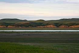
The Cannonball River (Lakota: Íŋyaŋwakağapi Wakpá[2]) is a tributary of the Missouri River, approximately 135 miles (217 km) long, in southwestern North Dakota in the United States.[3]
| Cannonball River | |
|---|---|
 The Cannonball River | |
| Physical characteristics | |
| Source | |
| • location | Slope County in White Lake National Wildlife Refuge |
| • coordinates | 46°28′12″N 103°12′24″W |
| • elevation | 2,780 ft (850 m) |
| Mouth | |
• location | Confluence with Missouri River in Lake Oahe |
• coordinates | 46°25′45″N 100°35′21″W |
• elevation | 1,611 ft (491 m) |
| Length | 135 mi (217 km) |
| Discharge | |
| • location | Breien |
| • average | 250 cu ft/s (7.1 m3/s)[1] |
| Basin features | |
| Progression | Cannonball River → Missouri → Mississippi → Gulf of Mexico |
| GNIS ID | 1035898 |
It rises in the Little Missouri National Grassland, in the badlands north of Amidon in northern Slope County. It flows ESE past New England, Mott, and Burt. It is joined by Cedar Creek approximately 15 miles (24 km) southwest of Shields and flows northeast, past Shields, forming the northern border of Sioux County and the Standing Rock Indian Reservation. It joins the Missouri in Lake Oahe near Cannon Ball. The cannonball concretions found in the vicinity of this river are the source of its name.[4]
See also
References
- https://waterdata.usgs.gov/nd/nwis/annual/?format=sites_selection_links&search_site_no=06354000&agency_cd=USGS&referred_module=sw
- Ullrich, Jan, ed. (2011). New Lakota Dictionary (2nd ed.). Bloomington, IN: Lakota Language Consortium. p. 877. ISBN 978-0-9761082-9-0. LCCN 2008922508.
- U.S. Geological Survey Geographic Names Information System: Cannonball River
- Federal Writers' Project (1938). North Dakota, a Guide to the Northern Prairie State,. WPA. p. 313. ISBN 978-1-62376-033-5.
| Authority control |
|
|---|
This article is issued from Wikipedia. The text is licensed under Creative Commons - Attribution - Sharealike. Additional terms may apply for the media files.