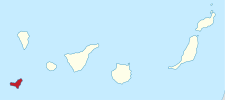
Canary Islands
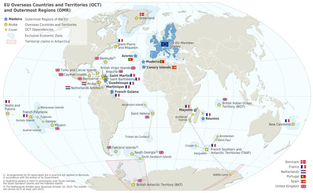
The Canary Islands (/kəˈnɛəri/; Spanish: Islas Canarias, pronounced [ˈislas kaˈnaɾjas]), also known informally as the Canaries, are a Spanish archipelago and the southernmost autonomous community of Spain located in the Atlantic Ocean, in a region known as Macaronesia, 100 kilometres (62 miles) west of Morocco at the closest point. It is one of eight regions with special consideration of historical nationality as recognized by the Spanish government.[6][7] The Canary Islands are geographically located in the African Tectonic Plate, even though the archipielago is economically and politically European, as it is part of the European Union.[8][9]
Canary Islands | |
|---|---|
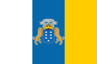 Flag 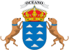 Coat of arms | |
| Anthem: "Himno de Canarias" "Anthem of the Canaries" | |
_in_Spain.svg.png) Location of the Canary Islands within Spain | |
| Coordinates: 28°N 16°W | |
| Country | Spain |
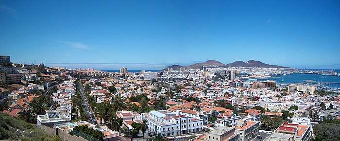
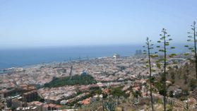
| Largest city | Las Palmas de Gran Canaria |
| Capital | Las Palmas de Gran Canaria and Santa Cruz de Tenerife[1] |
| Government | |
| • President | Ángel Víctor Torres (PSOE) |
| Area | |
| • Total | 7,493 km2 (2,893 sq mi) |
| Area rank | 1.88% of Spain; ranked 13th |
| Population (2019)[2] | |
| • Total | 2,153,389 |
| • Rank | 8th |
| • Density | 290/km2 (740/sq mi) |
| • Percentage | 4.58% of Spain |
| Demonyms | Canarian canario/-a (Spanish) |
| Ethnic groups | |
| • Spaniards | 87.1%[3] |
| • Foreign nationals | 12.9%[3][4] |
| Time zone | UTC (WET) |
| • Summer (DST) | UTC+1 (WEST) |
| ISO 3166 code |
|
| Most populated island | Tenerife |
| Official language | Spanish |
| Statute of Autonomy | 7 November 2018 |
| Parliament | Canarian Parliament |
| Congress seats | 15 (of 350) |
| Senate seats | 14 (of 265) |
| HDI (2018) | 0.861[5] very high · 15th |
| Website | gobcan |
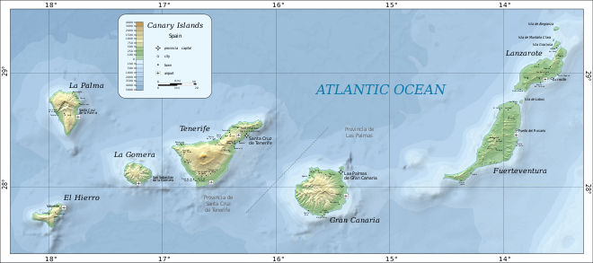
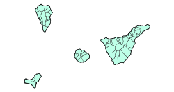
The eight main islands are (from largest to smallest in area) Tenerife, Fuerteventura, Gran Canaria, Lanzarote, La Palma, La Gomera, El Hierro and La Graciosa. The archipelago includes many smaller islands and islets: Alegranza, Isla de Lobos, Montaña Clara, Roque del Oeste, and Roque del Este. It also includes a series of adjacent rocks (those of Salmor, Fasnia, Bonanza, Garachico and Anaga). In ancient times, the island chain was often referred to as "the Fortunate Isles".[10] The Canary Islands are the most southerly region of Spain and the largest and most populated archipelago of Macaronesia.[11] Historically, the Canary Islands have been considered a bridge between four continents: Africa, North America, South America and Europe.[12]
In 2019, the Canary Islands had a population of 2,153,389 inhabitants[2] and a density of 287.39 inhabitants per km2, being the eighth most populous autonomous community. The population of the archipelago is mostly concentrated in the two capital islands: around 43% on the island of Tenerife and 40% on the island of Gran Canaria.
The archipelago's beaches, climate and important natural attractions, especially Maspalomas in Gran Canaria and Teide National Park and Mount Teide (a World Heritage Site) in Tenerife (the third tallest volcano in the world measured from its base on the ocean floor), make it a major tourist destination with over 12 million visitors per year, especially Tenerife, Gran Canaria, Fuerteventura and Lanzarote.[13][14] The islands have a subtropical climate, with long hot summers and moderately warm winters.[15] The precipitation levels and the level of maritime moderation vary depending on location and elevation. Green areas as well as desert exist on the archipelago. Due to their location above the temperature inversion layer, the high mountains of these islands are ideal for astronomical observation. For this reason, two professional observatories, Teide Observatory on the island of Tenerife and Roque de los Muchachos Observatory on the island of La Palma, have been built on the islands.
In 1927, the Province of Canary Islands was split into two provinces. The autonomous community of the Canary Islands was established in 1982. Its capital is shared by the cities of Santa Cruz de Tenerife and Las Palmas de Gran Canaria,[16][17] which in turn are the capitals of the provinces of Santa Cruz de Tenerife and Las Palmas. Las Palmas de Gran Canaria has been the largest city in the Canaries since 1768, except for a brief period in the 1910s.[18] Between the 1833 territorial division of Spain and 1927, Santa Cruz de Tenerife was the sole capital of the Canary Islands. In 1927, a decree ordered that the capital of the Canary Islands be shared, as it remains at present.[19][20] The third largest city of the Canary Islands is San Cristóbal de La Laguna (a World Heritage Site) on Tenerife.[21][22][23] This city is also home to the Consejo Consultivo de Canarias, which is the supreme consultative body of the Canary Islands.[24]
During the time of the Spanish Empire, the Canaries were the main stopover for Spanish galleons on their way to the Americas, which came south to catch the prevailing north-easterly trade winds.[25][26]
Etymology
The name Islas Canarias is likely derived from the Latin name Canariae Insulae, meaning "Islands of the Dogs", a name that was evidently generalized from the ancient name of one of these islands, Canaria – presumably Gran Canaria. According to the historian Pliny the Elder, the island Canaria contained "vast multitudes of dogs of very large size".[27]
Alternatively, it is said that the original inhabitants of the island, Guanches, used to worship dogs, mummified them and generally treated them as holy animals.[28] Some hypothesize that the Canary Islands' dog-worship and the ancient Egyptian cult of the dog-headed god Anubis are closely connected.[29]
Other theories speculate that the name comes from the Nukkari Berber tribe living in the Moroccan Atlas, named in Roman sources as Canarii, though Pliny again mentions the relation of this term with dogs.[30]
The connection to dogs is retained in their depiction on the islands' coat-of-arms.
It is considered that the aborigines of Gran Canaria called themselves "Canarios".[31] It is possible that after being conquered, this name was used in plural in Spanish, i.e., as to refer to all of the islands as the Canarii-as.[31]
What is certain is that the name of the islands does not derive from the canary bird; rather, the birds are named after the islands.
Physical geography
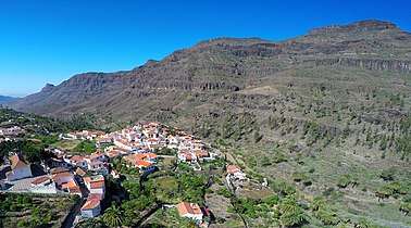
Tenerife is the largest and most populous island of the archipelago. Gran Canaria, with 865,070 inhabitants, is both the Canary Islands' second most populous island, and the third most populous one in Spain after Majorca and Tenerife. The island of Fuerteventura is the second largest in the archipelago and located 100 km (62 mi) from the African coast.
The islands form the Macaronesia ecoregion with the Azores, Cape Verde, Madeira, and the Savage Isles. The Canary Islands is the largest and most populated archipelago of the Macaronesia region.[11] The archipelago consists of seven large and several smaller islands, all of which are volcanic in origin.[32] The antipodes of the Canary Islands are found in the Pacific Ocean, between New Zealand, New Caledonia, Australia and the ocean.[33]
According to the position of the islands with respect to the north-east trade winds, the climate can be mild and wet or very dry. Several native species form laurisilva forests.
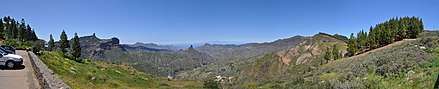
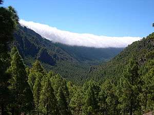
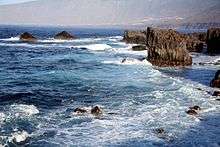
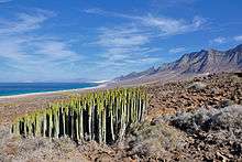
As a consequence, the individual islands in the Canary archipelago tend to have distinct microclimates. Those islands such as El Hierro, La Palma and La Gomera lying to the west of the archipelago have a climate which is influenced by the moist Canary Current. They are well vegetated even at low levels and have extensive tracts of sub-tropical laurisilva forest. As one travels east toward the African coast, the influence of the current diminishes, and the islands become increasingly arid. Fuerteventura and Lanzarote, the islands which are closest to the African mainland, are effectively desert or semi desert. Gran Canaria is known as a "continent in miniature" for its diverse landscapes like Maspalomas and Roque Nublo. In terms of its climate Tenerife is particularly interesting. The north of the island lies under the influence of the moist Atlantic winds and is well vegetated, while the south of the island around the tourist resorts of Playa de las Americas and Los Cristianos is arid. The island rises to almost 4,000 m (13,000 ft) above sea level, and at altitude, in the cool relatively wet climate, forests of the endemic pine Pinus canariensis thrive. Many of the plant species in the Canary Islands, like the Canary Island pine and the dragon tree, Dracaena draco are endemic, as noted by Sabin Berthelot and Philip Barker Webb in their work, L'Histoire Naturelle des Îles Canaries (1835–50).[34]
Climate
The climate is tropical and desertic, moderated by the sea and in summer by the trade winds. There are a number of microclimates and the classifications range mainly from semi-arid to desert. According to the Köppen climate classification,[35] the majority of the Canary Islands have a hot desert climate represented as BWh. There also exists a subtropical humid climate which is very influenced by the ocean in the middle of the islands of La Gomera, Tenerife and La Palma, where the laurisilva forests grow.
The climate of the Canary Islands has been said to be one of the best in the world, with temperatures mostly between 18 and 24 °C (64 and 75 °F).[36][37]
| Climate data for Gran Canaria Airport 24m (1981–2010) | |||||||||||||
|---|---|---|---|---|---|---|---|---|---|---|---|---|---|
| Month | Jan | Feb | Mar | Apr | May | Jun | Jul | Aug | Sep | Oct | Nov | Dec | Year |
| Average high °C (°F) | 20.8 (69.4) |
21.2 (70.2) |
22.3 (72.1) |
22.6 (72.7) |
23.6 (74.5) |
25.3 (77.5) |
26.9 (80.4) |
27.5 (81.5) |
27.2 (81.0) |
26.2 (79.2) |
24.2 (75.6) |
22.2 (72.0) |
24.2 (75.6) |
| Daily mean °C (°F) | 18.1 (64.6) |
18.4 (65.1) |
19.3 (66.7) |
19.5 (67.1) |
20.5 (68.9) |
22.2 (72.0) |
23.8 (74.8) |
24.6 (76.3) |
24.3 (75.7) |
23.1 (73.6) |
21.2 (70.2) |
19.3 (66.7) |
21.2 (70.2) |
| Average low °C (°F) | 15.3 (59.5) |
15.6 (60.1) |
16.2 (61.2) |
16.3 (61.3) |
17.3 (63.1) |
19.2 (66.6) |
20.8 (69.4) |
21.6 (70.9) |
21.4 (70.5) |
20.1 (68.2) |
18.1 (64.6) |
16.5 (61.7) |
18.2 (64.8) |
| Average precipitation mm (inches) | 25 (1.0) |
24 (0.9) |
13 (0.5) |
6 (0.2) |
1 (0.0) |
0 (0) |
0 (0) |
0 (0) |
9 (0.4) |
16 (0.6) |
22 (0.9) |
31 (1.2) |
151 (5.9) |
| Average precipitation days (≥ 1 mm) | 3 | 3 | 2 | 1 | 0 | 0 | 0 | 0 | 1 | 2 | 4 | 5 | 22 |
| Mean monthly sunshine hours | 184 | 191 | 229 | 228 | 272 | 284 | 308 | 300 | 241 | 220 | 185 | 179 | 2,821 |
| Source: World Meteorological Organization (UN),[38] Agencia Estatal de Meteorología[39] | |||||||||||||
| Climate data for Santa Cruz de Tenerife 35m (1981–2010) | |||||||||||||
|---|---|---|---|---|---|---|---|---|---|---|---|---|---|
| Month | Jan | Feb | Mar | Apr | May | Jun | Jul | Aug | Sep | Oct | Nov | Dec | Year |
| Average high °C (°F) | 21.0 (69.8) |
21.2 (70.2) |
22.1 (71.8) |
22.7 (72.9) |
24.1 (75.4) |
26.2 (79.2) |
28.7 (83.7) |
29.0 (84.2) |
28.1 (82.6) |
26.3 (79.3) |
24.1 (75.4) |
22.1 (71.8) |
24.6 (76.3) |
| Daily mean °C (°F) | 18.2 (64.8) |
18.3 (64.9) |
19.0 (66.2) |
19.7 (67.5) |
21.0 (69.8) |
22.9 (73.2) |
25.0 (77.0) |
25.5 (77.9) |
24.9 (76.8) |
23.4 (74.1) |
21.3 (70.3) |
19.4 (66.9) |
21.5 (70.7) |
| Average low °C (°F) | 15.4 (59.7) |
15.3 (59.5) |
15.9 (60.6) |
16.5 (61.7) |
17.8 (64.0) |
19.5 (67.1) |
21.2 (70.2) |
21.9 (71.4) |
21.7 (71.1) |
20.3 (68.5) |
18.4 (65.1) |
16.6 (61.9) |
18.4 (65.1) |
| Average rainfall mm (inches) | 31.5 (1.24) |
35.4 (1.39) |
37.8 (1.49) |
11.6 (0.46) |
3.6 (0.14) |
0.9 (0.04) |
0.1 (0.00) |
2.0 (0.08) |
6.8 (0.27) |
18.7 (0.74) |
34.1 (1.34) |
43.2 (1.70) |
225.7 (8.89) |
| Average rainy days (≥ 1.0 mm) | 8.0 | 7.2 | 6.9 | 5.5 | 2.9 | 0.9 | 0.2 | 0.8 | 2.7 | 6.1 | 8.8 | 9.4 | 59.4 |
| Mean monthly sunshine hours | 178 | 186 | 221 | 237 | 282 | 306 | 337 | 319 | 253 | 222 | 178 | 168 | 2,887 |
| Source: Agencia Estatal de Meteorología[40] | |||||||||||||
| Climate data for San Cristóbal de La Laguna (1981–2010) 632 m – Tenerife North Airport | |||||||||||||
|---|---|---|---|---|---|---|---|---|---|---|---|---|---|
| Month | Jan | Feb | Mar | Apr | May | Jun | Jul | Aug | Sep | Oct | Nov | Dec | Year |
| Average high °C (°F) | 16.0 (60.8) |
16.7 (62.1) |
18.2 (64.8) |
18.5 (65.3) |
20.1 (68.2) |
22.2 (72.0) |
24.7 (76.5) |
25.7 (78.3) |
24.9 (76.8) |
22.5 (72.5) |
19.7 (67.5) |
17.1 (62.8) |
20.5 (68.9) |
| Daily mean °C (°F) | 13.1 (55.6) |
13.4 (56.1) |
14.5 (58.1) |
14.7 (58.5) |
16.1 (61.0) |
18.1 (64.6) |
20.2 (68.4) |
21.2 (70.2) |
20.7 (69.3) |
18.9 (66.0) |
16.5 (61.7) |
14.3 (57.7) |
16.8 (62.2) |
| Average low °C (°F) | 10.2 (50.4) |
10.0 (50.0) |
10.7 (51.3) |
10.9 (51.6) |
12.0 (53.6) |
14.0 (57.2) |
15.7 (60.3) |
16.6 (61.9) |
16.5 (61.7) |
15.2 (59.4) |
13.3 (55.9) |
11.5 (52.7) |
13.0 (55.4) |
| Average rainfall mm (inches) | 80 (3.1) |
70 (2.8) |
61 (2.4) |
39 (1.5) |
19 (0.7) |
11 (0.4) |
6 (0.2) |
5 (0.2) |
16 (0.6) |
47 (1.9) |
81 (3.2) |
82 (3.2) |
517 (20.2) |
| Average rainy days (≥ 1.0 mm) | 11 | 10 | 10 | 10 | 7 | 4 | 3 | 3 | 5 | 10 | 10 | 12 | 95 |
| Mean monthly sunshine hours | 150 | 168 | 188 | 203 | 234 | 237 | 262 | 269 | 213 | 194 | 155 | 137 | 2,410 |
| Source: Agencia Estatal de Meteorología[41] | |||||||||||||
| Climate data for Tenerife South Airport 64m (1981–2010) | |||||||||||||
|---|---|---|---|---|---|---|---|---|---|---|---|---|---|
| Month | Jan | Feb | Mar | Apr | May | Jun | Jul | Aug | Sep | Oct | Nov | Dec | Year |
| Average high °C (°F) | 21.7 (71.1) |
22.0 (71.6) |
23.1 (73.6) |
23.1 (73.6) |
23.9 (75.0) |
25.4 (77.7) |
27.7 (81.9) |
28.4 (83.1) |
27.9 (82.2) |
26.8 (80.2) |
24.8 (76.6) |
22.8 (73.0) |
24.8 (76.6) |
| Daily mean °C (°F) | 18.4 (65.1) |
18.5 (65.3) |
19.3 (66.7) |
19.5 (67.1) |
20.4 (68.7) |
22.1 (71.8) |
24.0 (75.2) |
24.7 (76.5) |
24.5 (76.1) |
23.4 (74.1) |
21.5 (70.7) |
19.7 (67.5) |
21.4 (70.5) |
| Average low °C (°F) | 15.2 (59.4) |
15.0 (59.0) |
15.6 (60.1) |
16.0 (60.8) |
17.0 (62.6) |
18.8 (65.8) |
20.2 (68.4) |
21.1 (70.0) |
21.1 (70.0) |
20.0 (68.0) |
18.2 (64.8) |
16.5 (61.7) |
17.9 (64.2) |
| Average rainfall mm (inches) | 16.6 (0.65) |
19.9 (0.78) |
14.7 (0.58) |
7.4 (0.29) |
1.1 (0.04) |
0.1 (0.00) |
0.1 (0.00) |
1.3 (0.05) |
3.6 (0.14) |
11.9 (0.47) |
26.3 (1.04) |
30.3 (1.19) |
133.3 (5.23) |
| Average rainy days (≥ 1.0 mm) | 1.8 | 2.2 | 1.9 | 1.1 | 0.3 | 0.0 | 0.0 | 0.2 | 0.6 | 1.6 | 1.9 | 3.5 | 15.1 |
| Mean monthly sunshine hours | 193 | 195 | 226 | 219 | 246 | 259 | 295 | 277 | 213 | 214 | 193 | 195 | 2,725 |
| Source: Agencia Estatal de Meteorología[39] | |||||||||||||
| Climate data for La Palma Airport 33m (1981–2010) | |||||||||||||
|---|---|---|---|---|---|---|---|---|---|---|---|---|---|
| Month | Jan | Feb | Mar | Apr | May | Jun | Jul | Aug | Sep | Oct | Nov | Dec | Year |
| Average high °C (°F) | 20.6 (69.1) |
20.7 (69.3) |
21.2 (70.2) |
21.6 (70.9) |
22.6 (72.7) |
24.1 (75.4) |
25.5 (77.9) |
26.3 (79.3) |
26.6 (79.9) |
25.5 (77.9) |
23.5 (74.3) |
21.8 (71.2) |
23.3 (74.0) |
| Daily mean °C (°F) | 18.1 (64.6) |
18.0 (64.4) |
18.5 (65.3) |
18.9 (66.0) |
20.0 (68.0) |
21.7 (71.1) |
23.1 (73.6) |
23.9 (75.0) |
24.0 (75.2) |
22.8 (73.0) |
20.9 (69.6) |
19.3 (66.7) |
20.8 (69.4) |
| Average low °C (°F) | 15.5 (59.9) |
15.3 (59.5) |
15.7 (60.3) |
16.2 (61.2) |
17.4 (63.3) |
19.2 (66.6) |
20.7 (69.3) |
21.4 (70.5) |
21.3 (70.3) |
20.2 (68.4) |
18.3 (64.9) |
16.7 (62.1) |
18.2 (64.7) |
| Average rainfall mm (inches) | 49 (1.9) |
57 (2.2) |
33 (1.3) |
19 (0.7) |
7 (0.3) |
2 (0.1) |
1 (0.0) |
1 (0.0) |
12 (0.5) |
41 (1.6) |
70 (2.8) |
80 (3.1) |
372 (14.5) |
| Average rainy days | 5 | 4 | 4 | 3 | 1 | 0 | 0 | 0 | 2 | 5 | 7 | 8 | 40 |
| Mean monthly sunshine hours | 141 | 146 | 177 | 174 | 192 | 188 | 222 | 209 | 187 | 175 | 140 | 138 | 2,106 |
| Source: Agencia Estatal de Meteorología[42] | |||||||||||||
Geology
The seven major islands, one minor island, and several small islets were originally volcanic islands, formed by the Canary hotspot. The Canary Islands is the only place in Spain where volcanic eruptions have been recorded during the Modern Era, with some volcanoes still active (El Hierro, 2011).[43] Volcanic islands such as those in the Canary chain often have steep ocean cliffs caused by catastrophic debris avalanches and landslides.[44]
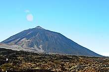
The Teide volcano on Tenerife is the highest mountain in Spain, and the third tallest volcano on Earth on a volcanic ocean island. All the islands except La Gomera have been active in the last million years; four of them (Lanzarote, Tenerife, La Palma and El Hierro) have historical records of eruptions since European discovery. The islands rise from Jurassic oceanic crust associated with the opening of the Atlantic. Underwater magmatism commenced during the Cretaceous, and reached the ocean's surface during the Miocene. The islands are considered as a distinct physiographic section of the Atlas Mountains province, which in turn is part of the larger African Alpine System division.
In the summer of 2011 a series of low-magnitude earthquakes occurred beneath El Hierro. These had a linear trend of northeast-southwest. In October a submarine eruption occurred about 2 km (1 1⁄4 mi) south of Restinga. This eruption produced gases and pumice, but no explosive activity was reported.[45]
The following table shows the highest mountains in each of the islands:
| Mountain | Elevation | Island | |
|---|---|---|---|
| m | ft | ||
| Teide | 3,718 | 12,198 | Tenerife |
| Roque de los Muchachos | 2,426 | 7,959 | La Palma |
| Pico de las Nieves | 1,949 | 6,394 | Gran Canaria |
| Pico de Malpaso | 1,501 | 4,925 | El Hierro |
| Garajonay | 1,487 | 4,879 | La Gomera |
| Pico de la Zarza | 812 | 2,664 | Fuerteventura |
| Peñas del Chache | 670 | 2,200 | Lanzarote |
| Aguja Grande | 266 | 873 | La Graciosa |
| Caldera de Alegranza | 289 | 948 | Alegranza |
| Caldera de Lobos | 126 | 413 | Lobos |
| La Mariana | 256 | 840 | Montaña Clara |
Natural symbols
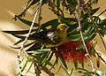
The official natural symbols associated with Canary Islands are the bird Serinus canaria (canary) and the Phoenix canariensis palm.[50]
 Serinus canaria
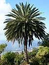
National parks
Four of Spain's thirteen national parks are located in the Canary Islands, more than any other autonomous community. Two of these have been declared UNESCO World Heritage Sites and the other two are part of Biosphere Reserves. The parks are:[51]
| Park | Island | Area | Year of Designation | UNESCO Status |
|---|---|---|---|---|
| Caldera de Taburiente National Park | La Palma | 46.9 km2 (18.1 sq mi) | 1954 | Part of the La Palma Biosphere Reserve since 2002 |
| Garajonay National Park | La Gomera | 39.86 km2 (15.39 sq mi) | 1981 | World Heritage Site since 1986 |
| Teide National Park | Tenerife | 18.99 km2 (7.33 sq mi) | 1954 | World Heritage Site since 2007 |
| Timanfaya National Park | Lanzarote | 51.07 km2 (19.72 sq mi) | 1974 | Part of the Lanzarote Biosphere Reserve since 1993 |
Teide National Park is the oldest and largest national park in the Canary Islands and one of the oldest in Spain. Located in the geographic centre of the island of Tenerife, it is the most visited national park in Spain. In 2010, it became the most visited national park in Europe and second worldwide.[46][47] The park's highlight is the Teide volcano; standing at an altitude of 3,718 metres (12,198 ft), it is the highest elevation of the country and the third largest volcano on Earth from its base. In 2007, the Teide National Park was declared one of the 12 Treasures of Spain.
Politics
Governance
The regional executive body, the Government of the Canary Islands, is presided over by Ángel Víctor Torres (PSOE), the current President of the Canary Islands.[52] The latter is invested by the members of the regional legislature, the Parliament of the Canary Islands, that consists of 70 elected legislators. The last regional election took place in May 2019.[53]
The islands have 14 seats in the Spanish Senate. Of these, 11 seats are directly elected (3 for Gran Canaria, 3 for Tenerife, and 1 each for Lanzarote (including La Graciosa), Fuerteventura, La Palma, La Gomera and El Hierro) while the other 3 are appointed by the regional legislature.[54]
Political geography
The Autonomous Community of the Canary Islands consists of two provinces (provincias), Las Palmas and Santa Cruz de Tenerife, whose capitals (Las Palmas de Gran Canaria and Santa Cruz de Tenerife) are capitals of the autonomous community. Each of the seven major islands is ruled by an island council named Cabildo Insular. Each island is subdivided into smaller municipalities (municipios); Las Palmas is divided into 34 municipalities, and Santa Cruz de Tenerife is divided into 54 municipalities.[55]
The international boundary of the Canaries is the subject of dispute between Spain and Morocco. Morocco's official position is that international laws regarding territorial limits do not authorise Spain to claim seabed boundaries based on the territory of the Canaries, since the Canary Islands enjoy a large degree of autonomy. In fact, the islands do not enjoy any special degree of autonomy as each one of the Spanish regions is considered an autonomous community with equal status to the European ones. Under the Law of the Sea, the only islands not granted territorial waters or an exclusive economic zone (EEZ) are those that are not fit for human habitation or do not have an economic life of their own, which is not the case of the Canary Islands.
The boundary determines the ownership of seabed oil deposits and other ocean resources. Morocco and Spain have been unable to agree on a compromise regarding the territorial boundary, since neither nation wants to cede its claimed right to the vast resources whose ownership depends upon the boundary. In 2002, for example, Morocco rejected a unilateral Spanish proposal.[56]
Canarian nationalism
There are some pro-independence political parties, like the National Congress of the Canaries (CNC) and the Popular Front of the Canary Islands, but these parties are non-violent, and their popular support is almost insignificant, with no presence in either the autonomous parliament or the cabildos insulares.
According to a 2012 study by the Centro de Investigaciones Sociológicas, when asked about national identity, the majority of respondents from the Canary Islands (49.3%) consider themselves Spanish and Canarian in equal measures, followed by 37.1% who consider themselves more Canarian than Spanish. Only 6.1% of the respondents consider themselves only Canarian.
| Only Spanish | 3.5% |
| More Spanish than Canarian | 2.0% |
| Equally Spanish and Canarian | 49.3% |
| More Canarian than Spanish | 37.1% |
| Only Canarian | 6.1% |
| Did not answer | 2.0% |
History
Ancient and pre-colonial times
Before the arrival of humans, the Canaries were inhabited by prehistoric animals; for example, the giant lizard (Gallotia goliath), the Tenerife and Gran Canaria giant rats,[58] and giant prehistoric tortoises, Geochelone burchardi and Geochelone vulcanica.
The islands may have been visited by the Phoenicians, the Greeks, and the Carthaginians. King Juba II, Caesar Augustus's Numidian protégé, is credited with discovering the islands for the Western world. According to Pliny the Elder, Juba found the islands uninhabited, but found "a small temple of stone" and "some traces of buildings".[59] Juba dispatched a naval contingent to re-open the dye production facility at Mogador in what is now western Morocco in the early first century AD.[60] That same naval force was subsequently sent on an exploration of the Canary Islands, using Mogador as their mission base.
| Roman name(s) | Modern name |
|---|---|
| Ninguaria or Nivaria | Tenerife |
| Canaria | Gran Canaria |
| Pluvialia or Invale | Lanzarote |
| Ombrion | La Palma |
| Planasia | Fuerteventura |
| Iunonia or Junonia | El Hierro |
| Capraria | La Gomera |
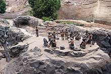
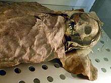
When the Europeans began to explore the islands in the late Middle Ages, they encountered several indigenous peoples living at a Neolithic level of technology. Although the prehistory of the settlement of the Canary Islands is still unclear, linguistic and genetic analyses seem to indicate that at least some of these inhabitants shared a common origin with the Berbers on the nearby North African coast.[61] The precolonial inhabitants came to be known collectively as the Guanches, although Guanches had been the name for only the indigenous inhabitants of Tenerife.[62] From the 14th century onward, numerous visits were made by sailors from Majorca, Portugal and Genoa. Lancelotto Malocello settled on Lanzarote in 1312. The Majorcans established a mission with a bishop in the islands that lasted from 1350 to 1400.
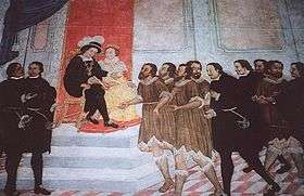
Castilian conquest
In 1402, the Castilian conquest of the islands began, with the expedition of the French explorers Jean de Béthencourt and Gadifer de la Salle, nobles and vassals of Henry III of Castile, to Lanzarote. From there, they went on to conquer Fuerteventura (1405) and El Hierro. Béthencourt received the title King of the Canary Islands, but still recognised King Henry III as his overlord. It was not a simple military enterprise, given the aboriginal resistance on some islands. Neither was it politically, since the particular interests of the nobility (determined to strengthen their economic and political power through the acquisition of the islands) conflicted with those of the states, particularly Castile, which were in the midst of territorial expansion and in a process of strengthening of the Crown against the nobility.[63]
Historians distinguish two periods in the conquest of the Canary Islands:
Aristocratic conquest (Conquista señorial). This refers to the early conquests carried out by the nobility, for their own benefit and without the direct participation of the Crown of Castile, which merely granted rights of conquest in exchange for pacts of vassalage between the noble conqueror and the Crown. One can identify within this period an early phase known as the Betancurian or Norman Conquest, carried out by Jean de Bethencourt (who was originally from Normandy) and Gadifer de la Salle between 1402 and 1405, which involved the islands of Lanzarote, El Hierro and Fuerteventura. The subsequent phase is known as the Castilian Conquest, carried out by Castilian nobles who acquired, through purchases, assignments and marriages, the previously conquered islands and also incorporated the island of La Gomera around 1450.
Royal conquest (Conquista realenga). This defines the conquest between 1478 and 1496, carried out directly by the Crown of Castile, during the reign of the Catholic Monarchs, who armed and partly financed the conquest of those islands which were still unconquered: Gran Canaria, La Palma and Tenerife. This phase of the conquest came to an end in the year 1496, with the dominion of the island of Tenerife, bringing the entire Canarian Archipelago under the control of the Crown of Castile.
Béthencourt also established a base on the island of La Gomera, but it would be many years before the island was fully conquered. The natives of La Gomera, and of Gran Canaria, Tenerife, and La Palma, resisted the Castilian invaders for almost a century. In 1448 Maciot de Béthencourt sold the lordship of Lanzarote to Portugal's Prince Henry the Navigator, an action that was accepted by neither the natives nor the Castilians. Despite Pope Nicholas V ruling that the Canary Islands were under Portuguese control, the crisis swelled to a revolt which lasted until 1459 with the final expulsion of the Portuguese. In 1479, Portugal and Castile signed the Treaty of Alcáçovas, which settled disputes between Castile and Portugal over the control of the Atlantic. This treaty recognized Castilian control of the Canary Islands but also confirmed Portuguese possession of the Azores, Madeira, and the Cape Verde islands, and gave the Portuguese rights to any further islands or lands in the Atlantic that might be discovered.
The Castilians continued to dominate the islands, but due to the topography and the resistance of the native Guanches, they did not achieve complete control until 1496, when Tenerife and La Palma were finally subdued by Alonso Fernández de Lugo. After that, the Canaries were incorporated into the Kingdom of Castile.
After the conquest
After the conquest, the Castilians imposed a new economic model, based on single-crop cultivation: first sugarcane; then wine, an important item of trade with England. In this era, the first institutions of colonial government were founded. Gran Canaria, a colony of the Crown of Castile since 6 March 1480 (from 1556, of Spain), and Tenerife, a Spanish colony since 1496, each had its own governor. There has been speculation that the abundance of roccella tinctoria on the Canary Islands offered a profit motive for Jean de Béthencourt during his conquest of the islands. Lichen has been used for centuries to make dyes. This includes royal purple colors derived from roccella tinctoria, also known as orseille.[64]
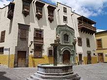
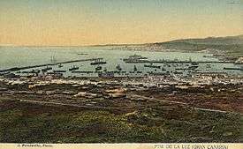
The cities of Santa Cruz de Tenerife and Las Palmas de Gran Canaria became a stopping point for the Spanish conquistadors, traders, and missionaries on their way to the New World. This trade route brought great prosperity to some of the social sectors of the islands. The islands became quite wealthy and soon were attracting merchants and adventurers from all over Europe. Magnificent palaces and churches were built on La Palma during this busy, prosperous period. The Church of El Salvador survives as one of the island's finest examples of the architecture of the 16th century. Civilian architecture survives in forms such as Casas de los Sánchez-Ochando or Casa Quintana.
The Canaries' wealth invited attacks by pirates and privateers. Ottoman Turkish admiral and privateer Kemal Reis ventured into the Canaries in 1501, while Murat Reis the Elder captured Lanzarote in 1585.
The most severe attack took place in 1599, during the Dutch Revolt. A Dutch fleet of 74 ships and 12,000 men, commanded by Pieter van der Does, attacked the capital Las Palmas de Gran Canaria (the city had 3,500 of Gran Canaria's 8,545 inhabitants). The Dutch attacked the Castillo de la Luz, which guarded the harbor. The Canarians evacuated civilians from the city, and the Castillo surrendered (but not the city). The Dutch moved inland, but Canarian cavalry drove them back to Tamaraceite, near the city.
The Dutch then laid siege to the city, demanding the surrender of all its wealth. They received 12 sheep and 3 calves. Furious, the Dutch sent 4,000 soldiers to attack the Council of the Canaries, who were sheltering in the village of Santa Brígida. 300 Canarian soldiers ambushed the Dutch in the village of Monte Lentiscal, killing 150 and forcing the rest to retreat. The Dutch concentrated on Las Palmas de Gran Canaria, attempting to burn it down. The Dutch pillaged Maspalomas, on the southern coast of Gran Canaria, San Sebastián on La Gomera, and Santa Cruz on La Palma, but eventually gave up the siege of Las Palmas and withdrew.
In 1618 the Barbary pirates attacked Lanzarote and La Gomera taking 1000 captives to be sold as slaves.[65] Another noteworthy attack occurred in 1797, when Santa Cruz de Tenerife was attacked by a British fleet under Horatio Nelson on 25 July. The British were repulsed, losing almost 400 men. It was during this battle that Nelson lost his right arm.
18th to 19th century
The sugar-based economy of the islands faced stiff competition from Spain's Caribbean colonies. Low sugar prices in the 19th century caused severe recessions on the islands. A new cash crop, cochineal (cochinilla), came into cultivation during this time, saving the islands' economy. During this time the Canarian-American trade was developed, in which Canarian products such as cochineal, sugarcane and rum were sold in American ports such as Veracruz, Campeche, La Guaira and Havana, among others.[66]
By the end of the 18th century, Canary Islanders had already emigrated to Spanish American territories, such as Havana, Veracruz, and Santo Domingo,[67] San Antonio, Texas[68] and St. Bernard Parish, Louisiana.[69][70] These economic difficulties spurred mass emigration during the 19th and first half of the 20th century, primarily to the Americas. Between 1840 and 1890 as many as 40,000 Canary Islanders emigrated to Venezuela. Also, thousands of Canarians moved to Puerto Rico where the Spanish monarchy felt that Canarians would adapt to island life better than other immigrants from the mainland of Spain. Deeply entrenched traditions, such as the Mascaras Festival in the town of Hatillo, Puerto Rico, are an example of Canarian culture still preserved in Puerto Rico. Similarly, many thousands of Canarians emigrated to the shores of Cuba.[71] During the Spanish–American War of 1898, the Spanish fortified the islands against a possible American attack, but no such event took place.
Romantic period and scientific expeditions
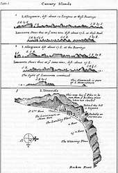
Sirera and Renn (2004)[72] distinguish two different types of expeditions, or voyages, during the period 1770–1830, which they term "the Romantic period":
First are "expeditions financed by the States, closely related with the official scientific Institutions. characterised by having strict scientific objectives (and inspired by) the spirit of Illustration and progress". In this type of expedition, Sirera and Renn include the following travellers:
- J. Edens, whose 1715 ascent and observations of Mt. Teide influenced many subsequent expeditions.
- Louis Feuillée (1724), who was sent to measure the meridian of El Hierro and to map the islands.
- Jean-Charles de Borda (1771, 1776) who more accurately measured the longitudes of the islands and the height of Mount Teide
- the Baudin-Ledru expedition (1796) which aimed to recover a valuable collection of natural history objects.
The second type of expedition identified by Sirera and Renn is one that took place starting from more or less private initiatives. Among these, the key exponents were the following:
- Alexander von Humboldt (1799)
- Buch and Smith (1815)
- Broussonet
- Webb
- Sabin Berthelot.
Sirera and Renn identify the period 1770–1830 as one in which "In a panorama dominated until that moment by France and England enters with strength and brio Germany of the Romantic period whose presence in the islands will increase".
Early 20th century
At the beginning of the 20th century, the British introduced a new cash-crop, the banana, the export of which was controlled by companies such as Fyffes.
30th of November 1833 the Province of Canary Islands had been created with the capital being declared as Santa Cruz de Tenerife.[73] The rivalry between the cities of Las Palmas de Gran Canaria and Santa Cruz de Tenerife for the capital of the islands led to the division of the archipelago into two provinces on 23 September 1927.[74]
During the time of the Second Spanish Republic, Marxist and anarchist workers' movements began to develop, led by figures such as Jose Miguel Perez and Guillermo Ascanio. However, outside of a few municipalities, these organisations were a minority and fell easily to Nationalist forces during the Spanish Civil War.
Franco regime
In 1936, Francisco Franco was appointed General Commandant of the Canaries. He joined the military revolt of 17 July which began the Spanish Civil War. Franco quickly took control of the archipelago, except for a few points of resistance on La Palma and in the town of Vallehermoso, on La Gomera. Though there was never a war in the islands, the post-war suppression of political dissent on the Canaries was most severe.[75]
During the Second World War, Winston Churchill prepared plans for the British seizure of the Canary Islands as a naval base, in the event of Gibraltar being invaded from the Spanish mainland.
Opposition to Franco's regime did not begin to organise until the late 1950s, which experienced an upheaval of parties such as the Communist Party of Spain and the formation of various nationalist, leftist parties.
Self-governance
After the death of Franco, there was a pro-independence armed movement based in Algeria, the Movement for the Independence and Self-determination of the Canaries Archipelago (MAIAC). In 1968, the Organisation of African Unity recognized the MAIAC as a legitimate African independence movement, and declared the Canary Islands as an African territory still under foreign rule.[76]
After the establishment of a democratic constitutional monarchy in Spain, autonomy was granted to the Canaries via a law passed in 1982, with a newly established autonomous devolved government and parliament. In 1983, the first autonomous elections were held. The Spanish Socialist Workers' Party (PSOE) won. In the 2007 elections, the PSOE gained a plurality of seats, but the nationalist Canarian Coalition and the conservative Partido Popular (PP) formed a ruling coalition government.[77]
Capitals
At present, the Canary Islands is the only autonomous community in Spain that has two capitals: Santa Cruz de Tenerife and Las Palmas de Gran Canaria, since the Statute of Autonomy of the Canary Islands was created in 1982.[16][17]
The political capital of the archipelago did not exist as such until the nineteenth century. The first cities founded by the Europeans at the time of the conquest of the Canary Islands in the 15th century were: Telde (in Gran Canaria), San Marcial del Rubicón (in Lanzarote) and Betancuria (in Fuerteventura). These cities boasted the first European institutions present in the archipelago, including Catholic bishoprics.[78] Although, because the period of splendor of these cities developed before the total conquest of the archipelago and its incorporation into the Crown of Castile never had a political and real control of the entire Canary archipelago.
The function of a Canarian city with full jurisdiction for the entire archipelago only exists after the conquest of the Canary Islands, although originally De facto, that is, without legal and real meaning and linked to the headquarters of the Canary Islands General Captaincy.
Las Palmas de Gran Canaria was the first city that exercised this function. This is because the residence of the Captain General of the Canary Islands was in this city during part of the sixteenth and seventeenth centuries.[79] In May 1661, the Captain General of the Canary Islands, Jerónimo de Benavente y Quiñones, moved the headquarters of the captaincy to the city of San Cristóbal de La Laguna on the island of Tenerife.[80] This was due to the fact that this island since the conquest was the most populated, productive and with the highest economic expectations.[81] La Laguna would be considered the De facto capital of the archipelago[82] until mid the official status of the capital of Canary Islands in the city of Santa Cruz de Tenerife was confirmed in the 19th century, due in part to the constant controversies and rivalries between the bourgeoisies of San Cristóbal de La Laguna and Las Palmas de Gran Canaria for the economic, political and institutional hegemony of the archipelago.[83]
Already in 1723, the Captain General of the Canary Islands Lorenzo Fernandez de Villavicencio had moved the headquarters of the General Captaincy of the Canary Islands from San Cristóbal de La Laguna to Santa Cruz de Tenerife. This decision continued without pleasing the society of the island of Gran Canaria.[84] It would be after the creation of the Province of Canary Islands in November 1833 in which Santa Cruz would become the first fully official capital of the Canary Islands (De jure and not of De facto as happened previously).[19][20] Santa Cruz de Tenerife would be the capital of the Canary archipelago until during the Government of General Primo de Rivera in 1927 the Province of Canary Islands was split in two provinces: Las Palmas with capital in Las Palmas de Gran Canaria, and Santa Cruz de Tenerife with capital in the homonymous city.
Finally, with the Statute of Autonomy of the Canary Islands in 1982 and the creation of the Autonomous Community of the Canary Islands, the capital of the archipelago between Las Palmas de Gran Canaria and Santa Cruz de Tenerife is fixed, which is how it remains today.
Demographics
| Year | Pop. | ±% p.a. |
|---|---|---|
| 1768 | 155,763 | — |
| 1787 | 168,928 | +0.43% |
| 1797 | 173,865 | +0.29% |
| 1842 | 241,266 | +0.73% |
| 1860 | 237,036 | −0.10% |
| 1887 | 301,983 | +0.90% |
| 1900 | 364,408 | +1.46% |
| 1920 | 488,483 | +1.48% |
| 1940 | 687,937 | +1.73% |
| 1960 | 966,177 | +1.71% |
| 1981 | 1,367,646 | +1.67% |
| 1990 | 1,589,403 | +1.68% |
| 2000 | 1,716,276 | +0.77% |
| 2010 | 2,118,519 | +2.13% |
| 2011[86] | 2,082,655 | −1.69% |
| 2014[87] | 2,104,815 | +0.35% |
| 2015[88] | 2,128,647 | +1.13% |
| 2017 | 2,154,905 | +0.61% |
| 2018[89] | 2,127,685 | −1.26% |
| 2019 | 2,153,389 | +1.21% |
The Canary Islands have a population of 2,153,389 inhabitants (2019), making it the eighth most populous of Spain's autonomous communities.[2] The total area of the archipelago is 7,493 km2 (2,893 sq mi),[90] resulting in a population density of 287.4 inhabitants per square kilometre.
| Population of the Canary Islands 2019 | |||
|---|---|---|---|
| Birthplace | Population | Percent | |
| 1,553,517 | 72.1 | ||
| Other regions (Spain) | 176,302 | 8.2 | |
| Total, Spain | 1,735,457 | 80.6 | |
| Foreign-born | 417,932 | 19.4 | |
| Americas | 201,257 | 9.3 | |
| Venezuela | 66,573 | - | |
| Cuba | 41,792 | - | |
| Colombia | 31,361 | - | |
| Argentina | 17.429 | - | |
| Uruguay | 8,687 | - | |
| Rest of Europe | 154,511 | 7.2 | |
| Italy | 39,469 | - | |
| Germany | 25,921 | - | |
| United Kingdom | 25,339 | - | |
| Africa | 38,768 | 1.8 | |
| Morocco | 24,268 | - | |
| Asia | 23,082 | 1.1 | |
| China | 9,848 | - | |
| Oceania | 314 | 0.0 | |
| Total | 2,153,389 | 100.0% | |
| Source[91][92] | |||
The Canarian population includes long-tenured residents and new waves of mainland Spanish immigrants, as well as foreign-born populations.[4] In 2019 the total population was 2,153,389, of which 72.1% were native Canary Islanders.[92] A total of 80.6%, or 1,735,457, were born in Spain and 19.4%, or 417,932, were born outside the country. Of these, the majority are from the Americas, mainly from Colombia (31,368), Venezuela (66,593) and Cuba (41,807). There are also almost 40,000 people from Africa, the majority from Morocco (24,281).[4][91]
Population of the individual islands
The population of the islands according to the 2019 data are:[2]
- Tenerife – 917,841
- Gran Canaria – 851,231
- Lanzarote – 152,289 (including the population of La Graciosa)
- Fuerteventura – 116,886
- La Palma – 82,671
- La Gomera – 21,503
- El Hierro – 10,968
Religion
The Roman Catholic branch of Christianity has been the majority religion in the archipelago for more than five centuries, ever since the Conquest of the Canary Islands. There are also several other religious communities.
Roman Catholic Church
The overwhelming majority of native Canarians are Roman Catholic (76.7%)[93] with various smaller foreign-born populations of other Christian beliefs such as Protestants.
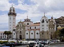
The appearance of the Virgin of Candelaria (Patron of Canary Islands) was credited with moving the Canary Islands toward Christianity. Two Catholic saints were born in the Canary Islands: Peter of Saint Joseph de Betancur[94] and José de Anchieta.[95] Both born on the island of Tenerife, they were respectively missionaries in Guatemala and Brazil.
The Canary Islands are divided into two Catholic dioceses, each governed by a bishop:
- Diócesis Canariense: Includes the islands of the Eastern Province: Gran Canaria, Fuerteventura and Lanzarote. Its capital was San Marcial El Rubicón (1404) and Las Palmas de Gran Canaria (1483–present). There was a previous bishopric which was based in Telde, but it was later abolished.
- Diócesis Nivariense: Includes the islands of the western province: Tenerife, La Palma, La Gomera and El Hierro. Its capital is San Cristóbal de La Laguna (1819–present).
Other religions
Separate from the overwhelming Christian majority are a minority of Muslims.[96] Among the followers of Islam, the Islamic Federation of the Canary Islands exists to represent the Islamic community in the Canary Islands as well as to provide practical support to members of the Islamic community.[97]
Other religious faiths represented include Jehovah's Witnesses, The Church of Jesus Christ of Latter-day Saints as well as Hinduism.[96] Minority religions are also present such as the Church of the Guanche People which is classified as a neo-pagan native religion.[96] Also present are Buddhism,[96] Judaism,[96] Baha'i,[96] African religion,[96] and Chinese religions.[96]
Statistics
The distribution of beliefs in 2012 according to the CIS Barometer Autonomy was as follows:[98]
- Catholic 84.9%
- Atheist/Agnostic/Unbeliever 12.3%
- Other religions 1.7%
Population genetics
Islands
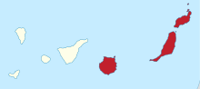
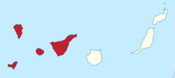
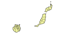
Ordered from west to east, the Canary Islands are El Hierro, La Palma, La Gomera, Tenerife, Gran Canaria, Fuerteventura, Lanzarote and La Graciosa. In addition, north of Lanzarote are the islets of Montaña Clara, Alegranza, Roque del Este and Roque del Oeste, belonging to the Chinijo Archipelago, and northeast of Fuerteventura is the islet of Lobos. There are also a series of small adjacent rocks in the Canary Islands: the Roques de Anaga, Garachico and Fasnia in Tenerife, and those of Salmor and Bonanza in El Hierro.
- The Canary Islands
 El Hierro
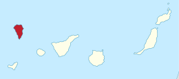 La Palma
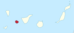 La Gomera
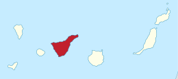 Tenerife
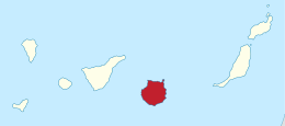 Gran Canaria
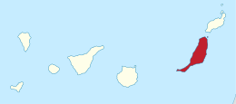 Fuerteventura
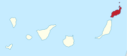 Lanzarote
 La Graciosa
El Hierro
El Hierro, the westernmost island, covers 268.71 km2 (103.75 sq mi), making it the second smallest of the major islands, and the least populous with 10,798 inhabitants. The whole island was declared Reserve of the Biosphere in 2000. Its capital is Valverde. Also known as Ferro, it was once believed to be the westernmost land in the world.
Fuerteventura
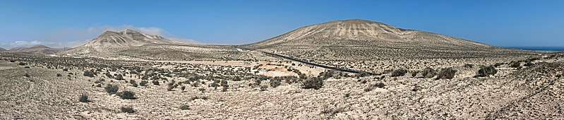
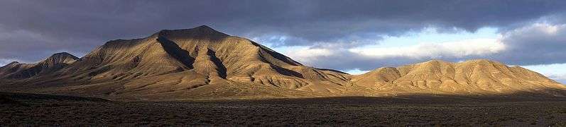
Fuerteventura, with a surface of 1,660 km2 (640 sq mi), is the second-most extensive island of the archipelago. It has been declared a Biosphere reserve by Unesco. It has a population of 113,275. Being also the most ancient of the islands, it is the one that is more eroded: its highest point is the Peak of the Bramble, at a height of 807 metres (2,648 feet). Its capital is Puerto del Rosario.
Gran Canaria
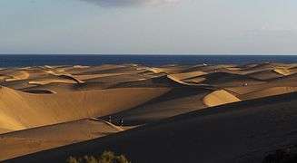
Gran Canaria has 846,717 inhabitants. The capital, Las Palmas de Gran Canaria (377,203 inhabitants), is the most populous city and shares the status of capital of the Canaries with Santa Cruz de Tenerife. Gran Canaria's surface area is 1,560 km2 (600 sq mi). In center of the island lie the Roque Nublo 1,813 metres (5,948 feet) and Pico de las Nieves ("Peak of Snow") 1,949 metres (6,394 feet). In the south of island are the Maspalomas Dunes (Gran Canaria), these are the biggest tourist attractions.
La Gomera
La Gomera has an area of 369.76 km2 (142.77 sq mi) and is the second least populous island with 21,136 inhabitants. Geologically it is one of the oldest of the archipelago. The insular capital is San Sebastian de La Gomera. Garajonay's National Park is located on the island.
Lanzarote
Lanzarote is the easternmost island and one of the most ancient of the archipelago, and it has shown evidence of recent volcanic activity. It has a surface of 845.94 km2 (326.62 sq mi), and a population of 149,183 inhabitants, including the adjacent islets of the Chinijo Archipelago. The capital is Arrecife, with 56,834 inhabitants.
Chinijo Archipelago
The Chinijo Archipelago includes the islands La Graciosa, Alegranza, Montaña Clara, Roque del Este and Roque del Oeste. It has a surface of 40.8 km2 (15.8 sq mi), and a population of 658 inhabitants all of them on La Graciosa. With 29 km2 (11 sq mi), La Graciosa, is the smallest inhabited island of the Canaries, and the major island of the Chinijo Archipelago.
La Palma
La Palma, with 81,863 inhabitants covering an area of 708.32 km2 (273.48 sq mi), is in its entirety a biosphere reserve. It shows no recent signs of volcanic activity, even though the volcano Teneguía entered into eruption last in 1971. In addition, it is the second-highest island of the Canaries, with the Roque de los Muchachos 2,423 metres (7,949 feet) as highest point. Santa Cruz de La Palma (known to those on the island as simply "Santa Cruz") is its capital.
Tenerife
Tenerife is, with its area of 2,034 km2 (785 sq mi), the most extensive island of the Canary Islands. In addition, with 904,713 inhabitants it is the most populated island of the archipelago and Spain. Two of the islands' principal cities are located on it: The capital, Santa Cruz de Tenerife and San Cristóbal de La Laguna (a World Heritage Site). San Cristóbal de La Laguna, the second city of the island is home to the oldest university in the Canary Islands, the University of La Laguna. The Teide, with its 3,718 metres (12,198 feet) is the highest peak of Spain and also a World Heritage Site. Tenerife is the site of the worst air disaster in the history of aviation, in which 583 people were killed in the collision of two Boeing 747s on 27 March 1977.
La Graciosa
Graciosa Island or commonly La Graciosa is a volcanic island in the Canary Islands of Spain, located 2 km (1.2 mi) north of the island of Lanzarote across the Strait of El Río. It was formed by the Canary hotspot. The island is part of the Chinijo Archipelago and the Chinijo Archipelago Natural Park (Parque Natural del Archipiélago Chinijo). It is administrated by the municipality of Teguise. In 2018 La Graciosa officially became the eighth Canary Island.[99][100][101] Before then, La Graciosa had the status of an islet, administratively dependent on the island of Lanzarote. It is the smallest and least populated of the main islands, with a population of about 700 people.
Data
| Flag | Coat of arms | Island | Capital | Area (km2) | Population (2010) | Population Density (people/km2) |
|---|---|---|---|---|---|---|
| El Hierro | Valverde | 268.71 | 10,960 | 40.79 | ||
| Fuerteventura | Puerto del Rosario | 1,660 | 103,492 | 62.34 | ||
| Gran Canaria | Las Palmas de Gran Canaria | 1,560.1 | 845,676 | 542.07 | ||
| La Gomera | San Sebastián | 369.76 | 22,776 | 61.6 | ||
| Lanzarote | Arrecife | 845.94 | 141,437 | 167.2 | ||
| La Palma | Santa Cruz de La Palma | 708.32 | 86,324 | 121.87 | ||
| Tenerife | Santa Cruz de Tenerife | 2,034.38 | 906,854 | 445.76 | ||
| – | – | La Graciosa | Caleta de Sebo | 29.05 | 658 | 22.65 |
| – | – | Alegranza | – | 10.3 | – | – |
| – | – | Isla de Lobos | – | 4.5 | – | – |
| – | – | Montaña Clara | – | 1.48 | – | – |
| – | – | Roque del Este | – | 0.06 | – | – |
| – | – | Roque del Oeste | – | 0.015 | – | – |
Economy and environment
| Year | Visitors |
|---|---|
| 2009 (Jan–Jun) | 4,002,013 |
| 2008 | 9,210,509 |
| 2007 | 9,326,116 |
| 2006 | 9,530,039 |
| 2005 | 9,276,963 |
| 2004 | 9,427,265 |
| 2003 | 9,836,785 |
| 2002 | 9,778,512 |
| 2001 | 10,137,205 |
| 2000 | 9,975,977 |
| 1993 | 6,545,396 |
| Largest by Country (2008) |
Population |
| Germany | 2,498,847 |
| United Kingdom | 3,355,942 |
The economy is based primarily on tourism, which makes up 32% of the GDP. The Canaries receive about 12 million tourists per year. Construction makes up nearly 20% of the GDP and tropical agriculture, primarily bananas and tobacco, are grown for export to Europe and the Americas. Ecologists are concerned that the resources, especially in the more arid islands, are being overexploited but there are still many agricultural resources like tomatoes, potatoes, onions, cochineal, sugarcane, grapes, vines, dates, oranges, lemons, figs, wheat, barley, maize, apricots, peaches and almonds.
Water resources are also being overexploited, due to the high water usage by tourists.[103] Also, some islands (such as Gran Canaria and Tenerife) overexploit the ground water. This is done in such degree that, according to European and Spanish legal regulations, the current situation is not acceptable. To address the problems, good governance and a change in the water use paradigm have been proposed. These solutions depend largely on controlling water use and on demand management. As this is administratively difficult and politically unpalatable, most action is currently directed at increasing the public offer of water through import from outside; a decision which is economically, politically and environmentally questionable.[104]
To bring in revenue for environmental protection, innovation, training and water sanitation a tourist tax was considered in 2018, along with a doubling of the ecotax and restrictions on holiday rents in the zones with the greatest pressure of demand.[105]
The economy is € 25 billion (2001 GDP figures). The islands experienced continuous growth during a 20-year period, up until 2001, at a rate of approximately 5% annually. This growth was fueled mainly by huge amounts of foreign direct investment, mostly to develop tourism real estate (hotels and apartments), and European Funds (near €11 billion in the period from 2000 to 2007), since the Canary Islands are labelled Region Objective 1 (eligible for euro structural funds). Additionally, the EU allows the Canary Islands Government to offer special tax concessions for investors who incorporate under the Zona Especial Canaria (ZEC) regime and create more than five jobs.
Spain gave permission in August 2014 for Repsol and its partners to explore oil and gas prospects off the Canary Islands, involving an investment of €7.5 billion over four years, to commence at the end of 2016. Repsol at the time said the area could ultimately produce 100,000 barrels of oil a day, which would meet 10 percent of Spain's energy needs.[106] However, the analysis of samples obtained did not show the necessary volume nor quality to consider future extraction, and the project was scrapped.[107]
The Canary Islands have great natural attractions, climate and beaches make the islands a major tourist destination, being visited each year by about 12 million people (11,986,059 in 2007, noting 29% of Britons, 22% of Spanish, not residents of the Canaries, and 21% of Germans). Among the islands, Tenerife has the largest number of tourists received annually, followed by Gran Canaria and Lanzarote.[13][14] The archipelago's principal tourist attraction is the Teide National Park (in Tenerife) where the highest mountain in Spain and third largest volcano in the world (Mount Teide), receives over 2.8 million visitors annually.[108]
The combination of high mountains, proximity to Europe, and clean air has made the Roque de los Muchachos peak (on La Palma island) a leading location for telescopes like the Grantecan.
The islands, as an autonomous region of Spain, are in the European Union and the Schengen Area. They are in the European Union Customs Union but outside the VAT area,[109] Instead of VAT there is a local Sales Tax (IGIC) which has a general rate of 7%, an increased tax rate of 13.5%, a reduced tax rate of 3% and a zero tax rate for certain basic need products and services. Consequently, some products are subject to additional VAT if being exported from the islands into mainland Spain or the rest of the EU.
Canarian time is Western European Time (WET) (or GMT; in summer one hour ahead of GMT). So Canarian time is one hour behind that of mainland Spain and the same as that of the UK, Ireland and mainland Portugal all year round.
Tourism statistics
The number of tourists who visited the Canary Islands had been in 2018 16,150,054 and in the year 2019 15,589,290.[110]
| Rank | Island | Number of Visitors |
|---|---|---|
| 1 | Tenerife | 5,889,454 |
| 2 | Gran Canaria | 4,267,385 |
| 3 | Lanzarote | 3,065,575 |
| 4 | Fuerteventura | 2,023,196 |
| 5 | La Palma | 343,680 |
| Month | Lanzarote | Fuerteventura | Gran Canaria | Tenerife | La Palma |
|---|---|---|---|---|---|
| 2020 May | 0 | 0 | 0 | 0 | 0 |
| 2020 April | 0 | 0 | 0 | 0 | 0 |
| 2020 March | 99,407 | 71,988 | 141,692 | 208,696 | 11,531 |
| 2020 February | 215,054 | 175,618 | 387,432 | 528,873 | 31,996 |
| 2020 January | 209,769 | 149,140 | 405,208 | 512,153 | 36,618 |
| 2020 | 524,230 | 396,746 | 934,332 | 1,249,722 | 80,145 |
| 2019 December | 256,733 | 168,717 | 416,723 | 526,258 | 35,515 |
| 2019 November | 231,995 | 159,352 | 405,715 | 487,576 | 29,614 |
| 2019 October | 258,722 | 175,472 | 354,718 | 484,905 | 24,506 |
| 2019 September | 235,534 | 154,056 | 291,855 | 432,241 | 21,106 |
| 2019 August | 273,783 | 175,153 | 328,921 | 501,712 | 26,465 |
| 2019 July | 270,438 | 171,819 | 333,530 | 481,976 | 22,059 |
| 2019 June | 242,901 | 159,945 | 274,881 | 451,244 | 18,266 |
| 2019 May | 230,821 | 140,370 | 261,250 | 423,740 | 19,447 |
| 2019 April | 256,776 | 179,318 | 324,647 | 484,097 | 32,927 |
| 2019 March | 295,614 | 201,556 | 447,905 | 579,224 | 39,570 |
| 2019 February | 272,428 | 164,970 | 403,123 | 513,880 | 32,162 |
| 2019 January | 239,830 | 172,468 | 424,117 | 522,601 | 42,043 |
| 2019 | 3,065,575 | 2,023,196 | 4,267,385 | 5,889,454 | 343,680 |
| 2018 December | 258,185 | 171,248 | 420,041 | 519,566 | 34,266 |
| 2018 November | 256,755 | 163,189 | 410,456 | 513,953 | 40,401 |
| 2018 October | 265,950 | 207,176 | 397,411 | 541,492 | 27,865 |
| 2018 September | 249,877 | 181,272 | 326,673 | 451,957 | 22,094 |
| 2018 August | 260,216 | 206,718 | 370,232 | 516,048 | 28,054 |
| 2018 July | 258,746 | 208,723 | 374,844 | 485,961 | 23,453 |
| 2018 June | 233,824 | 181,406 | 301,068 | 448,667 | 19,384 |
| 2018 May | 245,563 | 159,808 | 285,178 | 421,763 | 22,702 |
| 2018 April | 266,433 | 184,772 | 347,043 | 488,679 | 30,675 |
| 2018 March | 299,270 | 223,478 | 441,620 | 572,515 | 35,369 |
| 2018 February | 246,215 | 181,218 | 396,707 | 484,485 | 40,282 |
| 2018 January | 222,283 | 184,199 | 438,555 | 503,856 | 50,215 |
| 2018 | 3,063,317 | 2,253,207 | 4,509,828 | 5,948,942 | 374,760 |
| Source (05/2020): [110] |
Transport
The Canary Islands have eight airports altogether, two of the main ports of Spain, and an extensive network of autopistas (highways) and other roads. For a road map see multimap.[111] Traffic congestion is sometimes a problem in Tenerife and on Grand Canaria.[112][113][114]
There are large ferry boats that link islands as well as fast ferries linking most of the islands. Both types can transport large numbers of passengers and cargo (including vehicles). Fast ferries are made of aluminium and powered by modern and efficient diesel engines, while conventional ferries have a steel hull and are powered by heavy oil. Fast ferries travel relatively quickly (in excess of 30 kn (56 km/h; 35 mph)) and are a faster method of transportation than the conventional ferry (some 20 kn (37 km/h; 23 mph)). A typical ferry ride between La Palma and Tenerife may take up to eight hours or more while a fast ferry takes about two and a half hours and between Tenerife and Gran Canaria can be about one hour.
The largest airport is the Gran Canaria Airport. Tenerife has two airports, Tenerife North Airport and Tenerife South Airport.[115] The island of Tenerife gathers the highest passenger movement of all the Canary Islands through its two airports.[116] The two main islands (Tenerife and Gran Canaria) receive the greatest number of passengers.[117] Tenerife 6,204,499 passengers and Gran Canaria 5,011,176 passengers.[118]
The port of Las Palmas is first in freight traffic in the islands,[119] while the port of Santa Cruz de Tenerife is the first fishing port with approximately 7,500 tons of fish caught, according to the Spanish government publication Statistical Yearbook of State Ports. Similarly, it is the second port in Spain as regards ship traffic, only surpassed by the Port of Algeciras Bay.[120] The port's facilities include a border inspection post (BIP) approved by the European Union, which is responsible for inspecting all types of imports from third countries or exports to countries outside the European Economic Area. The port of Los Cristianos (Tenerife) has the greatest number of passengers recorded in the Canary Islands, followed by the port of Santa Cruz de Tenerife.[121] The Port of Las Palmas is the third port in the islands in passengers and first in number of vehicles transported.[121]
The SS America was beached at the Canary islands on 18 January 1994. However, the ocean liner broke apart after the course of several years and eventually sank beneath the surface.
Rail transport
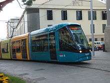
The Tenerife Tram opened in 2007 and is currently the only one in the Canary Islands, travelling between the cities of Santa Cruz de Tenerife and San Cristóbal de La Laguna.
Three more railway lines are being planned for the Canary Islands:
| Line | Island | Terminus A | Terminus B |
|---|---|---|---|
| Tren de Gran Canaria[122] | Gran Canaria | Las Palmas de Gran Canaria | Maspalomas |
| Tren del Sur | Tenerife | Santa Cruz de Tenerife | Los Cristianos |
| Tren del Norte[123] | Tenerife | Santa Cruz de Tenerife | Los Realejos |
Airports
- Tenerife South Airport – Tenerife
- Tenerife North Airport – Tenerife
- César Manrique-Lanzarote Airport – Lanzarote
- Fuerteventura Airport – Fuerteventura
- Gran Canaria Airport – Gran Canaria
- La Palma Airport – La Palma
- La Gomera Airport – La Gomera
- El Hierro Airport – El Hierro[124]
Ports
_01_ies.jpg)
- Port of Puerto del Rosario – Fuerteventura
- Port of Arrecife – Lanzarote
- Port of Playa Blanca—Lanzarote
- Port of Santa Cruz de La Palma – La Palma
- Port of San Sebastián de La Gomera – La Gomera
- Port of La Estaca – El Hierro
- Port of Las Palmas – Gran Canaria
- Port of Arinaga – Gran Canaria
- Port of Agaete – Gran Canaria
- Port of Los Cristianos – Tenerife
- Port of Santa Cruz de Tenerife – Tenerife
- Port of Garachico – Tenerife
- Port of Granadilla – Tenerife
Health
The Servicio Canario de Salud is an autonomous body of administrative nature attached to the Ministry responsible for Health of the Government of the Canary Islands. The majority of the archipelago's hospitals belong to this organization:[125]
- Hospital Nuestra Señora de los Reyes – El Hierro
- Hospital General de La Palma – La Palma
- Hospital Nuestra Señora de Guadalupe – La Gomera
- Hospital Universitario Nuestra Señora de Candelaria – Tenerife
- Hospital Universitario de Canarias – Tenerife
- Hospital del Sur de Tenerife – Tenerife
- Hospital del Norte de Tenerife – Tenerife
- Hospital Universitario de Gran Canaria Doctor Negrín – Gran Canaria
- Hospital Universitario Insular de Gran Canaria – Gran Canaria
- Hospital General de Lanzarote Doctor José Molina Orosa – Lanzarote
- Hospital General de Fuerteventura – Fuerteventura
Wildlife
Prehistoric fauna
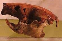
Before the arrival of the Aborigines, the Canary Islands was inhabited by endemic animals, such as some extinct; giant lizards (Gallotia goliath), giant rats (Canariomys bravoi and Canariomys tamarani)[126] and giant tortoises (Geochelone burchardi and Geochelone vulcanica),[127] among others.
Terrestrial wildlife
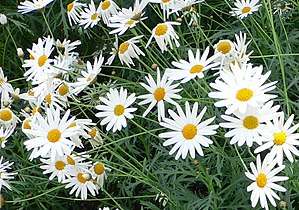
With a range of habitats, the Canary Islands exhibit diverse plant species. The bird life includes European and African species, such as the black-bellied sandgrouse; and a rich variety of endemic (local) taxa including the:
- Canary
- Graja, a subspecies of red-billed chough endemic to La Palma
- Blue chaffinch (endemic to Tenerife and Gran Canaria)
- Canary Islands chiffchaff
- Fuerteventura chat
- Tenerife goldcrest
- La Palma chaffinch
- Canarian Egyptian vulture
- Bolle's pigeon
- Laurel pigeon
- Plain swift
- Houbara bustard
- Spiders
- Snakes
- Scorpions
- Canary Islands oystercatcher (extinct)
Terrestrial fauna includes geckos, wall lizards, and three endemic species of recently rediscovered and critically endangered giant lizard: the El Hierro giant lizard (or Roque Chico de Salmor giant lizard), La Gomera giant lizard, and La Palma giant lizard. Mammals include the Canarian shrew, Canary big-eared bat, the Algerian hedgehog (which may have been introduced) and the more recently introduced mouflon. Some endemic mammals, the lava mouse, Tenerife giant rat and Gran Canaria giant rat, are extinct, as are the Canary Islands quail, long-legged bunting, the eastern Canary Islands chiffchaff and the giant prehistoric tortoises; Geochelone burchardi and Geochelone vulcanica.
Marine life
The marine life found in the Canary Islands is also varied, being a combination of North Atlantic, Mediterranean and endemic species. In recent years, the increasing popularity of both scuba diving and underwater photography have provided biologists with much new information on the marine life of the islands.
Fish species found in the islands include many species of shark, ray, moray eel, bream, jack, grunt, scorpionfish, triggerfish, grouper, goby, and blenny. In addition, there are many invertebrate species, including sponge, jellyfish, anemone, crab, mollusc, sea urchin, starfish, sea cucumber and coral.
There are a total of five different species of marine turtle that are sighted periodically in the islands, the most common of these being the endangered loggerhead sea turtle.[128] The other four are the green sea turtle, hawksbill sea turtle, leatherback sea turtle and Kemp's ridley sea turtle. Currently, there are no signs that any of these species breed in the islands, and so those seen in the water are usually migrating. However, it is believed that some of these species may have bred in the islands in the past, and there are records of several sightings of leatherback sea turtle on beaches in Fuerteventura, adding credibility to the theory.
Marine mammals include the large varieties of cetaceans including rare and not well-known species (see more details in the Marine life of the Canary Islands). Hooded seals[129] have also been known to be vagrant in the Canary Islands every now and then. The Canary Islands were also formerly home to a population of the rarest pinniped in the world, the Mediterranean monk seal.
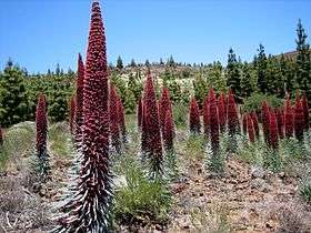
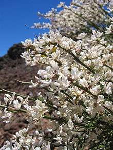
Native flora gallery
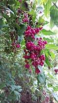 Bosea yervamora
.jpg)
_canariensis_by_Scott_zona_-_004.jpg)
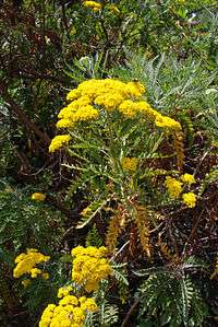 Gonospermum elegans
.jpg) Lavatera acerifolia var. acerifolia
Lavatera acerifolia var. acerifolia Lavatera phoenicea
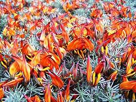
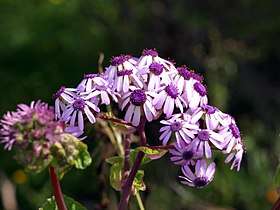 Pericallis webbii
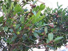
_01.jpg)
_04.jpg)
Holidays
Some holidays of those celebrated in the Canary Islands are international and national, others are regional holidays and others are of insular character. The official day of the autonomous community is Canary Islands Day on 30 May. The anniversary of the first session of the Parliament of the Canary Islands, based in the city of Santa Cruz de Tenerife, held on 30 May 1983, is commemorated with this day.
The common festive calendar throughout the Canary Islands is as follows:[130]
| Date | Name | Data |
|---|---|---|
| 1 January | New Year | International festival. |
| 6 January | Epiphany | Catholic festival. |
| March or April | Holy Thursday and Holy Friday | Christian festival. |
| 1 May | International Workers' Day | International festival. |
| 30 May | Canary Islands Day | Day of the autonomous community. Anniversary of the first session of the Parliament of the Canary Islands. |
| 15 August | Assumption of Mary | Catholic festival. This day is festive in the archipelago as in all of Spain. Popularly, in the Canary Islands it is known as the day on which the is celebrated of Virgin of Candelaria (Saint Patron of the Canary Islands).[131][132] |
| 12 October | Fiesta Nacional de España (Día de la Hispanidad) | National Holiday of Spain. Commemoration of discovery of the Americas. |
| 1 November | All Saints' Day | Catholic festival. |
| 6 December | Constitution Day | Commemoration of the Spanish constitutional referendum, 1978. |
| 8 December | Immaculate Conception | Catholic festival. The Immaculate Conception is the Saint Patron of Spain. |
| 25 December | Christmas | Christian festival. Commemoration of the birth of Jesus of Nazareth. |
In addition, each of the islands has an island festival in which it is a holiday only on that island in question. These are the festivities of island patrons saints of each island. Organized chronologically are:[133]
| Date | Island | Saint/Virgin |
|---|---|---|
| 2 February | Tenerife | Our Lady of Candelaria |
| 5 August | La Palma | Our Lady of the Snows |
| 8 September | Gran Canaria | Our Lady of the Pine |
| 15 September | Lanzarote | Our Lady of Dolours |
| Third Saturday of the month of September | Fuerteventura | Our Lady of the Peña |
| 24 September | El Hierro | Our Lady of the Kings |
| Monday following the first Saturday of October | La Gomera | Our Lady of Guadalupe |
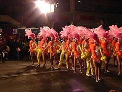
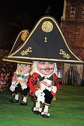
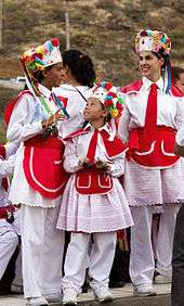
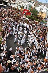
The most famous festivals of the Canary Islands is the carnival. It is the most famous and international festival of the archipelago. The carnival is celebrated in all the islands and all its municipalities, perhaps the two busiest are those of the two Canarian capitals; the Carnival of Santa Cruz de Tenerife (Tourist Festival of International Interest) and the Carnival of Las Palmas de Gran Canaria. It is celebrated on the streets between the months of February and March. But the rest of the islands of the archipelago have their carnivals with their own traditions among which stand out: The Festival of the Carneros of El Hierro, the Festival of the Diabletes of Teguise in Lanzarote, Los Indianos de La Palma, the Carnival of San Sebastián de La Gomera and the Carnival of Puerto del Rosario in Fuerteventura.
Science and technology
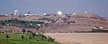
In the 1960s, Gran Canaria was selected as the location for one of the 14 ground stations in the Manned Space Flight Network (MSFN) to support the NASA space program. Maspalomas Station, located in the south of the island, took part in a number of space missions including the Apollo 11 Moon landings and Skylab. Today it continues to support satellite communications as part of the ESA network.[134]
Because of the remote location, a number of astronomical observatories are located in the archipelago, including the Teide Observatory on Tenerife, the Roque de los Muchachos Observatory on La Palma, and the Temisas Astronomical Observatory on Gran Canaria.
Sports
A unique form of wrestling known as Canarian wrestling (lucha canaria) has opponents stand in a special area called a "terrero" and try to throw each other to the ground using strength and quick movements.[138]
Another sport is the "game of the sticks" where opponents fence with long sticks. This may have come about from the shepherds of the islands who would challenge each other using their long walking sticks.[138]
Furthermore, there is the shepherd's jump (salto del pastor). This involves using a long stick to vault over an open area. This sport possibly evolved from the shepherd's need to occasionally get over an open area in the hills as they were tending their sheep.[138]
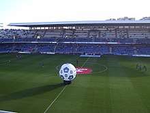
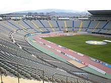
The two main football teams in the archipelago are: the CD Tenerife (founded in 1912) and UD Las Palmas (founded in 1949). As if the 2018/2019 season, both Tenerife and Las Palmas play in Liga Adelante. When in the same division, the clubs contest the Canary Islands derby. There are smaller clubs also playing in the mainland Spanish football league system, most notably UD Lanzarote and CD Laguna, although no other Canarian clubs have played in the top flight.
The mountainous terrain of the Canary Islands also caters to the growing popularity of ultra running and ultramarathons as host of annual competitive long-distance events including CajaMar Tenerife Bluetrail on Tenerife, Transvulcania on La Palma, Transgrancanaria[139] on Gran Canaria and the Half Marathon des Sables on Fuerteventura. A yearly Ironman Triathlon has been taking place on Lanzarote since 1992.[140][141]
Notable athletes
- Paco Campos, (1916–1995); a footballer who played as a forward. With 127 goals, 120 of which were for Atlético Madrid, he is the highest scoring player from the Canary Islands in La Liga.
- Nicolás García Hemme, born 20 June 1988 in Las Palmas de Gran Canaria, Canary Islands, 2012 London Olympics, Taekwondo Silver Medalist in Men's Welterweight category (−80 kg).
- Alfredo Cabrera, (1881–1964); shortstop for the St. Louis Cardinals in 1913
- Sergio Rodríguez, born in San Cristóbal de La Laguna in 1986, played point guard for the Portland Trail Blazers, Sacramento Kings, and New York Knicks
- David Silva, born in Arguineguín in 1986, plays association football for Manchester City, member of the 2010 FIFA World Cup champion Spain national football team
- Juan Carlos Valerón, born in Arguineguín in 1975, played association football for Deportivo la Coruna and Las Palmas
- Pedro, born in Santa Cruz de Tenerife in 1987, plays association football for Chelsea, member of the 2010 FIFA World Cup champion Spain national football team
- Carla Suárez Navarro, born in Las Palmas de Gran Canaria in 1988, professional tennis player
- Paola Tirados, born in Las Palmas de Gran Canaria in 1980, synchronized swimmer, who participated in the Olympic Games of 2000, 2004 and 2008. She won the silver medal in Beijing in 2008 in the team competition category.
- Jesé, born in Las Palmas de Gran Canaria in 1993, plays association football for Paris Saint-Germain
- Christo Bezuidenhout, born in Tenerife in 1970, played rugby union for Gloucester and South Africa.
See also
History
- Battle of Santa Cruz de Tenerife (1797)
- First Battle of Acentejo
- Pyramids of Güímar
- Second Battle of Acentejo
- Tanausu
- Tenerife airport disaster; the deadliest commercial aviation disaster in history.
Geography
- Cumbre Vieja, a volcano on La Palma
- Guatiza (Lanzarote)
- La Matanza de Acentejo
- Los Llanos de Aridane
- Orotava Valley
- San Andrés
- Islands of Macaronesia
Culture
- Canarian cuisine
- Canarian Spanish
- Religion in Canary Islands
- Isleños
- Military of the Canary Islands
- Music of the Canary Islands
- Silbo Gomero, a whistled language, is an indigenous variant of Spanish
- Virgin of Candelaria (Patron saint of Canary Islands)
Notes
- "Ley Orgánica 1/2018, de 5 de noviembre, de reforma del Estatuto de Autonomía de Canarias". BOE (in Spanish). 6 November 2018. Retrieved 23 September 2019.
- "Real Decreto 743/2019, de 20 de diciembre, por el que se declaran oficiales las cifras de población resultantes de la revisión del Padrón municipal referidas al 1 de enero de 2019". BOE (in Spanish). 27 December 2019. Retrieved 20 February 2020.
- "Estadística del Padrón Continuo a 1 de enero de 2019. Datos a nivel nacional, comunidad autónoma y provincia". Retrieved 20 February 2020.
- Suárez, Borja (25 June 2018). "El 91% de los nuevos habitantes de Canarias viene del extranjero". www.canarias7.es.
- "Sub-national HDI – Area Database – Global Data Lab". hdi.globaldatalab.org. Retrieved 13 September 2018.
- "GOBIERNO DE CANARIAS :: Reforma del Estatuto de Autonomía de Canarias". 15 May 2006. Archived from the original on 15 May 2006.
- "Canarias en la España contemporánea: La formación de una nacionalidad histórica". Archived from the original on 7 July 2016. Retrieved 31 January 2020.
- Utreta, Federico (1996). Canarias, secreto de estado: episodios inéditos de la transición política y militar en las islas. Madrid: Mateos López Editores. p. 291.
- Tamaimos. "Canarias está en África". tamaimos.com.
- Benjamin, Thomas (2009). The Atlantic World: Europeans, Africans, Indians and Their Shared HIstory, 1400–1900. Cambridge University Press. p. 107. ISBN 9780521850995.
- "La Macaronesia. Consideraciones geológicas, biogeográficas y paleoecológicas". Archived from the original on 17 November 2015. Retrieved 10 February 2010.
- "Canarias, un puente entre continentes". Lanacion.com.ar.
- Página web Archived 29 August 2010 at the Wayback Machine del ISTAC sobre entrada de turistas en Canarias.
- [none#'Menú Principal'!A1 Estadísticas de Turismo de Tenerife]
- "Canary Islands Weather and Climate". Worldtravelguide.net. Archived from the original on 31 May 2008. Retrieved 21 January 2010.
- Real Decreto de 30 de noviembre de 1833 en wikisource
- Real Decreto de 30 de noviembre de 1833 Archived 22 July 2012 at the Wayback Machine en el sitio web oficial del Gobierno de Canarias
- "La población de Canarias se ha multiplicado por trece en los últimos 250 años". Canarias7.es.
- Real Decreto de 30 de noviembre de 1833 on wikisource
- Real Decreto de 30 de noviembre de 1833 Archived 22 July 2012 at the Wayback Machine at the official website of the Canary Islands Government
- "La Laguna. Guía turística de Tenerife. Tenerife, la isla de la eterna primavera". Tenerife2.com. Publiceuta S.L. 5 January 2009. Retrieved 21 January 2010.
- "2.2.6. Diagnóstico" (PDF). Plan Territorial Especial De Ordenación Del Sistema Viario Del Área Metropolitana De Tenerife (in Spanish). Retrieved 21 January 2010.
- "Presentación general de la isla". Dracma (in Spanish). Retrieved 21 January 2010.
- "La Casa Montañés". Consultivodecanarias.org (in Spanish). Consejo Consultivo de Canarias.
- "1733 Spanish Galleon Trail, Plate Fleets". flheritage.com. Florida Department of State. Retrieved 30 August 2016.
- "Trade Winds and the Hadley Cell". earthguide.ucsd.edu. Calspace, University of California, San Diego. 24 June 2013. Retrieved 30 August 2016.
- Pliny the Elder, The Natural History, Book 6, Chap. 37. (32.) —The Fortunate Islands
- 10 Facts about the Canary Islands – Touropia.com – Retrieved 22 August 2011.
- Frank Joseph (2005). The Atlantis Encyclopedia. New Page Books. p. 131. ISBN 978-1-56414-795-0. Archived from the original on 23 June 2016. Retrieved 14 October 2015.
- Pliny the Elder, The Natural History, Book 5, Chap. 1. —The Two Mauritanias.
- COOK, ALICE CARTER (9 July 1900). "The Aborigines of the Canary Islands". American Anthropologist. 2 (3): 451–493. doi:10.1525/aa.1900.2.3.02a00040. ISSN 0002-7294.
- (Universidad de Las Palmas,) José Mangas Viñuela, "The Canary Islands Hot Spot" This is the source for the geological history that follows.
- Antípodas de Canarias
- Webb, Philip Barker; Berthelot, Sabin; Oudart, P. L.; Valenciennes; Goode, G. Brown (1836). Histoire naturelle des Iles Canaries. Paris :: Béthune, éditeur,.CS1 maint: extra punctuation (link)
- Archived 24 August 2015 at the Wayback Machine
- "AN ETERNAL SPRING: | The best climate of the world". Retrieved 11 April 2020.
- "The Canary Islands, the best weather in the world". Retrieved 11 April 2020.
- "Weather Information for Las Palmas".
- "Guía resumida del clima en España (1981–2010)". Archived from the original on 18 November 2012.
- "Valores Climatológicos Normales. Santa Cruz De Tenerife". Archived from the original on 18 November 2012.
- "Guía resumida del clima en España (1981–2010)". AEMET (in Spanish). 2010. Archived from the original on 18 November 2012. Retrieved 10 July 2018.
- "Valores climatológicos normales. La Palma Aeropuerto".
- "Instituto Geográfico Nacional". Fomento.es. 10 November 1949. Archived from the original on 1 April 2010. Retrieved 26 April 2010.
- Pararas-Carayannis, G. (2002). "Evaluation of the Threat of Mega Tsunami Generation from Postulated Massive Slope Failure of Island Stratovolcanoes on La Palma, Canary Islands, and on The Island of Hawaii, George". Science of Tsunami Hazards 20 (5): 251–277.
- Prensa, Nota de. "Finalizada la erupción submarina que se inició en octubre en El Hierro". El Hierro Digital (in Spanish). Retrieved 14 May 2020.
- "El Teide, el parque más visitado de Europa y el segundo del mundo". Diariodeavisos.com. Canaria de Avisos S.A. 30 July 2010. Archived from the original on 26 September 2010. Retrieved 20 September 2010.
- "El parque nacional del Teide es el primero más visitado de Europa y el segundo del mundo". Sanborondon.info. Archived from the original on 24 September 2010. Retrieved 20 September 2010.
- "El Teide (Tenerife) es el parque nacional más visitado de Canarias con 2,8 millones de visitantes en 2008". Europapress.es. 31 August 2009. Retrieved 26 April 2010.
- "Official Website of Tenerife Tourism Corporation". Webtenerife.com. Archived from the original on 16 January 2010. Retrieved 26 April 2010.
- "Ley 7/1991, de 30 de abril, de símbolos de la naturaleza para las Islas Canarias – in Spanish". Gobcan.es. 10 May 1991. Archived from the original on 8 August 2011. Retrieved 26 April 2010.
- "Parques Nacionales de Canarias". Pueblos10.com. Archived from the original on 7 March 2009. Retrieved 26 April 2010.
- laprovincia.es. "Investidura de Ángel Víctor Torres como presidente de Canarias". www.laprovincia.es (in Spanish). Retrieved 12 July 2019.
- "Comienza la X Legislatura en el Parlamento canario con 70 diputados". www.laprovincia.es. Retrieved 14 May 2020.
- "Senators by geographical origin, Comunidad Autónoma de Canarias". Senate of Spain. Archived from the original on 4 March 2019. Retrieved 29 January 2020.
- Herms, Franziska (2006). Alternative Tourism on Gran Canaria: The diversification of tourism products as an alternative to mass tourism. diplom.de. p. 24. ISBN 9783832492816. Retrieved 18 February 2019.
- "CIA World Factbook". Retrieved 31 January 2020.
- "Barómetro Autonómico (III), (Comunidad autónoma de Canarias)" (PDF) (in Spanish). Centro de Investigaciones Sociológicas. 2012. Archived from the original (PDF) on 18 May 2016. Retrieved 23 September 2019.
- "Según la Página Web del Gobierno de Canarias". Archived from the original on 28 December 2009. Retrieved 31 January 2020.
- Pliny the Elder. "Book 6 Chapter 37". Natural History : 77–79 AD. Translated by Bostock, John. Retrieved 22 April 2017.
- Hogan, C. Michael. Burnham, Andy (ed.). "Chellah". Megalithic.co.uk. The Megalithic Portal. Retrieved 26 April 2010.
- "Old World Contacts/Colonists/Canary Islands". Archived from the original on 3 June 2008.
- Benjamin, Thomas (2009). The Atlantic World: Europeans, Africans, Indians and their shared history, 1400–1900. Cambridge University Press. p. 73.
- John Mercer, The Canary Islanders: their prehistory, conquest, and survival (1980).
- Randi W. (12 December 2006). "Dyeing with Lichens & Mushrooms". blog.mycology.cornell.edu. Retrieved 22 August 2019.
- John Mercer (1980), The Canary Islanders : their prehistory, conquest, and survival, p. 236, Collings.
- "El comercio canario-americano en el siglo XVIII (I parte)". Canariascnnews.com. Archived from the original on 7 July 2018. Retrieved 8 November 2017.
- "The Spanish of the Canary Islands". Personal.psu.edu. Retrieved 26 April 2010.
- "Handbook of Texas Online – Canary Islanders". Tshaonline.org. Retrieved 26 April 2010.
- "Los Isleños Heritage & Cultural Society website". Losislenos.org. Archived from the original on 7 May 2010. Retrieved 26 April 2010.
- "Isleños Society of St. Bernard Parish". Americaslibrary.gov. Archived from the original on 7 October 2009. Retrieved 26 April 2010.
- "THE SPANISH OF THE CANARY ISLANDS". www.personal.psu.edu. Retrieved 31 January 2020.
- "Montesinos Sirera, Jose Luis and Jurgen Renn (2004) Expeditions to the Canary Islands in the romantic period (1770–1830)". Humboldt.mpiwg-berlin.mpg.de. Archived from the original on 31 January 2006. Retrieved 26 April 2010.
- Real Decreto de 30 de noviembre de 1833 en wikisource
- "Real Decreto 1586" (PDF) (in Spanish). Retrieved 16 May 2020.
- León Álvarez, Aarón. "La represión franquista en Canarias: una guerra de 40 años". canariasahora (in Spanish). Retrieved 18 January 2017 – via eldiario.es.
- James B. Minahan (2002), Encyclopedia of the Stateless Nations: Ethnic and National Groups Around the World, p. 377, Greenwood.
- "Parlamento de Canarias - Parlamento de Canarias". www.parcan.es. Archived from the original on 18 March 2020. Retrieved 31 January 2020.
- Julio Sánchez Rodríguez. "San Marcial de Rubicón y los obispados de Canarias" (PDF) (in Spanish). Archived from the original (PDF) on 3 April 2015. Retrieved 24 May 2016.
- La Junta Suprema de Canarias. Volumen I. Buenaventura Bonnet y Riveron. Real Sociedad Económica de Amigos del País de Tenerife, Editorial: Editorial Interinsular Canaria SA, publicado en Santa Cruz de Tenerife en 1980 (reedición de 1948) Páginas 104–106
- "Archivo Intermedio Militar de Canarias. Gobierno de España" (in Spanish). Archived from the original on 22 February 2017. Retrieved 5 April 2017.
- "La Diócesis de San Cristóbal de La Laguna en los inicios del siglo XIX: el Obispo Folgueras Sión, el Cabildo Catedral y la jurisdicción eclesiástica" (in Spanish).
- "Capital de facto de Canarias" (in Spanish). Archived from the original on 5 January 2009. Retrieved 5 April 2017.
- "Pleito Insular; Autonomía y Nacionalidad". Gran Enciclopedia Virtual Islas Canarias (in Spanish). Archived from the original on 22 April 2020. Retrieved 7 January 2019 – via www.gevic.net.
- "Su Origen". Gran Enciclopedia Virtual Islas Canarias (in Spanish). Archived from the original on 10 November 2018. Retrieved 7 January 2019 – via www.gevic.net.
- "Official census statistics of the Canary Islands population". Gobiernodecanarias.org. Archived from the original on 26 March 2010. Retrieved 26 April 2010.
- "Censos de Población y Viviendas 2011" (PDF). Ine.es.
- "Canarias – Población 2017". Datosmacro.com.
- "La población en Canarias" (PDF). Ine.es.
- "Real Decreto 1458/2018, de 14 de diciembre, por el que se declaran oficiales las cifras de población resultantes de la revisión del Padrón municipal referidas al 1 de enero de 2018". BOE (in Spanish). 29 December 2018. Retrieved 23 September 2019.
- "Estadísticas de la Comunidad Autónoma de Canarias". Gobiernodecanarias.org. Archived from the original on 23 March 2010. Retrieved 26 April 2010.
- "Estadística del Padrón Continuo a 1 de enero de 2019. Datos a nivel nacional, comunidad autónoma y provincia". Retrieved 20 February 2020.
- "Estadística del Padrón Continuo a 1 de enero de 2019. Datos a nivel nacional, comunidad autónoma y provincia (Canarias)". Retrieved 20 February 2020.
- Centro de Investigaciones Sociológicas (Centre for Sociological Research) (October 2019). "Macrobarómetro de octubre 2019, Banco de datos - Document 'Población con derecho a voto en elecciones generales y residente en España, Canarias (aut.)" (PDF) (in Spanish). p. 23. Retrieved 4 February 2020.
- "Pedro de San José Betancurt, Santo". Es.catholic.net.
- "José de Anchieta, Santo". Es.catholic.net.
- Tenerife, La Opinión de. "Un 5% de canarios profesa una religión minoritaria". Laopinion.es.
- Tenerife, La Opinión de. "Los musulmanes de la Isla constituyen la primera Federación Islámica de Canarias". Laopinion.es.
- "Frecuencias marginales unidimensionales del estudio 2956.5.0". Cis.es.
- Agustín Monzón (26 June 2018). "La Graciosa se convierte en la octava isla de Canarias". El Independiente (in Spanish). El Independiente. Archived from the original on 16 April 2019. Retrieved 3 December 2019.
- Hugh Morris, Travel news editor. "Nine fascinating facts about the newest Canary Island". The Telegraph. Retrieved 3 December 2019.
- "El Senado reconoce a La Graciosa como la octava isla canaria habitada". La Vanguardia (in Spanish). 26 June 2018. Retrieved 3 December 2019.
- "Statistics". Gobiernodecanarias.org. Archived from the original on 26 March 2010. Retrieved 26 April 2010.
- Santamarta, Juan; Rodríguez-Martín, Jesica (1 January 2013). INTRODUCTION TO WATER PROBLEMS IN CANARY ISLANDS. pp. 169–179. Retrieved 31 January 2020 – via ResearchGate.
- Custodio, Emilio; Albiac, José; Cermerón, Manuel; Hernández, Marta; Llamas, M. Ramón; Sahuquillo, Andrés (1 September 2017). "Groundwater mining: benefits, problems and consequences in Spain". Sustainable Water Resources Management. 3 (3): 213–226. doi:10.1007/s40899-017-0099-2.
- Soo Kim, Travel writer. "The Canary Islands could become the next holiday hotspot to introduce a tourist tax". The Telegraph. Retrieved 31 January 2020.
- "Spain's Repsol gets long awaited green signal to explore off Canary Islands". Spain News.Net. 13 August 2014. Archived from the original on 14 August 2014. Retrieved 13 August 2014.
- "Repsol completes its exploration well in the Canary Islands - repsol.com". Repsol.com. Archived from the original on 20 December 2016. Retrieved 8 December 2016.
- "Página Web Oficial de Turismo de Tenerife; El Teide". Webtenerife.com. Archived from the original on 16 January 2010. Retrieved 26 April 2010.
- Territorial status of EU countries and certain territories – European Commission, retrieved 18 December 2018
- "ISTAC: Estadísticas de la Comunidad Autónoma de Canarias". www.gobiernodecanarias.org. Retrieved 14 May 2020.
- "Canary Islands road map: Spain – Multimap". Multimap.de. Archived from the original on 18 August 2013. Retrieved 21 January 2010.
- "Cabildo announce changes to reduce massive traffic jams caused by GC1 daytime resurfacing work | The Canary - News, Views & Sunshine". Archived from the original on 31 January 2020. Retrieved 31 January 2020.
- "Arona leads fight against south's "unbearable" traffic jams". Tenerife News - Official Website. 2 July 2017. Archived from the original on 31 January 2020. Retrieved 31 January 2020.
- "Traffic - Information about the trafic on Canaria". www.canariainfo.com. Archived from the original on 7 September 2017. Retrieved 31 January 2020.
- "Airport traffic". Archived from the original on 30 August 2010. Retrieved 31 January 2020.
- "AENA statistics for 2012" (PDF). Estadisticas.aena.es. Archived from the original (PDF) on 8 August 2019. Retrieved 10 March 2017.
- "Passengers in airports". Archived from the original on 13 November 2010. Retrieved 31 January 2020.
- "TURISTAS EXTRANJEROS ENTRADOS SEGÚN PAIS DE ORIGEN, POR ISLAS. 1997–2001". Gobiernodecanarias.org. 22 January 2003. Archived from the original on 22 January 2003.
- "Freight traffic". Archived from the original on 30 August 2010. Retrieved 31 January 2020.
- "04-CAPITULO 4-2006" (PDF). Archived from the original (PDF) on 31 March 2010. Retrieved 20 September 2010.
- "TRÁFICO DE PASAJE REGISTRADO EN LOS PUERTOS. 1996–2007". gobiernodecanarias.org. Retrieved 20 September 2010.
- "Gran Canaria Train". Playa-del-ingles.biz. Archived from the original on 18 May 2010. Retrieved 26 April 2010.
- "Aprobado el avance del proyecto del tren del norte de Tenerife con 7 paradas entre Los Realejos y S/C". Canarias7. Archived from the original on 18 January 2017.
- "Airports by passenger traffic, 2010, July". Archived from the original on 30 August 2010. Retrieved 31 January 2020.
- "Hospitales pertenecientes al Servicio Canario de la Salud". gobiernodecanarias.org.
- Algunas extinciones en Canarias Archived 28 December 2009 at the Wayback Machine Consejería de Medio Ambiente y Ordenación Territorial del Gobierno de Canarias
- «La Paleontología de vertebrados en Canarias.» Spanish Journal of Palaeontology (antes Revista Española de Paleontología). Consultado el 17 de junio de 2016.
- Lissie Wright; Brian Groombridge (1982). The IUCN Amphibia-reptilia Red Data Book. IUCN. p. 140. ISBN 978-2-88032-601-2.
- "Cystophora cristata (Hooded Seal)". IUCN Red List of Threatened Species. Retrieved 29 October 2018.
- "Calendario oficial en Canarias". Sede.gobcan.es.
- "Programa de las Fiestas de la Virgen de Candelaria. Agosto de 2017" (PDF). Webtenerfife.ru.
- "Candelaria se prepara para recibir en agosto a 150.000 devotos de la Virgen". Diariodeavisos.elespanol.com. 20 July 2017.
- "Fiestas insulares de Canarias" (PDF). Ccooendesa.com. Archived from the original (PDF) on 4 February 2018. Retrieved 26 June 2018.
- "Maspalomas station". European Space Agency. Archived from the original on 8 February 2019. Retrieved 8 February 2019.
- Alonso, Javier (25 July 2015). "El Heliodoro Rodríguez López cumple 90 años". Vavel.com.
- "Estadio Heliodoro Rodríguez López". Lovecanarias.com. Archived from the original on 29 June 2016. Retrieved 22 February 2017.
- "Canary Islands Stadiums". WorldStadiums.com. Archived from the original on 27 March 2010. Retrieved 1 April 2010.
- "The Canary Islands". Ctspanish.com. 21 October 1971. Retrieved 21 January 2010.
- "Transgrancanaria (English website)". Retrieved 15 January 2018.
- "IMLanzarote". www.ironman.com. Retrieved 31 January 2020.
- "Ironman Lanzarote". Web de Lanzarote (in Spanish). Retrieved 27 August 2019.
References
- Alfred Crosby, Ecological Imperialism: The Biological Expansion of Europe, 900–1900 (Cambridge University Press) ISBN 0-521-45690-8
- Felipe Fernández-Armesto, The Canary Islands after the Conquest: The Making of a Colonial Society in the Early-Sixteenth Century, Oxford U. Press, 1982. ISBN 978-0-19-821888-3; ISBN 0-19-821888-5
- Sergio Hanquet, Diving in Canaries, Litografía A. ROMERO, 2001. ISBN 84-932195-0-9
- Martin Wiemers: The butterflies of the Canary Islands. – A survey on their distribution, biology and ecology (Lepidoptera: Papilionoidea and Hesperioidea) – Linneana Belgica 15 (1995): 63–84 & 87–118
Further reading
- Borgesen, F. (1973). "Marine Algae from the Canary Islands". Taxon. 22 (1): 150. doi:10.2307/1218064. ISSN 0040-0262. JSTOR 1218064.
- Børgesen, Frederik Verfasser (1925). Marine algae from the Canary Islands, especially from Teneriffe and Gran Canaria. Høst in Komm. OCLC 1070942615.
- Gill, Robin (1994). J.T., Greensmith (ed.). Tenerife, Canary Islands. [London]: Geologists' Association. ISBN 0-900717-62-9. OCLC 31214272.
- * Greensmith, Trevor (2000). Lanzarote, Canary Islands. [London]: Geologists' Association. ISBN 0-900717-74-2.
- Paegelow, Claus (2009). Bibliografie Kanarische Inseln = Canary Islands bibliography. Bremen: Paegelow. ISBN 978-3-00-028676-6. OCLC 551948019.
External links
| Autonomous communities | ||
|---|---|---|
| Autonomous cities | ||
| Plazas de soberanía | ||
Outermost regions of European Union states | ||
|---|---|---|
| Portugal |  | |
| Spain | ||
| France | ||
Islands and provinces of the Canary Islands | ||
|---|---|---|
| Main islands | 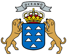 | |
| Other islands | ||
| Provinces | ||
Countries and territories of North Africa | |||||||||||||||||
|---|---|---|---|---|---|---|---|---|---|---|---|---|---|---|---|---|---|
| Sovereign states | |||||||||||||||||
| Partially recognized state | |||||||||||||||||
| Territories |
| ||||||||||||||||
1Entirely claimed by both Morocco and the SADR. 2Spanish exclaves claimed by Morocco. 3Portuguese archipelago claimed by Spain. 4Disputed between Sudan and Egypt. 5Terra nullius located between Egypt and Sudan. 6Disputed between Sudan and South Sudan. 7Part of Chad, formerly claimed by Libya. 8Disputed between Morocco and Spain | |||||||||||||||||
| Authority control |
|
|---|