Blissville Parish, New Brunswick
Blissville is a civil parish[lower-alpha 1] in Sunbury County, New Brunswick, Canada.[2]
Blissville | |
|---|---|
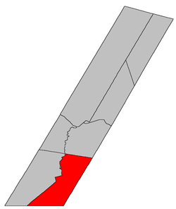 Location within Sunbury County, New Brunswick | |
| Country | |
| Province | |
| County | Sunbury County |
| Established | 1869 |
| Area | |
| • Land | 341.74 km2 (131.95 sq mi) |
| Population (2016)[1] | |
| • Total | 919 |
| • Density | 2.4/km2 (6/sq mi) |
| • Change 2011-2016 | |
| • Dwellings | 378 |
| Time zone | UTC-4 (AST) |
| • Summer (DST) | UTC-3 (ADT) |
For governance purposes it is divided between CFB Gagetown and the local service district of the parish of Blissville.[3]
History
Blissville Parish was set off from Burton Parish and Lincoln Parish in 1834. Blissville Parish included Gladstone Parish until 1874, and was named for John Murray Bliss (1771-1834), who was an administrator of the New Brunswick government.
Delineation
Blissville Parish is defined in the Territorial Division Act[2] as being bounded:
South and southeast by the County lines; northeast by Burton Parish, and west and northwest by a line beginning on the western bank or shore of the Oromocto River, where the dividing line between the Parishes of Blissville and Burton intersects the same, thence following the various courses of the said river up stream to the main forks; thence following the various courses of the south branch of the said river up stream to the northeast angle of lot thirteen, granted to Nathaniel Hubbard, about one mile above the forks; thence westerly along the northern line of said lot to the northwest angle thereof; thence southerly along the rear line of said lots fronting on western side of said south branch to the old Block House Road;[lower-alpha 2] and thence south sixty-seven degrees west to the Charlotte County line.
Communities
Parish population total does not include incorporated municipalities (in bold):
|
|
Bodies of water & Islands
This is a list of rivers, lakes, streams, creeks, marshes and Islands that are at least partially in this parish
Demographics
Access Routes
Highways and numbered routes that run through the parish, including external routes that start or finish at the parish limits:[6]
See also
Notes
- Civil parishes served a variety of government functions until 1966, when the new Municipalities Act stripped them of their responsibilities; they continue to provide convenient boundaries for government uses, especially electoral districts and local service districts. Statistics Canada uses civil parishes as census subdivisions for all parts of the province that are not within municipalities and similar entities.
- Which does not appear on any modern maps.
References
- "Census Profile, 2016 Census Blissville, Parish [Census subdivision], New Brunswick". Statistics Canada. Retrieved September 30, 2019.
- "Chapter T-3 Territorial Division Act". Government of New Brunswick. Retrieved 22 July 2020.
- "New Brunswick Regulation 84-168 under the Municipalities Act (O.C. 84-582)". Government of New Brunswick. Retrieved 22 July 2020.
- Statistics Canada: 2001, 2006 census
- 2011 Statistics Canada Census Profile: Blissville Parish, New Brunswick
- Atlantic Canada Back Road Atlas ISBN 978-1-55368-618-7
Places adjacent to Blissville Parish, New Brunswick | |
|---|---|
| Subdivisions |
|
|---|---|
| Cities | |
| Counties | |
| |