Battle Creek (Owyhee River tributary)
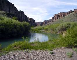
Battle Creek is a 67-mile (110 km) long[3] tributary of the Owyhee River. Beginning at an elevation of 6,704 feet (2,043 m)[2] in central Owyhee County, Idaho, it flows generally south through the Owyhee Desert to its mouth west of Riddle,[4] at an elevation of 4,636 feet (1,413 m).[1] In 2009, 23.4 miles (37.7 km) of the creek were designated as wild by the Omnibus Public Land Management Act, which also created the Owyhee River Wilderness.[5][6]
| Battle Creek | |
|---|---|
 Battle Creek | |
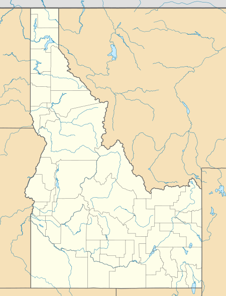 Location of the mouth of Battle Creek in Idaho  Battle Creek (Owyhee River tributary) (the United States) | |
| Location | |
| Country | United States |
| State | Idaho |
| County | Owyhee County, Idaho |
| Physical characteristics | |
| Source | |
| • location | Owyhee County, Idaho |
| • coordinates | 42°44′32″N 116°24′16″W[1] |
| • elevation | 6,704 ft (2,043 m)[2] |
| Mouth | Owyhee River |
• location | west of Riddle, Owyhee County, Idaho |
• coordinates | 42°14′14″N 116°31′29″W[1] |
• elevation | 4,636 ft (1,413 m)[1] |
| Length | 67 mi (108 km)[3] |
| Type | Wild |
| Designated | March 30, 2009 |
See also
References
- "Battle Creek". Geographic Names Information System. United States Geological Survey. June 21, 1979. Retrieved February 10, 2013.
- Source elevation derived from Google Earth search using GNIS source coordinates.
- "National Hydrography Dataset". United States Geological Survey. Retrieved February 10, 2013.
- Idaho Road and Recreation Atlas (Map) (2nd ed.). 1:250,000. Benchmark Maps. 2010. p. 80. ISBN 978-0-929591-06-3. OCLC 567571371.
- "Battle Creek, Idaho". National Wild and Scenic Rivers System. Retrieved February 10, 2013.
- "Owyhee River System". Bureau of Land Management. November 21, 2012. Archived from the original on February 14, 2013. Retrieved February 10, 2013.
This article is issued from Wikipedia. The text is licensed under Creative Commons - Attribution - Sharealike. Additional terms may apply for the media files.