Askrova
Askrova is an island in Kinn Municipality in Vestland county, Norway. It is located along the Brufjorden, near the mouth of the Førdefjorden, about 4 kilometres (2.5 mi) northwest of the island of Svanøya. Askrova sits about 7 kilometres (4.3 mi) southwest of the town of Florø and about the same distance southeast of the island of Reksta. The population of the 7.8-square-kilometre (3.0 sq mi) island (2001) was 143, with most residents living on the south and west shores of the island. The 219-metre (719 ft) tall mountain Skara is the highest point on the island.[1][2] Askrova Chapel is located on the island.
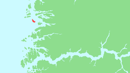 | |
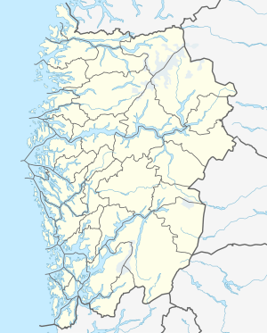 Askrova Location of the island  Askrova Askrova (Norway) | |
| Geography | |
|---|---|
| Location | Kinn, Norway |
| Coordinates | 61.5145°N 4.9496°E |
| Area | 7.8 km2 (3.0 sq mi) |
| Length | 5 km (3.1 mi) |
| Width | 2 km (1.2 mi) |
| Highest elevation | 220 m (720 ft) |
| Highest point | Skara |
| Administration | |
| County | Vestland |
| Municipality | Kinn |
| Demographics | |
| Population | 143 (2001) |
The main industry for the island is fishing. In 1936, there was a record catch of herring at Askrova. Official figures put it at between 100,000 to 120,000 hectolitres (2,200,000 to 2,600,000 imp gal; 2,600,000 to 3,200,000 US gal) of herring. It was the biggest catch to date in Vestland county.
See also
References
- Store norske leksikon. "Askrova" (in Norwegian). Retrieved 2010-08-07.
- Statistisk sentralbyrå (2001). "Folke- og boligtellingen 2001, kommune- og bydelshefter 1401 Flora" (PDF) (in Norwegian). Cite journal requires
|journal=(help)