Arkansas Highway 209
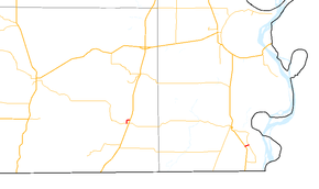
Arkansas Highway 209 is a designation for two north–south state highways in southeast Arkansas. One segment of 1.02 miles (1.64 km) runs in Parkdale from US 165 to Arkansas Highway 8.[1][2] A segment in Chicot County runs 0.59 miles (0.95 km) from US 65 to Highway 8.[3] Neither route has any spur or business routes.[1]
| ||||
|---|---|---|---|---|
 | ||||
| Route information | ||||
| Maintained by AHTD | ||||
| Existed | 1958–present | |||
| Section 1 | ||||
| Length | 1.02 mi[1] (1.64 km) | |||
| South end | ||||
| North end | ||||
| Section 2 | ||||
| Length | 0.59 mi[1] (0.95 km) | |||
| South end | ||||
| North end | ||||
| Location | ||||
| Counties | Ashley, Chicot | |||
| Highway system | ||||
| ||||

Route description
Parkdale segment
The route begins at Highway 8 and heads north and east through Parkdale. Highway 209 meets US 165 and terminates north of town. The route is named School Avenue in Parkdale, and passes two properties listed on the National Register of Historic Places: the Dr. Robert George Williams House and the Parkdale Baptist Church.
History
Highway 209 began as a route along Grand Lake from Highway 8 south, first numbered on the state highway map in 1959. This route would later be shortened when Highway 8 was extended along its former length, leaving the Highway 209 designation on the connector road only. The route in Parkdale was added to the state highway system in 1975.[1]
Major intersections
See also
References
- Planning and Research Division (2010). "Arkansas Road Log Database". Arkansas State Highway and Transportation Department. Archived from the original (Database) on 23 June 2011. Retrieved June 9, 2011.
- Route and Section Map (PDF) (Map) (Ashley County ed.). Arkansas State Highway and Transportation Department. Archived (PDF) from the original on 23 June 2011. Retrieved June 10, 2011.
- Route and Section Map (PDF) (Map) (Chicot County ed.). Arkansas State Highway and Transportation Department. Archived (PDF) from the original on 23 June 2011. Retrieved June 10, 2011.
External links
![]()