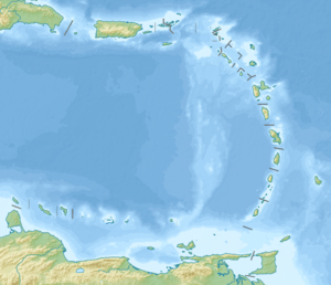
Anegada Passage
Anegada Passage is a strait in the Caribbean that separates the British Virgin Islands and the British ruled Sombrero Island of Anguilla, and connects the Caribbean and the Atlantic Ocean. It is 2300 m deep. Because the threshold depths are 1800 and 1600 m, Atlantic deep water from 1600 m level may flow into the deep areas in the Caribbean Sea.[1]
| Anegada Passage | |
|---|---|
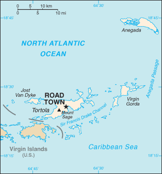 Map of the British Virgin Islands, with the Anegada Passage labeled at right side. | |
 Anegada Passage  Anegada Passage | |
| Coordinates | 18°22′41″N 63°50′15″W |
| Basin countries | British Virgin Islands Anguilla |
| Max. length | 200 kilometres (120 mi) |
| Max. width | 65 kilometres (40 mi) |
| Average depth | 2,300 metres (7,500 ft) |
The Anegada Passage is a key shipping lane for the Panama Canal.[2] Often called the "Oh-my-god-a Passage"[3], it is considered a difficult passage for sailors because of the winds, waves, and swells.[4]
The passage consists of multiple basins and ridges. The Anegada Trough or Virgin Islands Basin was the likely site of the 1867 Virgin Islands earthquake and subsequent tsunami.[5][6]
See also
References
- "Anegada Passage". Encyclopedia Britannica. Retrieved 1 August 2018.
- "The World Factbook". CIA. Retrieved 1 August 2017.
- "The "Oh-my-god-a Passage"". Motivator. Retrieved 1 August 2017.
- "Anegada Passage". SV Party of Five. Retrieved 1 August 2018.
- "Significant Earthquake". NOAA. Retrieved 1 August 2018.
- Barkan, R.; Ten Brink, U. (2010). "Tsunami Simulations of the 1867 Virgin Island Earthquake: Constraints on Epicenter Location and Fault Parameters". Bulletin of the Seismological Society of America. 100 (3): 995. Bibcode:2010BuSSA.100..995B. CiteSeerX 10.1.1.544.6624. doi:10.1785/0120090211.
This article is issued from Wikipedia. The text is licensed under Creative Commons - Attribution - Sharealike. Additional terms may apply for the media files.