Alabama State Route 134
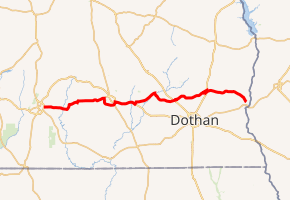
State Route 134 (SR 134) is an east-west state route located in Covington, Coffee, Dale, Henry, and Houston counties in Alabama. It loosely parallels U.S. Route 84 (US 84) between Opp and the Chattahoochee River.
| ||||
|---|---|---|---|---|
| ||||
| Route information | ||||
| Maintained by ALDOT | ||||
| Length | 76.795 mi[1] (123.590 km) | |||
| Major junctions | ||||
| West end | ||||
| ||||
| East end | ||||
| Location | ||||
| Counties | Covington, Coffee, Dale, Henry, Houston | |||
| Highway system | ||||
| ||||

Route description
The route begins at US 331/US 84 along the Opp Bypass. It heads east into southern Coffee County, intersecting SR 189 and SR 87 en route to Enterprise. Upon reaching Enterprise, it does not follow Boll Weevil Circle around Enterprise but instead continues through the city via Damascus Rd, Main St, and East Park Ave. Between Enterprise and Daleville, it is concurrent with US 84, crossing into Dale County en route. In Daleville, it turns off of US 84 for a brief concurrency with SR 85 before turning east and northeast towards Newton. After a concurrency with SR 123 in Newton, it continues east to Midland City, intersecting US 231 en route.
SR 134 follows 3rd St and Kelly Ave through Midland City before continuing east and passing around the north side of the Dothan Regional Airport. It crosses into Henry County en route to Headland, meeting SR 173. After intersecting US 431, SR 134 continues easterly, ending at SR 95 just north of Columbia shortly after entering Houston County.
History
Prior to September, 2010,[2] SR 134 turned east in Headland onto East Church St and did not continue north on Main St to intersect SR 173.
Major intersections
| County | Location | mi[1] | km | Destinations | Notes |
|---|---|---|---|---|---|
| Covington | Opp | 0.000 | 0.000 | Western terminus | |
| Coffee | | 5.881 | 9.465 | ||
| | 14.303 | 23.018 | West end of SR 87 overlap | ||
| | 14.907 | 23.990 | East end of SR 87 overlap | ||
| Enterprise | 23.748 | 38.219 | |||
| 25.737 | 41.420 | West end of SR 88 overlap | |||
| 25.737 | 41.420 | West end of SR 27 overlap | |||
| 26.179 | 42.131 | East end of SR 27 overlap | |||
| 27.115 | 43.637 | East end of SR 88 overlap | |||
| 27.941 | 44.967 | West end of US 84 / SR 12 overlap | |||
| Dale | Daleville | 33.565 | 54.018 | ||
| 34.684 | 55.818 | East end of US 84 / SR 12 overlap, west end of SR 85 overlap | |||
| 35.534 | 57.186 | East end of SR 85 overlap | |||
| Newton | 42.451 | 68.318 | West end of SR 123 overlap | ||
| 44.879 | 72.226 | East end of SR 123 overlap | |||
| Midland City | 50.098 | 80.625 | Interchange | ||
| Henry | Headland | 61.260 | 98.588 | West end of SR 173 overlap | |
| 62.345 | 100.335 | East end of SR 173 overlap, west end of US 431 / SR 1 overlap | |||
| 62.861 | 101.165 | East end of US 431 / SR 1 overlap | |||
| Houston | Columbia | 76.795 | 123.590 | Eastern terminus | |
1.000 mi = 1.609 km; 1.000 km = 0.621 mi
| |||||
References
- "Alabama Department of Transportation Milepost Maps". ALDOT. Retrieved April 27, 2017.
- "Henry County Milepost Map" (PDF). ALDOT. Retrieved April 27, 2017.
2015-16 Official Alabama Highway Map. Accessed April 27, 2017.
Alabama Department of Transportation Fiscal Year 2015 Report Accessed April 27, 2017.
Alabama Department of Transportation Milepost and General County Maps. Accessed April 27, 2017.
External links
- Alabama State Highway 134 (Adam Froehlig website)
