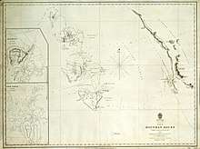
Admiralty chart
Admiralty charts are nautical charts issued by the United Kingdom Hydrographic Office[1] (UKHO) and subject to Crown Copyright. Over 3,500 Standard Nautical Charts (SNCs) and 14,000 Electronic Navigational Charts (ENCs) are available with the Admiralty portfolio offering the widest official coverage of international shipping routes and ports, in varying detail.
Admiralty charts have been produced by UKHO for over 200 years, with the primary aim of saving and protecting lives at sea. The core market for these charts includes over 40,000 defence and merchant ships globally. Today, their products are used by over 90% of ships trading internationally.
Features
The scale of the charts can vary according to purpose; large-scale charts often cover approaches to harbours, such as Port Approach Guides, medium-scale charts often cover frequently used coastal areas, and small-scale charts are regularly used for navigation in more open areas. A series of small craft charts are also available at even smaller scales.[2][3]
Admiralty charts include information on: depths (chart datum), coastline, buoyage, land and underwater contour lines, seabed composition, hazards, tidal information (indicated by "tidal diamonds"), prominent land features, traffic separation schemes radio direction finding (RDF) information, lights, and other information to assist in navigation.[3]
Navigation charts at a scale of 1:50,000 or smaller (note that 1:100,000 is a smaller scale than 1:50,000) use the Mercator projection, and have since at least the 1930s . The Mercator projection has the property of maintaining angles correctly, so that a line on the earth's surface that crosses all the meridians at the same angle (a rhumb line) will be represented on the chart by a straight line at the same angle. Thus if a straight line is drawn on the chart from A to B, and the angle determined, the ship may sail at a constant bearing at that angle to reach B from A. Allowances for magnetic variation and magnetic deviation must also be made. However, a rhumb line is not in general the shortest distance between two points, which is a great circle. (The equator and lines of longitude are both great circles and rhumb lines.) When navigating over longer distances the difference becomes important, and charts using the gnomonic projection, on which all great circles are shown as straight lines, are used for course planning. In the past, the gnomonic projection was widely used for navigation charts, and also for polar charts.
Since the late 1970s, all charts at a scale of 1:50,000 or larger have used the transverse Mercator projection, which is the projection used for the Ordnance Survey National Grid. Topology on Admiralty charts of the UK is generally based on Ordnance Survey mapping. For the small areas depicted on such maps, the differences between projections are of no practical importance.
Admiralty charts are issued by the UKHO for a variety of users; Standard Nautical Charts (SNCs) are issued to mariners subject to the Safety of Life at Sea (SOLAS) convention, while chart folios, at a convenient A2 size, are produced for leisure users.[3] Alongside its paper charts, UKHO produces an expanding range of digital products to fulfil the impending compulsory carriage requirements of ECDIS/ENCs, as issued by the International Maritime Organization (IMO).
The digital range comprises Electronic Navigational Charts (ENCs) for use with an Electronic Chart Display and Information System (ECDIS), which can be displayed and interrogated through Admiralty Vector Chart Service (AVCS).[2] The range also includes Admiralty Raster Chart Service (ARCS), which allows paper nautical charts to be viewed in raster form on an ECDIS.[3]
Due to the changing nature of the seabed and other charted features, chart users’ information must be up-to-date to maintain accuracy and general safety. This is ensured by UKHO through continually assessing hydrographic data for vital safety information, with urgent updates issued via weekly Notices to Mariners (NMs)
Survey vessels
- HMS Investigator (1798)
- HMS Endeavour
- HMS Beagle
- HMS Enterprise
- HMS Palinurus
- HMS Thetys
- HMS Benares
- HMS Hugh Lindsay
- HMS Challenger (1858)
- HMS Challenger (1931)
- HMS Cook
- HMS Dalrymple
- HMS Dampier
- HMS Hecate
- HMS Hecla
- HMS Hydra
- HMS Herald
- HMS Shackleton, with HMS Gleaner, HMS Franklin, HMS Jason and HMS Scott
- HMS Owen
References
- UK Hydrographic Office
- Tim Bartlett. RYA Navigation Handbook. Royal Yachting Association; 2nd edition (2014), 192 pag. ISBN 1906435944, ISBN 978-1906435943
- Tom Cunliffe. The Complete Day Skipper: Skippering with Confidence Right From the Start. Adlard Coles; 5 edition (2016), 208 pag. ISBN 1472924169, ISBN 978-1472924162