131st meridian east

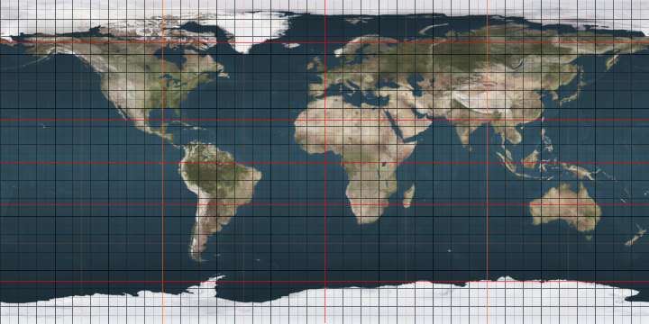
The meridian 131° east of Greenwich is a line of longitude that extends from the North Pole across the Arctic Ocean, Asia, Australia, the Indian Ocean, the Southern Ocean, and Antarctica to the South Pole.

131°
131st meridian east

The 131st meridian east forms a great circle with the 49th meridian west.

From Pole to Pole

Starting at the North Pole and heading south to the South Pole, the 131st meridian east passes through:

Co-ordinates Country, territory or sea Notes
90°0′N 131°0′E Arctic Ocean
77°7′N 131°0′E Laptev Sea
70°44′N 131°0′E  Russia Sakha Republic
Khabarovsk Krai — from 56°10′N 131°0′E
Amur Oblast — from 55°42′N 131°0′E
Khabarovsk Krai — from 54°18′N 131°0′E
Amur Oblast — from 53°49′N 131°0′E
Khabarovsk Krai — from 51°10′N 131°0′E
Amur Oblast — from 50°24′N 131°0′E
Jewish Autonomous Oblast — from 48°58′N 131°0′E
47°41′N 131°0′E  People's Republic of China Heilongjiang
44°52′N 131°0′E  Russia Primorsky Krai — for about 6 km
44°48′N 131°0′E  People's Republic of China Heilongjiang
Jilin — from 43°29′N 131°0′E
42°51′N 131°0′E  Russia Primorsky Krai
42°38′N 131°0′E Sea of Japan Passing just east of the island of Ulleungdo,  South Korea (at 37°30′N 130°55′E)
Passing just west of the island of Mishima, Yamaguchi Prefecture,  Japan (at 34°47′N 131°7′E)
34°26′N 131°0′E  Japan Island of Honshū, Yamaguchi Prefecture (passing through Chōfu station in eastern Shimonoseki)
33°59′N 131°0′E Kanmon Straits
33°57′N 131°0′E  Japan Island of Kyūshū
Fukuoka Prefecture
Ōita Prefecture — from 33°31′N 131°0′E
Kumamoto Prefecture — from 33°10′N 131°0′E
— Ōita Prefecture — from 33°7′N 131°0′E
— Kumamoto Prefecture — from 33°1′N 131°0′E
Miyazaki Prefecture — from 32°9′N 131°0′E
Kagoshima Prefecture — from 31°44′N 131°0′E
31°11′N 131°0′E East China Sea
30°44′N 131°0′E  Japan Island of Tanegashima, Kagoshima Prefecture
30°32′N 131°0′E Pacific Ocean Passing just west of the island of Minami Daitō, Okinawa Prefecture,  Japan (at 25°50′N 131°12′E)
Passing just west of the island of Oki Daitō, Okinawa Prefecture,  Japan (at 24°28′N 131°11′E)
Passing just west of the island of Tobi,  Palau (at 3°0′N 131°7′E)
Passing just west of the Asia Islands,  Indonesia (at 1°0′N 131°13′E)
Passing just west of the Ayu Islands,  Indonesia (at 3°23′N 131°1′E)
0°3′S 131°0′E  Indonesia Island of Waigeo
0°21′S 131°0′E Dampier Strait
0°56′S 131°0′E  Indonesia Islands of Salawati and New Guinea
1°28′S 131°0′E Ceram Sea Passing just east of the island of Seram,  Indonesia (at 3°35′S 130°52′E)
3°54′S 131°0′E Banda Sea
7°26′S 131°0′E  Indonesia Island of Wuliaru
7°30′S 131°0′E Banda Sea
7°40′S 131°0′E  Indonesia Island of Seira
7°44′S 131°0′E Banda Sea
8°6′S 131°0′E  Indonesia Island of Selaru
8°13′S 131°0′E Arafura Sea
9°3′S 131°0′E Timor Sea
11°21′S 131°0′E  Australia Northern Territory — Melville Island
11°54′S 131°0′E Clarence Strait
12°10′S 131°0′E  Australia Northern Territory
South Australia — from 26°0′S 131°0′E
31°33′S 131°0′E Indian Ocean Australian authorities consider this to be part of the Southern Ocean[1][2]
60°0′S 131°0′E Southern Ocean
66°6′S 131°0′E Antarctica Australian Antarctic Territory, claimed by  Australia

See also

References

  1. Darby, Andrew (22 December 2003). "Canberra all at sea over position of Southern Ocean". The Age. Retrieved 13 January 2013.
  2. "Indian Ocean". Encyclopædia Britannica. Retrieved 13 January 2013.

This article is issued from Wikipedia. The text is licensed under Creative Commons - Attribution - Sharealike. Additional terms may apply for the media files.