Trail
Trail is a small city of 7,700 people (2016) in the West Kootenays region of interior southeast British Columbia. The city is about 10 km north of the USA border at Waneta and about 25 km from Castlegar, a town also on the Columbia River. Another neighbouring community is Rossland. The main employer in Trail and the most prominent feature on the city's skyline is the smelter operated by Teck Cominco.
Understand
The city was named after the Dewdney Trail, which passed through the area.
Employing approximately 1,800 people, Teck Resources (formerly Cominco) is the region’s largest employer.
The City of Trail is also home to the largest hospital in the West Kootenay region.
- Trail & District Visitor Centre, #200, 1199 Bay Ave, (second floor above TD Bank), ☎ +1 250-368-3144. Winter: M-F 9AM-5PM; summer: daily 9AM-5PM. Travel and local information. Anwide range of visitor services, including visitor information, local travel information, brochures, visitor guides, and maps.
Climate
Summer climate in Trail is generally hot and dry with moderately cool nights. Temperatures often exceed 35 °C during summer afternoons, average 29 °C. Thunderstorms are common during the late-Spring and Summer season, often moving into the valley from the south. The fall months bring dense river fog, especially overnight and in the morning, as a cold air inversion lingers above the relatively warm river surface. Winters are mild to cold with periods of moderate snowfall. Nearby villages such as Warfield and Fruitvale often receive greater amounts of snow due to higher elevation.
Get in
By car
Trail is on Hwy 3B, the main route through southern BC, and extends out on both sides of the Columbia River. A private vehicle is the most common and most convenient way to reach Trail, but there are a few other options:
By bus
|
Greyhound Canada Greyhound Canada terminated all services in Western Canada and Northern Ontario effective October 31, 2018. |
By plane
- Castlegar Airport, about 25 minutes from Trail, has commercial flights from Vancouver, the Okanagan and Calgary with Air Canada Express.
- 🌍 Trail Regional Airport (YZZ IATA), 1394 Pine Avenue, ☎ +1 250-364-1262, fax: +1 250-364-0830. Just south of the city on the way to Waneta and the USA border, and has flights twice daily to Vancouver via Pacific Coastal Airlines
- Spokane International Airport in Spokane, Washington, is about 200 km south of Trail.
Get around
Although the downtown is reasonably compact and easily walkable, some outlying areas of the city are at some distance and require a car or a bike. There is some public transit in Trail and the surrounding area provided by the Regional District of Kootenay Boundary and BC Transit or phone +1 250-364-0261. Several nearby communities are served by connections with this system.
See
- Silver City Days began in 1962 and are held early in May each year.
- Teck Cominco Interpretive Centre. The largest non-ferrous lead and zinc smelter in the world. A 2½-hour industrial tour of the Teck (Cominco) smelter can be arranged in the Interpretive Centre through the Trail & District Chamber of Commerce office above the Toronto-Dominion Bank, in downtown Trail. This centre is the starting point for the free tours beginning M-F at 10 AM during the summer; by appointment from September to May. Learn about the plants' operations in the mini-science centre featuring hands-on exhibits for the whole family. View video presentations and displays which exhibit sophisticated environmental monitoring systems installed in the Trail area by Teck. Other presentations illustrate the history of Cominco's Trail smelting operations.
Do
Hike
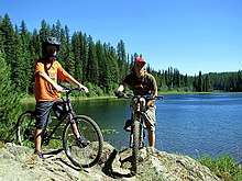
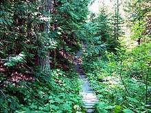
Besides producing hockey and baseball talent, the Greater Trail area offers many excellent hiking biking and nature walk trails within 5 to 20 minutes from downtown Trail.
Visit the many popular hiking and biking trails in and around Violin Lake or take a short trip to the Champion Lakes Provincial Park area for a day hike, or hike up to any of the four Canadian flags that have been placed on various mountain peaks around the Trail area by members of the 44th Field Engineering Squadron.

Each hike offers excellent 1-hour to 2½-hour hikes up to the flag viewpoints, and the trails can be accessed by novice to avid hiking enthusiasts. Visitors and residents can hike to the East Trail Canadian flag viewpoint via the McQuarrie Creek trail route. The one hour hike to the top sees hikers viewing across the Columbia River towards West Trail, Warfield, and Rossland. The flag can be seen waving in the wind above the regional hospital near the viewpoint. Park in the J.L. Crowe High School parking area and follow the McQuarrie Creek hiking trail up alongside the creek that comes down to meet the road where it intersects to the J. Lloyd Crowe Secondary School or the Kootenay Boundary Regional Hospital. The McQuarrie Creek hiking is a fairly easy trial if you take your time. Parts of the trail can be steep.

An alternative route to the East Trail Flag viewpoint above the hospital is to take the easier trail leading from the upper Miral Heights area of Trail. At the Shavers Bench/Miral Heights traffic lights turn up to Miral heights sub-division and follow McBride Street. to Albert Drive. The trailhead is at the end of Albert Dr. and it is equally enjoyable and scenic route to the flag viewpoint.
Another good hike is the Upper Sunningdale Sandhill viewpoint hiking trail. The trail-head can be reached by driving to the Upper Sunningdale Park on Marianna Crescent where you can safely park your car at the park entrance. Walk west (to the right) down Marianna Crescent until you reach the Water Tower Hill Road. Walk up past the chain link fence, and look for the trail-head on the right just past the granite rocks which can be seen in the water runoff ditch. This 40 minute, easy level rating hiking trail is clearly marked, and the steepest part of the trail heads up past the pine trees at the start of the trail, and then you follow the trail along the sandhill ridge until you reach the viewpoint just below the Sandhill plateau above the Upper Sunningdale Park.
Another Canadian flag waves above Sunningdale, and can be viewed from most areas of Upper and Lower Sunningdale. If you want to take a longer hike than the Upper Sunningdale Sandhill viewpoint, you can hike further, by taking the trail that heads from the Sandhill viewpoint, towards the rock cliffs. Take the clearly marked trail up past a number of rock cliffs to the Sunningdale Canadian Flag viewpoint to reach the Canadian Flag.

The hike rating for the Sunningdale Canadian Flag viewpoint on Mount Heinze is an intermediate level, and you can make it up to the viewpoint in approximately 2½ hours, as most of the hiking trail is clearly marked, but sections of the trail up near the swamps below the flag viewpoint on Mount Heinze can be thick with brush. Leave enough time to hike back down, so the best time to make this hike is in the early morning. Be bear and wild animal aware, and make lots of noise if you startle a bear. Always pack enough water, or 1 to 2 litres of your favorite hiking drink, and pack a lunch and your digital camera for this hike, as the views of the Greater Trail BC area are spectacular from this viewpoint.
From each of the Sunningdale hiking trail vantage points, you'll get a beautiful view of the sub-division of Sunningdale, Bingay Bay (Sandy Island), the Columbia River as it flows towards Gyro and past downtown Trail, Teck Cominco's lead and zinc smelter property (which is relatively green and clean looking), Tadanac, Rivervale, and up towards Warfield, Rossland, and Red and Granite Mountain ski hills.
Buy
Trail has at least two good food stores in or close to the downtown, Ferraro's and Safeway. Some distance east on Hwy 3B you can also find an Extra Foods, a WalMart and a Canadian Tire.
Eat
- The Colander, 1475 Cedar Avenue, ☎ +1 250-364-1816. M-F 12:30AM-2PM, and daily 4:30PM-8:30PM. A family pasta restaurant.
- Ace of Taste, 1344 Bay Ave, ☎ +1 250-368-6448. M-Sa 11AM-2:30PM, 4:30PM-8:30PM. Moderately priced, high quality Chinese cuisine; well known for their Dim Sum.
- Cornerstone Cafe & Deli, 760 Schofield Hwy, Warfield, ☎ +1 250-364-1818. M-F 7AM-3PM.
- Cafe Michael, 8266 3b Hwy, ☎ +1 250-364-2112. M-Sa from 11AM for lunch and dinner. Clubhouse, beef dip or pan-seared steak sandwich, crepes, croissants. Dishes that are celiac, vegetarian and kosher friendly.
Drink
- Trail Beer Refinery, 1299 Bay Ave, ☎ +1 778-456-2827. Tu-Sa 3PM-9PM, Su noon-8PM. Gastropub.
Sleep
Campgrounds
- The City of Trail RV Park (+1 250-368-3144) at 7500 Hwy 3B has 31 partially-serviced sites at the east end of Trail near the Walmart and the Canadian Tire, close to the junction of Hwy 22A and 3B. Operates from May through September.
Hotels and motels
- Best Western Columbia River Hotel, 1001 Rossland Ave, Trail, BC, ☎ +1 250 368-3355. Check-in: 2PM, check-out: 11AM. $160 and up.
- Glenwood Inn & Suites, 2769 Glenwood Dr, toll-free: +1-800-667-9544, e-mail: reservations@glenwoodinnandsuites.com. From $110.
- Ray Lyn Motel, 118 Wellington Ave, Trail, BC, ☎ +1 250-368-5541. About half way to Warfield on the road to Rossland. From $75.
Go next
Visit nearby Rossland, 6 km west on Highway 3B. Rossland is well-known for its mountain biking during summer and skiing during winter.
| Routes through Trail |
| ENDS at |
W |
→ Salmo → END |
| END ← Castlegar ← | N |
→ Rossland → Davenport |