Sulitjelma
Sulitjelma (Pite Sami: Sulidælbmá, Lule Sami: Sulisjielmmá) is a village and former mining town in Nordland, Norway. It is a trailhead for treks to the Sulitjelmaisen and Blåmansisen glaciers and nearby fells, as well as for the 800 km Nordkalottleden trail.
The Sulitjelma/Sulitjelma mountains are on the border to Sweden, the Swedish part belonging to the Laponia national park system.
Understand

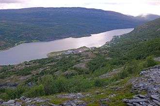
Sulitjelma is situated by a lake in a lush valley, surrounded by mountains and glaciers. It has a population of some 500 people. The village has reliable snow cover in winter.
The village originated as a Sámi settlement. In the mid-19th century Norwegians arrived, cleared farms, and soon found copper and sulphur. In the early 20th century the mining company was the largest in Norway, with some 1750 people employed. Beside the mine itself, there were facilities for processing the ore and to support the population. The bulk of the ore was however deep down in the mountain and mining became expensive over time. The mine was closed in 1991. The present road is built on the former narrow gauge railway.
The village belongs to the Fauske municipality.
Get in
Fauske centre is 44 km (27 mi) to the west by county road 830. There are bus connections.
Get around
See

- The natural landscape
- Remains of the mining activity
Do
- Hiking: High mountains (Suliskongen reaches almost 2,000 m) and two large glaciers (Sulitjelmaisen and Blåmansisen – Norway's 5th largest) are within hiking range.
- Jakobsbakken, a little further, is an excellent base for cross country skiing in winter and early spring, and mountain hiking from July to late September.
Buy
- Coop Marked Sulitjelma, Charlotta 52, 8230 Sulitjelma, ☎ +47 75-64-01-00, e-mail: sulitjelma.marked@coop.no. M–F 09:00–20:00, Sa 09:00–18:00.
Eat
Drink
Sleep
Connect
Go next
- The Nordkalottruta (Swedish: -leden) hiking trail leads by the Norwegian, Finnish and Swedish fells to Kautokeino in Finnmark, via Laponia, Kebnekaise, Abisko and Kilpisjärvi, a trek of 800 km.
- Kvikkjokk in Sweden is reachable by 4–7 days of hiking, first along the shores of Låmivatnet to Pieskehaure and then along Nordkalottruta. For a somewhat longer but more spectacular route, go via Staddajåkkå, where Nordkalottruta forks between its southern trailheads (i.e. following it all the way).