Similkameen
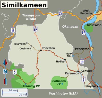
The Similkameen Valley (or simply, the Similkameen) lies in the southern part of the Thompson-Okanagan region of British Columbia, Canada. The towns and villages are few and small, but there's some big scenery, particularly in the provincial parks. The eastern end of the valley is similar to the nearby Okanagan and is a great place to stop and get fresh fruit in the summer and early fall.
Cities

Other destinations
- 🌍 Manning Provincial Park - hiking in the summer and cross-country skiing in the winter
- 🌍 Cathedral Provincial Park - off the beaten path, but the hikes and scenery make it worthwhile
Understand
Get in
By car
BC Highway 3 (the Crowsnest Highway) is the main road in and out of the region, connecting it with the Okanagan Valley to the east and Vancouver via Hwy 1 at Hope to the west. BC Highway 3A, at Keremeos, provides an alternate and shorter way of reaching the Okanagan. BC Highway 5A, at Princeton, connects the region to Merritt and Kamloops in the Thompson-Nicola.
By bus
|
Greyhound Canada Greyhound Canada terminated all services in Western Canada and Northern Ontario effective October 31, 2018. |
By plane
There are no major airports in the region. The nearest airports with commercial flights are Kelowna (about 90 minutes northeast of Keremeos) and Abbotsford (about 2 hours west of Princeton).
Get around
The provincial highways in the Similkameen are the main means of getting around. Highway 3 is the main road and has fairly frequent passing lanes and 4-lane sections. Once you're off the highways, the roads are often gravel, or if they are paved, it will be narrow and windy. Having your own car is the easiest way to get around, and the only way, if you want to get off Highway 3. The Greyhound bus is a useable, although not necessarily convenient, way to get to the main centers of the region.
See

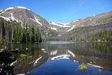
- Take in the mountain scenery in Manning Provincial Park and Cathedral Provincial Park
- There are some small museums focusing on local history in Princeton, Keremeos and Hedley
Do
- There are lots of hiking options in Manning Provincial Park and Cathedral Provincial Park
- Cycle or hike along the Kettle Valley Railway — the trains are gone, but the railbed remains and has been turned into a multi-purpose trail
- Enjoy the chill of the Similkameen River in summer at Bromley Rock, near Princeton
- Cross-country ski at Manning Provincial Park in winter
Eat
The eastern end of the valley has many orchards and fruit stands, particularly around Keremeos. Stop by in summer and early fall to taste some of the local produce.
Drink
Stay safe
Go next
Highway 3A is the gateway to the central Okanagan. From Keremeos, it is roughly a half-hour drive to Penticton and 75 minutes to Kelowna. Remaining on Highway 3 (eastwards) takes you to Osoyoos and the south Okanagan, which has many more wineries and orchards. Further along Highway 3 is the Kootenays.
Heading west along Highway 3 is Hope, which is the gateway to the Lower Mainland and the Fraser Canyon.