Quttinirpaaq National Park
Quttinirpaaq National Park is a national park on the northeastern corner of Ellesmere Island in Nunavut, Canada.
Understand


Quttinirpaaq National Park covers an area of 37,775 km² (14,585 sq mi), which is larger than Taiwan. It is the second largest park in Canada, after Wood Buffalo National Park.
In Inuktitut, Quttinirpaaq means "top of the world".
Parks Canada maintains warden stations and gravel air strips at Tanquary Fiord Airport, Lake Hazen and Ward Island. Tanquary Fiord and Lake Hazen are the main access points for tourists. Beyond these warden stations, there are no facilities within the park.
In 2004, the park was one of nine sites added to Canada's tentative list of potential World Heritage Sites.
Contact the park office +1 867-975-4673, toll-free: 1-888-773-8888, or email: nunavut.info@pc.gc.ca
History
The park was established in 1988.
Due to its high latitude and limited wildlife, there has never been any significant human presence within this part of Ellesmere Island. The pass from Tanquary Fiord through to Lake Hazen shows evidence of being used by Arctic people since about 5000 years ago. Tent rings and food caches show that the area was visited by pre-Dorset, Dorset and Thule people, the ancestors of modern Inuit.
The east and north end of the island was used as a starting point for various polar explorations. Fort Conger was an early Arctic exploration research base, and is now maintained as a Federal Heritage Building.
Landscape
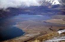
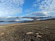
The land is dominated by rock and ice. It is a polar desert with very little annual precipitation.
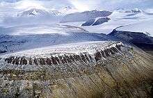
Much of the highlands of the park are covered in ice caps. These ice caps, and the glaciers that descend from them, date back at least to the last episode of glaciation.
The park includes Barbeau Peak, which at 2,616 m (8,583 ft) is the highest mountain in Nunavut.
Flora and fauna
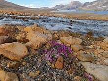
Some wildlife, notably Arctic hares, lemmings, muskoxen and Arctic wolves reside in this national park, but sparse vegetation and low temperatures support only small populations. There is a very small Peary caribou population as well. Other animal inhabitants include ringed seals, bearded seals, walruses, polar bears, and narwhals. During summer months, birds nest in the park including semipalmated plovers, red knots, gyrfalcons and long-tailed jaegers. Common plants include dwarf willow and Arctic cotton, in addition to grasses and lichens. Plant and animal life is more concentrated in the Lake Hazen region, which has a milder climate than the surrounding ice cap-covered mountains and valleys.
Climate
Get in
Resolute Bay is the nearest commercial airline access point with flights from Iqaluit. From Resolute, a charter is required to reach Quttinirpaaq. Outfitters arrange participants’ flights, but solo travellers’ charter prices depend on fuel costs.
Weather dictates travel schedules so factor in time for delays. The best time to visit is from mid-May to mid-August, when park staff are on site.
- To Iqaluit: Iqaluit is the hub for air traffic in Nunavut. First Air Ltd. and Canadian North fly direct to Iqaluit from Montreal, Ottawa, and Yellowknife.
- To Resolute: First Air Ltd. offer regular flights from Iqaluit to Resolute.
- To Quttinirpaaq National Park: Parks Canada offers Northern Iconic Experience Charter flights on a Twin Otter between the town of Resolute and Tanquary Fiord, Parks Canada’s base of operations in Quttinirpaaq National Park.
Fees and permits
Northern Park Backcountry Excursion/Camping Permit valid at Quttinirpaaq, Auyuittuq, Ivvavik, Nahanni, Aulavik, Sirmilik, Tuktut Nogait and Vuntut National Parks (per person, 2018):
- Daily $24.50
- Annual $147.20
Fishing permit:
- Daily $9.80
- Annual $34.30
Get around
See
Do
Two backpacking routes are the route between Lake Hazen and Tanquary Fiord, and a loop around the Ad Astra and Viking ice caps, both approximately 100 kilometres (62 mi).