Southeast Arizona
Southeast Arizona is a sparsely-populated, scenic region of the Sonoran desert with a number of historic sights and remote wilderness areas.
Cities
- 🌍 Benson – a historic rail town and convenient base.
- 🌍 Bisbee – an old mining town, now an artist colony.
- 🌍 Douglas – a border town with some early 20th-century architecture.
- 🌍 Sierra Vista – the region's largest town, with a historic military fort.
- 🌍 Tombstone – an iconic Wild West town most famous for the conflict between Wyatt Earp and the Clanton.
- 🌍 Willcox – a historic town and gateway to Chiricahua National Monument.
Other destinations
- 🌍 Chiricahua National Monument – one of the National Park Service's more remote units, with a unique landscape of stone hoodoos.
Understand
Travelers speeding by on I-10 between western New Mexico and Tucson could be forgiven for assuming there's not much to see in this remote corner of Arizona. The only real clue is the Texas Canyon rest stop on I-10; there's little else to suggest that there's more here than tumbleweeds and rocks. Leave the interstate, however, and soon you find yourself in storied cowboy and Indian country: the land of Wyatt Earp and the Clanton brothers, and of Geronimo's last stand. There's much more than that here, though, as the oldest documented evidence of human inhabitants anywhere on North America is in this region. To really experience all of this the traveler should leave the highway, and, ideally, the pavement.
Culturally there is a long history of human activity here, beginning with the Clovis culture approximately 9000 BCE, and continuing through the pre-Columbian and early Spanish periods. Besides scattered petroglyphs and pictographs and adobe ruins, however, there's little from this early history for the traveler to easily appreciate. In contrast, the region's more recent Apache, Mexican, and American history is inescapable. With the exception of the Chiricahua Apaches, who were sadly forcibly removed in the 19th century, the influence of this cultural melange continues to the present day.
Geographically the region is characterized by basin and range topography punctuated by Madrean Sky Islands, a landscape which is unique to southeastern Arizona, southwestern New Mexico, and northern Sonora, Mexico. The desert valleys are hot and arid, while the mountain ranges are covered by cool pine and oak forests, with corresponding cooler temperatures.
Read
- Richard Shelton, Going Back to Bisbee. In this engaging memoir and travelogue, the Tucson-based poet describes a day trip taken from Tucson to Bisbee while recounting his earlier experiences in the region, beginning with his posting as a soldier in Fort Huachuca in 1956. Interspersed are numerous and entertaining observations of the ecology and regional history.
Talk
English is the primary language spoken here, although Spanish is widely understood and spoken, particularly along the Mexican border.
Get in
By plane
Tucson International Airport (TUS IATA), , 7250 S Tucson Blvd, ☎ +1 520-573-8100. Served by a number of airlines, this is the closest airport with commercial service. There is shuttle service available to Sierra Vista.
By train
Benson is the only city with an Amtrak station at 105 E 4th St. It is served by two routes: the Sunset Limited and Texas Eagle.
By car
Interstate 10 (I-10) is the main thoroughfare, with access from the northwest from Tucson and from the east from New Mexico.
Get around
A car is essential as there is no public transportation. To access some of the more remote off-road areas, a four-wheel drive is recommended.
See
Historic sites

- 🌍 Amerind Foundation, 2100 N Amerind Rd, Dragoon (one mile south of I-10, between Benson and Willcox, in scenic Texas Canyon), ☎ +1 520-586-3666. Tu-Su 10AM-4PM. A private museum dedicated to the preservation of Native American cultures and histories, with special events and educational programs. $8 adults, children free.
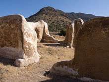
- 🌍 Fort Bowie National Historic Site, Apache Pass Rd (20 miles southeast of Willcox on State Road #186, then 8 miles on unpaved road to trailhead), ☎ +1 520-847-2500. 8AM-4:30PM (Visitor Center); sunrise-sunset (trails). A ruined army fort which played a pivotal role in the Apache Wars of the 19th century, and abandoned in 1894. The fort ruins are accessible via a 1.5-mile trail, which also passes by the remains of a Butterfield stagecoach station and a historic cemetery. Free.
- 🌍 Fairbank Historic Townsite, Hwy 82 (east of Whetstone, just east of the San Pedro River). Dawn to dusk. A ghost town which once functioned as transit point for Tombstone, with an even wilder reputation. The town has been incorporated into the San Pedro Riparian National Conservation Area, and a number of buildings remain, with the former schoolhouse now functioning as a gift shop. The old nearby cemetery is also worth a visit, and can be found along a foot trail heading north of the town. Free.
- 🌍 Slaughter Ranch Museum (San Bernardino Ranch), 6153 Geronimo Trail (east of Douglas). W-Su 9:30AM-3:30PM. Formerly known as the San Bernardino Ranch, the ranch was once the home of gunfighter and Civil War veteran John Slaughter. The buildings have been restored and declared a National Historic Landmark. Free, donations gratefully accepted.
- 🌍 Murray Springs Clovis Site, Moson Rd (from Sierra Vista, head E on Hwy 90 4 miles to Moson Rd, then head N 1.1 mile to the entrance road on the E side), ☎ +1 520-439-6400. Dawn to dusk. One of the oldest archeological sites in North America, used by nomadic hunters 12,000-13,000 years ago to pursue large game, including woolly mammoth. The site is managed as part of the San Pedro Riparian National Conservation Area, and has several trails, including a .3-mile long interpretative trail with exhibits and shade. Free.
- 🌍 Charleston & Millville Historic Townsite, E Charleston Rd, east of Sierra Vista (parking is just east of the San Pedro River, on the north side of the road), ☎ +1 520-439-6400. Daylight hours. Remains of two ghost towns, both of which were founded in 1879 and completely abandoned by 1889. The sites have now been incorporated into the San Pedro Riparian National Conservation Area; an interpretative trail leads past some of the remains and some pre-Columbian petroglyphs. Watch out for rattlesnakes! Free.
- 🌍 Camp Naco (Fort Naco, Camp Newell), S Wilson Rd and W Newell St, Naco (west of Bisbee, south of Hwy 92). The only remaining fort on the US-Mexico border, built in 1917 to protect the US border from sustained fighting during the Mexican Revolution. The site is listed on the National Register of Historic Places and some buildings have been partially restored. Unfortunately due to vandalism most buildings are behind a chain link fence, but they can still be seen from the road.
- 🌍 Presidio Santa Cruz de Terranate (trailhead is in parking lot on Kellar Rd, 2 miles north of Hwy 82). Daylight hours. The most intact remains in the US of a Spanish colonial fortress, built in 1776 and abandoned just four years later due to persistent Apache attacks. The site is now managed as part of the San Pedro Riparian National Conservation Area. Free.
- 🌍 Geronimo Surrender Monument, Hwy 80 (39 miles east of Douglas, 9 miles west of the AZ-NM state line, just north of Skeleton Canyon Rd). This simple monument commemorates Geronimo's final surrender to General Nelson Miles in 1886. The actual surrender site is several miles away off of Skeleton Canyon Rd, but is on private property and unfortunately rarely open to the public. There is a shaded picnic area by the monument.
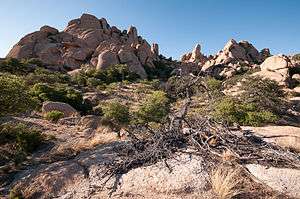
- 🌍 Texas Canyon, I-10 rest area (between Exits 318 and 322, west of Willcox). Named after pioneer settlers from Texas whose family still operates a nearby ranch, the pass is between the Dragoon Mountains in the south and the Little Dragoon Mountains in the north. The entire area is marked by huge granite boulders which can be easily appreciated from the I-10 rest stop. To explore further, take Exit 318 and turn south and head toward the Amerind Foundation (listed above).
Itineraries

Ghost Town Trail
- Begin in Tombstone on Gleeson Rd, which becomes a graded dirt road. The 🌍 Gleeson Cemetery will be on your left, a short distance before the townsite. Remains of 🌍 Gleeson include a saloon, schoolhouse, hospital, and newly restored jail.
- Head north to 🌍 Courtland on N Gleeson-Pearce Rd, aka Ghost Town Trail, which has just a couple of ruined structures remaining.
- Go further on to 🌍 Pearce with two structures on the National Register of Historic Places: the Old Pearce General Store and Our Lady of Victory Catholic Church.
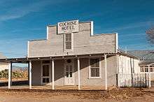
- From here continue on Hwy 191 to see Cochise and the historic 🌍 Cochise Hotel.
Do

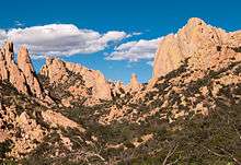
- 🌍 Coronado National Memorial, S Coronado Memorial Dr (off of South Highway 92). 8AM-4PM (Visitor Center). This memorial commemorates the expedition by conquistador Francisco Vásquez de Coronado, and has several scenic hiking trails of different levels of difficulty. Coronado Peak offers great views into Mexico, and is accessible via a short trail from the graded dirt road of Montezuma Pass. Free.
- 🌍 Hiking the Arizona Trail. A 817-mile long National Scenic Trail that traverses the entire state of Arizona south to north. The trail begins at Montezuma Pass (Coronado National Memorial) and follows the Crest Trail of the Huachuca Mountains, before continuing on through the Santa Rita and Rincon Mountains near Tucson. Good detailed trail maps and descriptions can be found at HikeArizona.com .
- 🌍
Dragoon Mountains (western access: turn east off of Hwy 80 onto Middlemarch Rd; eastern access: turn west off of Hwy 191 onto W Ironwood Rd), ☎ +1 520-364-3468 (Douglas Ranger District). With very rugged terrain, the Dragoons provided refuge for the Chiricahua Apaches during the Apache Wars of the 19th century, and offer excellent hiking, rock climbing, horseback riding, and camping opportunities. The area is managed by the Coronado National Forest; maps and hiking information can be obtained from the Douglas Ranger District office. Free.
- 🌍 Dragoon Springs. This site includes a ruined Butterfield Stagecoach station, and Civil War graves from the First Battle of Dragoon Springs.
- 🌍 Cochise Stronghold. Apache chief Cochise is believed to be buried in this area. Cochise Trail #279 is a challenging but very scenic 5-mile trail (one-way) beginning on the western side of the range and terminating at Cochise Stronghold Campground.
- 🌍 Council Rocks. This site, surrounded by giant boulders with pre-Columbian pictographs, is believed to be where the 1872 peace treaty between Chief Cochise and General Howard was negotiated.
- 🌍 Rock climbing. Rockfellow Dome is one of the most popular locations. Some areas are closed from March through June to protect sensitive raptor-nesting sites. Call the Douglas office at +1 520-364-6800 for a list of routes that are open year-round.
- 🌍
Chiricahua Mountains, south of Willcox, north of Douglas, east of Portal. (Access from Hwy 80, Hwy 181, Hwy 186), ☎ +1 520-364-3468 (Douglas Ranger District). South of Chiricahua National Monument, managed by the Coronado National Forest Service. The area features excellent bird watching and wildlife viewing opportunities, as well as hiking, horseback riding, and camping. Much of the range sustained damage in 2011 as a result of the Horseshoe II wildfire; however many trails have been repaired and the forest is now open to the public. Maps and trail information can be obtained from the Douglas Ranger District Office. Free.
- 🌍 Camp Rucker (Fort Rucker), N Rucker Canyon Rd (take Hwy 191 north of Douglas, turn right on N Rucker Canyon Rd). A former US Army post which was abandoned in 1890. A number of buildings are still standing, and access from the adjacent Chiricahua National Forest is permitted. The very popular Camp Rucker Campground is nearby (see listings below). Free.
Bird-watching
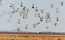
- 🌍 Whitewater Draw Wildlife Area, N Coffman Rd (near McNeal and Double Adobe). An outstanding bird-watching site where 20,000 sandhill cranes winter each year, along with other numerous avian species and wildlife. The best time to see the cranes is from December until February in the early morning and afternoon, although other wildlife can be seen here year-round. Free.
- 🌍 Southwest Research Station, 2003 W Cave Creek Rd, Portal, ☎ +1-520-558-2396. The Chiricahua Mountains in particular are excellent for bird watching as well as wildlife viewing, with a number of very rare avian species sighted here. This facility is operated by the American Museum of Natural History, and offers bird watching tours, and accommodation for naturalists and hikers.
Sleep
Accommodation options listed below are outside of major population centers. For locations with more urban amenities, see town and city listings above.
Lodging
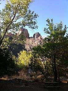
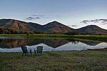
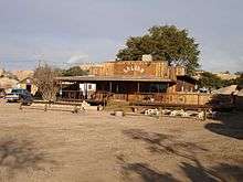
- Birder's B&B, 100 Cave Creek Rd, Portal, toll-free: +1 888-596-2557, e-mail: birders@vtc.net. A restored 1930s-era stone guesthouse operated by naturalists; pets permitted (with restrictions).
- 🌍 Cave Creek Ranch, 1396 W Piedra Blanca Ln, ☎ +1 520-558-2334, toll-free: +1 855-558-2334, fax: +1 520-558-2313, e-mail: info@cavecreekranch.com. In the Chiricahua Mountains, makes an ideal base for bird-watchers and hikers. $95-175/night.
- 🌍 Cochise Stronghold Retreat, 2126 Windancer Trail (near Pearce), ☎ +1 520-826-4141, toll-free: +1 877-426-4141, fax: +1 520-826-4141, e-mail: cochisestrongholdretreat@gmail.com. In the Dragoon Mountains, this lodging option has some atmosphere, and its operators seem to be trying to be good citizens of the region, as witness their hosting the website for Cochise Stronghold itself. Makes a good base for hiking and bird-watching.
- 🌍 The George Walker House, 2225 W George Walker Ln, Portal, ☎ +1 520-558-2287, e-mail: Winjac12@vtc.net. A historic house which has been fully restored and available on a nightly basis. The caretakers live in a separate house next door. Fully equipped, no television but free Wi-fi. $75-189/night (depending on number of guests).
- 🌍 Half Moon Ranch, 1900 W Ironwood Rd, Pearce (E Cochise Stronghold), ☎ +1 877-833-6777. Check-in: 2PM, check-out: noon. Set in a dramatic canyon in the Dragoon Mountains, the seven-room ranch can accommodate up to ten people and six horses. The fully-furnished ranch house has electricity and running water, but guests must bring their own sleeping bags, pillows, and other supplies. Non-smoking, pets permitted. The property is maintained by the US Forest Service, and reservations can be made online. $150/night.
- 🌍 Hideout Ranch, 11730 N Horses Hideout Rd, San Simeon (Hwy 80 northwest of Douglas), ☎ +1 520-558-4433, toll-free: +1 855-879-4433. An overnight guest ranch that also offers horseback riding into the Dragoon and Chiricahua Mountains. Horseback riding is also available for day visitors. $200-250/night, minimum stay 2 nights.
- 🌍 Portal Bunkhouse, 1192 W Saddle View Rd (entrance to Cave Creek Canyon, Chiricahua Mts), ☎ +1 877-833-6777. Check-in: 2PM, check-out: noon. Built in the 1930s by the Civilian Conservation, this two-room cabin is listed on the National Register of Historic Places. The fully-furnished cabin has electricity and running water, but guests must bring their own sleeping bags, pillows, and other supplies. Non-smoking, pets permitted. The property is maintained by the US Forest Service, and reservations can be made online. $100/night.
- 🌍 Portal CCC House, 1192 W Saddle View Rd (entrance to Cave Creek Canyon, Chiricahua Mts), ☎ +1 877-833-6777. Check-in: 2PM, check-out: noon. Built in the 1930s, this five-room cabin is one of the few remaining structures from the Cave Creek CCC Camp. The fully-furnished cabin has electricity and running water, but guests must bring their own sleeping bags, pillows, and other supplies. Non-smoking, pets permitted. The property is maintained by the US Forest Service, and reservations can be made online. $125/night.
- 🌍 Price Canyon Ranch, 10923 N Price Canyon Rd, San Simon, ☎ +1 520-240-6177, fax: +1 520-731-9453. A working cattle ranch with 10 rooms for guest accommodation. The ranch offers horseback riding lessons, and guided excursions.
- 🌍 Shaw House, W Ironwood Rd, Pearce (E Cochise Stronghold), ☎ +1 877-833-6777. Check-in: 2PM, check-out: noon. A historic eight-room stone cabin located in the eastern Dragoon Mountains. The fully-furnished cabin has electricity and running water, but guests must bring their own sleeping bags, pillows, and other supplies. Non-smoking, pets permitted. The property is maintained by the US Forest Service, and reservations can be made online. $150/night.
- 🌍 Sunglow Ranch, 14066 S Sunglow Rd, Pearce, ☎ +1 520-824-3334, toll-free: +1 866-786-4569. In addition to full room and board, this guest ranch also offers photography and yoga workshops. $299-$449/night.
- 🌍 Triangle T Guest Ranch, 4190 Dragoon Rd, Dragoon (take Exit 318 south of I-10, between Benson and Willcox), ☎ +1 520-586-7533, fax: +1 520-586-4476, e-mail: ttgr@earthlink.net. Historic ranch which offers overnight accommodation (including for RVs and tents), a restaurant, and saloon. The ranch has been used as a filming location for movies, TV shows, and commercials.
Camping


- 🌍 Cochise Stronghold Campground, ☎ +1 520-364-3468. A beautifully-situated campground in the Dragoon Mountains, with camping for tents and trailers. Toilets, no water, no hookups. No reservations required, closed annually from 1 Jun - 1 Sep. $10/night.
- Chiricahua Mountains, ☎ +1 520-364-3468. The Forest Service maintains seven developed campgrounds in the Chiricahua Mountains, and dispersed camping is possible in two other areas. Black bears are active throughout the area. Campgrounds with water are listed below. $10/night (developed campgrounds).
- 🌍 Idlewilde Campground, ☎ +1 520-364-3468. Due to flood damage in fall of 2014, this campground is closed until further notice. This site is known for its beautiful scenery and is a good birding spot. Best suited for tents or pickup trucks, although trailers up to 16' are permitted. Drinking water from April - October. $10/night.
- 🌍 Stewart Campground, ☎ +1 520-364-3468. Trailers up to 22', no hookups. Drinking water from April - October. $10/night.
- 🌍 Sunny Flat Campground, ☎ +1 520-364-3468. A particularly good campsite for birdwatching. Trailers and RVs up to 22', no hookups. Drinking water available year-round. $10/night.
- 🌍 Indian Bread Rocks Picnic Area (from Bowie travel south on Apache Pass Rd then west on the dirt road leading to Happy Camp Canyon), ☎ +1 928-348-4400, fax: +1 928-348-4450, e-mail: SFOWEB_AZ@blm.gov. Named for the prehistoric Native American grinding holes found in the granite bedrock, this scenic area marks the access point to the Dos Cabezas Mountains Wilderness Area. The campground has picnic tables, fire rings, vault toilets, but no water. Open year-round and managed by the BLM (Bureau of Land Management).
- 🌍 Lakeview Campground, ☎ +1 520-378-0311. Located by Parker Canyon Lake on the west side of the Huachuca Mountains, this campground is managed by the Forest Service. There is a small general store on the site, and boats are available for rent. RVs 32' and less, no hookups. Drinking water, toilets. $10/night.
Eat
As this is ranching country steakhouses are easy to find, and much food is heavily influenced by Sonoran cuisine. Mexican food is widely available.
Aside from in the population centers, restaurants in this sparsely-populated region are few and far between. For provisions, the towns of Sierra Vista, Bisbee, Willcox, Benson, and Douglas all have good-sized grocery stores, with Sierra Vista having the best selection.
Drink
Stay safe
Outdoors
As with any outdoor activity in the desert southwest, the standard precautions should be taken here, especially in more remote areas.
- Water. Always take more water than you think you will need, even if going for a short stroll. In the arid climate you can lose a lot more water in perspiration than you realize, until it's too late.
- Heat exhaustion. Heat exhaustion can occur very quickly. Symptoms can include dizziness, rapid breathing, heavy sweating, and muscle spasms.
- Buddy system. In remote areas it's always a good idea to have a companion with you.
Wildlife
.jpg)
- Rattlesnakes. If you don't bother them they won't bother you. Rattlesnakes hibernate during the winter months, and are active from spring to fall. The main risk is stepping on them; never place your feet or hands where you haven't looked first. Wear boots or sturdy shoes, not sandals. If you are bitten, seek medical attention immediately.
- Mountain lions (pumas/cougars). In the extremely unlikely event that you should encounter one, it is best to make yourself look as large as possible, so that you don't look like prey (wave your arms, fan your jacket, etc.) Throw things if possible. Do not play dead!
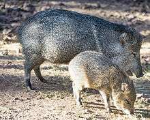
- Javelinas (peccaries). These pig-like mammals travel in herds, and while they generally avoid people, they are very near-sighted and protective of their young, and will attack if they feel at all threatened. Make as much noise as possible so that they are not surprised and panic.
- Bears. Black bears are found in a few mountain ranges, notably in the Huachucas (near Sierra Vista) and in the Chiricahuas. When camping, secure your food away from your campsite; when hiking, make plenty of noise.
Drug and human trafficking
Southeast Arizona is a corridor for traffickers, although in the 2010s, the problem has abated somewhat as smuggling routes have shifted to the east and west. Still, it may be inadvisable to camp in some areas as smugglers travel most often at night; day hiking however in the same areas may be safe. Inquire locally about current conditions, or contact the nearest Border Patrol office (tel. +1 800-232-5378) for guidelines.
The Border Patrol maintains two checkpoints monitoring all north-bound traffic heading toward Interstate 10: the 🌍 Highway 90 checkpoint north of Huachuca City, and the 🌍 Highway 80 checkpoint north of Tombstone. Drivers passing through should lower their windows; agents may ask limited questions regarding residency or immigration status of any driver or passenger, although frequently they will simply wave cars through. You do have the right to refuse to answer such questions, but this could result in detention while your immigration status is verified.
Go next
Tucson is within an hour's drive, as is neighboring southwest New Mexico. Visit Mexico for the day (via Douglas or Nogales), or visit nearby Tumacácori Mission and Tubac in South Central Arizona.