Padjelantaleden
Padjelantaleden is a hiking trail in Lappland, in northern Sweden. It is 140km long and leads from Kvikkjokk northwards through Padjelanta National Park (in the Laponia park system) to Ritsem. The hike usually takes around 9–10 days (although one might want to plan for breaks, expected and unexpected). Not having much elevation gain (at maximum 300m per day), it is suitable as a beginner's trekking tour, provided one has experience with outdoor camping, hiking and staying in remote areas
- This article is an itinerary.
Understand
- See also: Hiking in the Nordic countries
This trip goes into wilderness areas where assistance is unavailable and unexpected events can occur. Always use caution and make sure you know the conditions you might encounter. Do not attempt to hike on Padjelantaleden without a detailed hiking map. Consulting a guide book is wise, although as of spring 2017 no guide book in English is available. Off line GPS hiking maps for Padjelanta and Kvikkjokk-Jakkvik can be purchased via the app Calazo.
Padjelanta national park is part of the Laponia UNESCO World Heritage site. The area is a Sámi region, where reindeer husbandry and other traditional livelihoods are still practised.
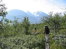
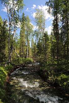
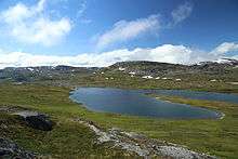
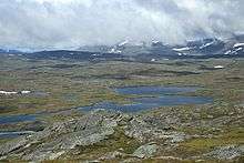
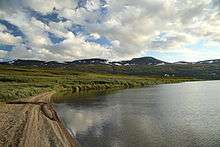
It is possible to hike Padjelantaleden in either direction. At Ritsem, the Fjäll (mountain landscape) consists of higher and steeper fells than in Kvikkjokk, where the trail leads through forest sections. This article describes the direction from Kvikkjokk to Ritsem, thus providing a climactic scenic experience for most travellers.
In this article, we concentrate on a summer hike.
There is also the possibility of going in the winter, but only with the right skills. You will need skis suitable for off-track skiing. The trail markings can be obscured by snow and there is less service; the huts are not necessarily manned, but one of the huts in any of the camps should be open. Beware of snow storms in open areas, and Arctic temperatures. The huts are manned at Easter, which is about the best time for winter hikes.
The huts in the national park itself are maintained by the local Sámi communities through
- Badjelánnda Laponia Turism, Storgatan 40, Jokkmokk, ☎ +46 70 281 30 03, e-mail: padjelanta@padjelanta.com.
Some huts, such as at the trailheads, are maintained by the Swedish tourist association, STF.
Prepare
Food
It is essential to bring the right items (equipment, food and emergency kit) with you. This is a wilderness area, and though small huts exist on the way, the ability to buy items is very limited. Basically, besides the larger huts in Ritsem and Kvikkjokk, you are restricted to a small number of food items. About every two days you will reach a hut that offers bread, and every once in a while also a small selection of other items. You may also be able to buy fish and fresh bread in Sámi camps (ask at the huts or note signs by the trail). Staloluokta, placed conveniently in the middle of Padjelantaleden, has a bit more options. Here you might be able to stock up on some more food. However, food supply is not guaranteed, and huts can run out of supplies at the end of the season. It is best to bring food for the entire trip, except for maybe bread and a bit of chocolate or muesli. You should also note that food is very expensive on the trail, since everything has to be brought in by helicopter. Make sure you have enough cash with you, since you can generally not pay by credit card in the huts, on the boat or the buses (this reflects a recent change with credit card companies' policies).
Equipment
In terms of equipment, what to bring depends on whether you wish to stay in the huts for the night, or bring a tent. Obviously, bringing a tent will allow you to travel much more flexibly and you will for the most part find good spots for your tent easily. There are stoves, kitchen utensils, tableware, duvet and pillows in the huts, but you will need at least own linen (or sleeping bags). Depending on when you are going you might have to be prepared also for emergency camping with what you carry.
See Trekking for a general description of what you might want to bring. Bringing waterproof, sturdy boots, a waterproof jacket, rain pants and a backpack cover is prudent, since it can pour for days.
It is essential to prepare for mosquitos. The huge number of aggressive mosquitos that can occur in summer makes them not merely an inconvenience, but a real challenge for the trip. Bug spray helps only so much, it is therefore essential to have clothes that protect the entire body, including a mosquitos hat. Consider hiking at a later time in summer, since mosquitos usually die in the first cold night around September.
Water
Plenty of water is available along the trail. Most hikers drink it without treatment. Be sure to bring one or more bottles though.
Get in
From Stockholm, there is a night train to Murjek, from which you can take the connecting bus to Kvikkjokk. In Kvikkjokk, you have to take a small boat to get to the trailhead.
The trail ends in Anonjalme, on the south side of lake Akkajaure. There is a ferry going to Ritsem, from which you can take the bus to Gällivare, where you take back the night train to Stockholm.
The connection by train to Stockholm takes some time, but staying in a sleeper in the train is quite comfortable and the buses and ferries are generally set up to provide a seamless trip without having to wait too much in one place. It is recommended to buy your bus ticket combined with the train. In that case, if the train is delayed and you miss the bus you will be supported to make the final link. Although less ecological, flying to Kiruna from Stockholm might be an alternative.
A lot of huts on the trail also have a connection via helicopter. Although not a very affordable and ecological solution, they do provide the possibility for quick travel in case of unexpected problems, provided one is near one of the huts with helicopter landing zones.
Huts on the way
Both in the starting/end points Kvikkjokk and Ritsem there are STF huts, that are quite large and carry a greater range of supplies than the huts in between. Other than that, only Staloluokta is large enough to have a range of items available.
Also when the huts are unmanned there should be firewood available. If you use an unmanned hut, pay by the giro forms available at the hut, to the host at the next hut, or on the Internet.
Kvikkjokk - Ritsem
The following list is not meant as an day-to-day itinerary. For instance, most hikers will prefer to walk more than the 6km from Njunjes to Tarrekaise on their first day.
- Njunjes - Tarrekaise, 6 km
- Tarrekaise - Såmmarlappa, 13 km
- Såmmarlappa - Tarraluoppal, 13 km
- Tarraluoppal - Tuottar, 11 km
- Tuottar - Staloluokta, 18 km
- Staloluokta - Arasluokta, 12 km
- Arasluokta - Låddejåkkå, 13 km
- Låddejåkkå - Kisuris, 23 km
- Kisuris - Akka, 14 km (the ferry departs from the nearby Anonjalme)
For the last two stages, the following variation is possible. This Nordkalottleden segment leads to more fell landscape and less forest, which besides a great view, provides for a more mosquitos-free environment.
- Låddejåkkå - Kutjaure, 19 km
- Kutjaure - Vaisaluokta, 18 km
From Vaisaluokta, one can take either take the ferry directly to 🌍 Ritsem (note that it leaves from Vaisaluokta less frequently) or walk to Anonjalme to get to the original end point of Padjelantaleden.
Connecting hikes
Kvikkjokk is not only the starting point of Padjelantaleden, but also serves as an important waypoint of Kungsleden. Connecting to Kungsleden is thus possible.
On the other end of the trail, hiking the Nordkalottleden is possible (as described above as an alternative exit).
In Ritsem itself, few hiking possibilities exist, besides the Gränsleden trail to Norway. At Akka (the end of the hiking trail, just before taking the ferry over to Akkajaure), it is possible to do some more serious mountaineering in going into the Akka massif. Proper precautions should be made, since the weather may change rapidly at any time. A small trail starts near the east side of the large bridge over Vuojatädno.