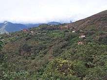
La Paz (department, Bolivia)
La Paz Department is situated on the Altiplano at the western border of Bolivia, sharing Lake Titicaca with Peru. It contains the mighty mountain range of Cordillera Real with many popular treks and peaks for climbing. Northeast of the Cordillera Real are the Yungas, the steep eastern slopes of the Andes that make the transition to the Amazon basin. It also contains the city of La Paz, the administrative capital of the country.
Cities
- 🌍 La Paz – The capital city.
- 🌍 Chulumani
- 🌍 Copacabana – A popular resort town on the shores of Lake Titicaca on a small peninsula that is actually contiguous with Peru. It actually gave the famous beach in Rio de Janeiro its name. It is home to an impressive cathedral.
- 🌍 Coroico – A town at the end of the "Death Road" and "El Choro Trek" with nice weather and a resort feel to it.
- 🌍 Desaguadero – A tiny border town shared with Peru.
- 🌍 Quime – A practically unknown town with secret valleys, and elfin forests at the beginning of the Coca Trail—though, a little quiet.
- 🌍 San Miguel del Bala
- 🌍 Sorata – A lively mountain village with many trails and mountain hiking around it, reaching as far as Rurrenabaque and as high as 6,000 m.
- 🌍 Yampupata
Other destinations
- 🌍 Chacaltaya – The worlds highest ski area and a popular day trip from La Paz.
- 🌍 Huayna Potosí – "The world's easiest 6,000 m peak" and a national park close to La Paz.
- 🌍 Isla del Sol
- 🌍 Madidi National Park
- 🌍 Tiwanaku
Understand
La Paz Department includes part of the Yungas region, a kind of paradise on earth that is very hard to leave. As one comes down from the highlands to the Yungas, the rocky landscape gives way to colorful flora, to new smells and waterfalls that seem to fall from the sky. Further on, the vegetation thickens, until it becomes virgin rainforest. The valley soil is very fertile and abundant. Generous crops of fruit and vegetables, which supply the cities of the highland region, are cultivated here. Melons, mangos, papayas, bananas, and coffee are in abundance, among of the parrots and monkeys.
And coca, of course, a traditional part of this culture. The Yungas offer many possibilities: 4WD discovery trips, hiking, unprecedented mountain bike crossings, white water rafting, or simply lazing around at great heights.

Get in
The region borders both Chile and Peru, to and from which there are international bus services. It's also popular to enter from Cochabamba to the east and Oruro to the south.
Get around
See
Lake Titicaca. The lake is located at the northern end of the endorheic Altiplano basin high in the Andes on the border of Peru and Bolivia. The eastern side is located in the Bolivian La Paz Department.Copacabana is the main Bolivian town on Lake Titicaca, from where boats leave for Isla del Sol, the sacred Inca island. The town has a large 16th-century shrine, the Basilica of Our Lady of Copacabana.
Do
- Going down the Worlds Most Dangerous Road on a mountain bike is probably the safest way to get to Coroico. Read more in the La Paz section.
- Climb Huayna Potosi. A non-technical 6088M climb with a hard(er) last 120m. Recommended 5 days at altitude prior to climbing.
- Hike El Choro Trek, which takes you through various climatic zones as it descent from 4900m to 1300m.
La Paz is a good place to eat, a different food, but you can find plenty of possibilities to find from Thai food to traditional food. El Consulado offers you an alternative in new Andean kitchen.