Hallingdal
Hallingdal is a valley in Norway's Buskerud county, west and northwest of Oslo. The valley is home to Norway's most popular ski resorts and is the main entrance to key hiking areas.
Understand

Hallingdal is one of Norway's major valleys. It cuts through the bedrock for about 150 km from Lake Krøderen to Hardangervidda at Geilo. Hemsedal is a branch of the main valley. Road 50 runs through the Hol branch towards Flåm/Aurland at Sognefjord. The valley floor is gentle while the surrounding hills and mountains are steep and home to several ski resorts. The valley is also home to road 7 (a key east-west road) and Bergensbanen (the Bergen railway line).
In the barren mountains the reindeer is master, while the forests is home to a large number of elk/moose ("elg"). Some brown bears also thrive there, some are kept in a park (zoo) at Flå.
Hallingdal generally enjoys relatively dry continental climate (warm summers and cold winters). Winters can be bitterly cold in the interior. Nesbyen has the highest recorded temperatures in summer in Norway and usually among the warmest places in summer on average. Winters are also relatively cold. At Geilo temperatures are consistently below 0°C (frost) from December through March, most of November and April are also below 0°C during night. There is modest precipitation in Hallingdal. Wind can however be rough on the exposed mountain plateaus.
Towns and other destinations
- 🌍 Geilo, e-mail: turistinfo@geilo.no. One of Norway's main ski resort, stable weather.
- 🌍 Hemsedal. Hemsedal ski resort is on the steep slopes in the high Hemsedal valley. Long season. Popular among the younger and the more skilled skiers. Frequently mentioned as one of Norway's most complete alpine resort, can be compared to leading resorts in Austria and Canada.
- Gol
- Nesbyen
Get in
By rail
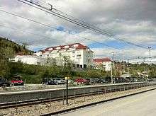
Trains on Bergensbanen between Oslo and Bergen stop at Hønefoss, Gol, Ål, Geilo. Some trains stop also at Flå, Nesbyen, Ustaoset and Haugastøl. Tickets are sold by NSB
By car


- Road 51 through Gol mountain pass connects Hallingdal to central Valdres
- Road 40 from Kongsberg through Numedal valley and Dagali mountain pass (1100 meters) to Geilo
Get around
- The Bergen railway runs up and down the valley between Geilo and Hønefoss
- Access to Hemsedal by bus or car from Gol
See
- 🌍 Torpo stave church (Torpo stavkyrkje), Torpo in Ål district, Hallingdal. National cultural heritage
Do
Hiking
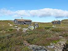
Hallingdal is the main entrance to Norway's most popular hiking area, the Hardangervidda. Hallingskarvet is a distinct ridge rising above the plateau, more demanding but also a more rewarding hike. On the northern side of Hallingskarvet there are fine trails down the lovely Aurlandsdalen in Aurland area. Hallingskarvet and the area north to road E16 (Lærdal) is known as Skarvheimen. Hallingskarvet and Hardangervidda er both protected as national parks.
- 🌍 Hardangervidda and Hallingskarvet - hiking, Bergen railway or road 7. The Hardangervidda plateau is wide treeless mountain plateau. Bergen railway (Bergensbanen) runs on the northern edge along the distinct Hallingskarvet ridge and at Finse also the Hardangerjøkulen glacier.
- 🌍 Skarvheimen and Aurlandsdalen hiking. Highly varied hiking area stretching from the distinct Hallingskarvet and the barren plateau to the deep valleys and fjords around Flåm/Aurland.
Cross-country skiing

Hallingdal and the surrounding mountains and plateaus offers great back country skiing. There are also networks of groomed tracks in the back country where light cross-country skis can be used.
Alpine skiing
Hallingdal is Norway's key area for alpine skiing. Resorts:
- Norefjell (south end of Krøderen lake)
- Nesbyen
- Gol
- Gol skipark
- Storefjell
- Golsfjellet
- Hemsedal
- Ål
- Ål skisenter
- Skarsli - also tobogging/sledging
- Hallingskarvet
- Geilo
Sleep

Stay safe
As Norway in general Hallingdal is a safe place.
- Outdoor. Visitors should be prepared when they go on hikes in the high plateaus and mountains - weather can be cold even in summer and navigation can be difficult in bad weather. Waterfalls are treacherous and rivers are cold even in summer. Several rivers in Hallingdal and Hemsedal are controlled by hydro electric power plants and flow may change suddenly.
- Driving. Drivers should take it easy on the steep roads such as around Geilo and Dagali. Many roads are narrow and winding, even if speed limit is 80 km/h safe speed around corners may be 50 or 60. In the interior winter is long and frost/snow can occur spring and autumn. Drivers should consult weather forecasts and inspect road surface when on the road. Hallingdal is moose territory and the big animal may suddenly wander into the road, particularly at dusk and dawn.
Go next
| Routes through Hallingdal |
| Eidfjord ← | W |
→ Hønefoss |
| Lærdal ← Hemsedal ← | N |
→ Gol |