Free State
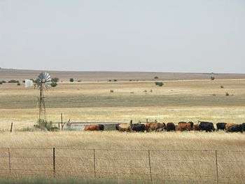
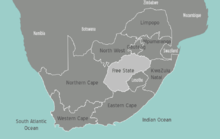
The Free State Province is situated in the heartland of the Karoo semi-desert of South Africa.

Regions

| Lejweleputswa Western Free State, also known as the Free State Gold Fields |
| Motheo |
| Northern Free State Large portions of this area still show the scars of the Vredefort Dome meteor impact. |
| Thabo Mofutsanyana Eastern portion of the Free State, bordering onto the Lesotho highlands to the south. |
| Xhariep The southern grass plains |
Other destinations
National parks
Other nature reserves
- 🌍 Caledon Nature Reserve , near Caledon
- Erfenis Dam Nature Reserve , just outside Theunissen
- Gariep Dam Nature Reserve, at Gariep Dam
- Kalkfontein Dam Nature Reserve , close to Fauresmith
- Sandveld Nature Reserve , near Bloemhof
- Soetdoring Nature Reserve, just outside Bloemfontein
- Tussen-die-Riviere Game Reserve , outside Bethulie
- Tweefontein Nature Reserve
- 🌍 Willem Pretorius Game Reserve , near Ventersburg
- Qwa-Qwa Park , near Harrismith
- 🌍 Sterkfontein Dam Nature Reserve , near Harrismith
Understand
The former Oranje-Vrystaat (Orange Free State) was the heartland of the white Afrikaner population and therefore most people in this region speak Afrikaans, although the majority have SeSotho as mother tongue. It was one of the first independent states, before joining the South African Union, and the people here still live up to the Voortrekker traditions of braaing. The rich soil and pleasant climate allow a thriving agricultural industry. With more than 30,000 farms, which produce over 70% of the country's grain, it is known locally as South Africa's breadbasket.
Bloemfontein is the judicial capital of South Africa, mainly because the founders of the Union of South Africa wanted to unite all people, including the Afrikaner population.
The Free State is an important agricultural area in South Africa, with beef and maize the primary products.
Talk
Afrikaans is still the first language of many, but most will definitely understand and speak English. Be prepared for understanding through the accent.
Get in
By car
- The N1 highway runs through the Free State. It comes from Cape Town and goes further to Johannesburg and Pretoria and from there to Harare in Zimbabwe. Use this route when coming from/going to Mozambique, too.
- The N3 runs in the east of the Free State through Harrismith. Use it to go to Durban or the Gauteng area.
- The N8 goes from Bloemfontein to Kimberley and further to Upington.
- The N6 goes south to the Eastern Cape
The N5 only serves as a connection between the N1 and the N3.
By plane
Bloemfontein Airport (BFN IATA) has flights to Johannesburg and Cape Town and some other cities in South Africa. Flights are operated by the South African Airways family.
Get around
Best by car, as there are little means of public transport and great distances between each of the towns and cities.
The traffic police is very active, especially on the N1 - keep to the speed limit!
See
- Bloemfontein
- The Gariep Dam -- one of the biggest dams in South Africa
- Golden Gate Highlands Park -- Famous park in the north of the Drakensberg Mountains
Eat
Drink
Stay safe
Always have enough water with you, in case your car has a break down. Tell your last hotel where you are going to and which route you use, especially when going into a less populated and rural area.
Go next
- North-west are Kimberley with its diamond museum and Upington near the Kgalagadi Transfrontier Park.
- South-west lies Cape Town, the Cape Winelands and the Garden Route.
- North-east is Johannesburg and the Kruger National Park.
- South-east is Durban and the Sunshine Coast.