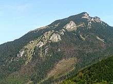
Choč Mountains
Choč mountains (Chočské vrchy) is a mountain range in Central Slovakia. It is a portion of the Fatra-Tatra Area of the Inner Western Carpathians. The range is 24 km long and on average only 4 km wide.

Veľký Choč from Liptov
Understand
History
Landscape
Highest peaks:
- Veľký Choč, 1611 metres
- Malý Choč, 1465 metres
- Prosečné, 1371 metres
- Holica, 1340 metres
- Lomná, 1278 metres
Flora and fauna
Climate
Get in
One of the possible access points is Valašská Dubová village between Ružomberok and Dolný Kubín. An alternative is Lúčky village.
Fees and permits
Get around
Blue hiking trail will take you from Valašská Dubová to a meadow under the Veľký Choč peak. Afterwards, continue with the green trail. Red trail goes from Lučky, via the peak to Jasenová village.
See
Do
- 🌍 Veľký Choč. The most common mountain hiking target here because of the great views all around.
- 🌍 Prosiecka dolina (Prosiek valley) (Accessible from Prosiek). One of the most beautiful valleys in Slovakia. Hiking the valley includes some ladders, waterfalls etc.
- 🌍 Kvačianska dolina (Accessible from Kvačany or Huty, also some other routes are available.). Some ancient watermills "inside", nice place to go with kids.
Buy
Eat
Drink
Stay safe
Go next
Ružomberok | Liptovský Mikuláš | Dolný Kubín
Western Tatras | Great Fatra | Little Fatra
gollark: There ARE antispam rules.
gollark: Further evidence of new esolangs necessary.
gollark: That's… wrong.
gollark: ???
gollark: Maybe disable that.
This article is issued from Wikivoyage. The text is licensed under Creative Commons - Attribution - Sharealike. Additional terms may apply for the media files.