Zorge, Walkenried
Zorge is a village and a former municipality in the district of Göttingen, in Lower Saxony, Germany. Since 1 November 2016, it is a part of the municipality Walkenried. The river Zorge starts in the village.
Zorge | |
|---|---|
Ortsteil of Walkenried | |
 Coat of arms | |
Location of Zorge 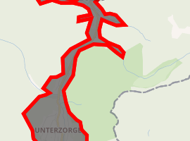
| |
 Zorge 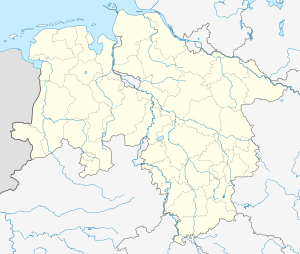 Zorge | |
| Coordinates: 51°38′12″N 10°38′05″E | |
| Country | Germany |
| State | Lower Saxony |
| District | Göttingen |
| Municipality | Walkenried |
| Area | |
| • Total | 2.21 km2 (0.85 sq mi) |
| Elevation | 478 m (1,568 ft) |
| Population (2015-12-31) | |
| • Total | 984 |
| • Density | 450/km2 (1,200/sq mi) |
| Time zone | CET/CEST (UTC+1/+2) |
| Postal codes | 37449 |
| Dialling codes | 05586 |
| Vehicle registration | GÖ, OHA |
Sights
There is a good view of Zorge from the Pferdchen viewing point which is located at about 430 metres above sea level and is checkpoint 58 in the Harzer Wandernadel hiking network.[1]
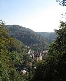
View of Zorge from the Pferdchen viewing point
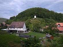
Museum and Bell tower
gollark: It's hardly unreasonable.
gollark: Also, list of active fansites.
gollark: Also, valley sherwood, DragHatch.
gollark: Egg Drop Soup.
gollark: hatching.club?
References
- Stempelstelle 58 / Pferdchen at www.harzer-wandernadel.de. Retrieved 1 Nov 2017.
This article is issued from Wikipedia. The text is licensed under Creative Commons - Attribution - Sharealike. Additional terms may apply for the media files.