Yuny Strait
Yuny Strait (Russian: Юный пролив) is a strait in Severnaya Zemlya, Russia. It is covered with ice most of the year.
| Yuny Strait | |
|---|---|
| Jungsturm Strait | |
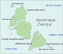 Map showing the location of Yuny Strait | |
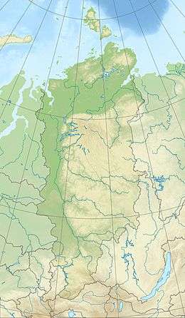 Yuny Strait Location in Krasnoyarsk Krai | |
| Location | Arctic |
| Coordinates | 80°6′N 92°34′E |
| Native name | Юный пролив |
| Ocean/sea sources | Kara Sea / Red Army Strait |
| Basin countries | Russia |
| Max. length | 60 km (37 mi) |
| Max. width | 24 km (15 mi) |
History
Initially named Proliv Yungshturm (Russian: пролив Юнгштурм) after the Roter Jungsturm of the German Communist Youth, following the Great Patriotic War, its name was changed to Yuny (Youth).[1][2][3][4]
Geography
The Yuny Strait is a maximum 24 km (15 mi)-wide strait that separates Pioneer Island from Komsomolets Island, connecting the Kara Sea in the northwest with the Red Army Strait in the southeast.[5] It runs roughly in a northwest/southeast direction and its confluence with the Red Army Strait is located 23 km (14 mi) to the southwest of Cape October. The minimum width of Yuny Strait is 4 km (2.5 mi).[6]
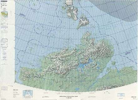
1975 map showing Severnaya Zemlya and the Taymyr Peninsula
gollark: No.
gollark: I should technologize more G™.
gollark: I imagine it's a trait of your tool.
gollark: No, it can be made selective.
gollark: They could at least throttle it. Steam downloads hyperaggressively somehow and consumes all bandwidth if not limited.
References
- Архипелаг, открытый последним (Северная Земля)
- Исследование Северной Земли
- Плавание на ледоколе «Садко» 1935 г.
- Ушаков Г. А. По нехоженной земле
- "Proliv Yunyy". Mapcarta. Retrieved 26 November 2016.
- GoogleEarth
This article is issued from Wikipedia. The text is licensed under Creative Commons - Attribution - Sharealike. Additional terms may apply for the media files.