Iconi Airport
Iconi Airport (IATA: YVA, ICAO: FMCN) was an airport located in Moroni,[1] the capital city of the Comoros islands. The airport was on the western side of the island of Grande Comore, north of the town of Iconi.
Iconi Airport | |||||||||||
|---|---|---|---|---|---|---|---|---|---|---|---|
| Summary | |||||||||||
| Airport type | Closed | ||||||||||
| Serves | Moroni, Comoros | ||||||||||
| Elevation AMSL | 33 ft / 10 m | ||||||||||
| Coordinates | 11°42′45″S 43°14′35″E | ||||||||||
| Map | |||||||||||
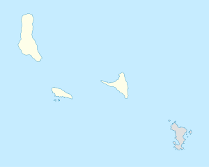 YVA Location of the airport in Comoros | |||||||||||
| Runways | |||||||||||
| |||||||||||
It was closed a few years ago[3] in favor of the new Prince Said Ibrahim International Airport.
Facilities
The airport resided at an elevation of 33 feet (10 m) above mean sea level. It had one runway that was 1,355 metres (4,446 ft) in length.[1]
The Iconi non-directional beacon (Ident: FXM) is located just north of the field.[4]
gollark: "Zero growth" bad, sustained economic growth necessary.
gollark: Globalisation good, complex global supply chains basically fine?
gollark: Hmm. Also, gradual phase out of road networks and replacement with trains etc. good.
gollark: Renewables are not energy dense, need vast amounts of batteries to be any good, and take tons of energy to produce in the first place.
gollark: Nationalised healthcare possibly not good?
See also

- Transport in Comoros
- List of airports in Comoros
References
- Airport information for Moroni, Comoros at Great Circle Mapper.
- "Iconi Airport". Google Maps. Google. Retrieved 2 May 2019.
- Google Earth Historical Imagery (4/21/2009), (11/2/2011)
- "Iconi NDB". Our Airports. Retrieved 2 May 2019.
External links
- OpenStreetMap - Iconi Airport
- SkyVector - Moroni Iconi Airport
- Accident history for Moroni-Iconi Airport at Aviation Safety Network
This article is issued from Wikipedia. The text is licensed under Creative Commons - Attribution - Sharealike. Additional terms may apply for the media files.