Wyoming Highway 240
Wyoming Highway 240 (WYO 240) is a 12.28-mile-long (19.76 km) state road that in Lincoln County, Wyoming that connects U.S. Route 30 (US 30) and US 189 in the southeastern end of the county.
| ||||
|---|---|---|---|---|
| Opal Road | ||||

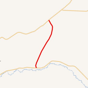
WYO 240 highlighted in red | ||||
| Route information | ||||
| Maintained by WYDOT | ||||
| Length | 12.28 mi[1] (19.76 km) | |||
| Major junctions | ||||
| South end | ||||
| North end | ||||
| Location | ||||
| Counties | Lincoln | |||
| Highway system | ||||
State highways in Wyoming
| ||||
Route description
Wyoming Highway 240 is a north-south highway that runs from US 30 in Opal north 12.28 miles (19.76 km) to a north end at US 189 located approximately 21 miles (34 km) northeast of Kemmerer. WYO 240 Acts as a bypass for travelers connecting from US 30 west to US 189 north. [2]
Major intersections
The entire route is in Lincoln County.
| Location | mi | km | Destinations | Notes | |
|---|---|---|---|---|---|
| Opal | 0.00 | 0.00 | Southern Terminus of WYO 240 | ||
| | 12.28 | 19.76 | Northern Terminus of WYO 240 | ||
| 1.000 mi = 1.609 km; 1.000 km = 0.621 mi | |||||
gollark: * a stonk
gollark: !q i points
gollark: Too late.
gollark: Who *designed* this?
gollark: It compiles a bunch of dicts into a cryptic regex.
References
- Wyoming @ AARoads.com - Wyoming Routes 200-299
- Google (21 December 2016). "Wyoming Highway 240" (Map). Google Maps. Google. Retrieved 21 December 2016.
- Official 2003 State Highway Map of Wyoming
External links
This article is issued from Wikipedia. The text is licensed under Creative Commons - Attribution - Sharealike. Additional terms may apply for the media files.
