Woore County

Woore County is one of the 141 Cadastral divisions of New South Wales.

Woore
New South Wales
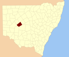
Location in New South Wales
Lands administrative divisions around Woore:
Werunda Rankin Booroondarra
Werunda Woore Mossgiel
Livingstone Manara Mossgiel

Woore County was named in honour of Commissioner of Crown Lands John C Woore.[1]

Parishes within this county

A full list of parishes found within this county; their current LGA and mapping coordinates to the approximate centre of each location is as follows:

ParishLGACoordinates
Baden ParkCentral Darling Shire32°10′34″S 144°12′43″E
BambillaCentral Darling Shire32°17′05″S 144°17′14″E
BannyCobar Shire32°02′28″S 144°18′22″E
BarchamCobar Shire32°19′50″S 144°45′59″E
BerangabahCobar Shire32°16′42″S 144°32′10″E
BoingadahCentral Darling Shire32°22′00″S 144°23′59″E
BroughhamCobar Shire
BullaCobar Shire31°50′38″S 144°34′33″E
BullberryCentral Darling Shire32°34′06″S 144°19′40″E
CarringtonCobar Shire32°06′51″S 144°46′52″E
CathkinCentral Darling Shire32°10′35″S 144°02′03″E
CoorubaCentral Darling Shire32°27′43″S 144°28′45″E
EmeraldCobar Shire31°55′54″S 144°45′34″E
EmeraldCobar Shire31°58′01″S 144°45′35″E
EurugabahCobar Shire32°12′57″S 144°40′26″E
HannCentral Darling Shire32°05′32″S 144°08′09″E
HayCentral Darling Shire32°21′17″S 143°57′08″E
KerpaCentral Darling Shire32°16′22″S 143°55′25″E
KewCobar Shire32°05′47″S 144°21′25″E
KoorinyaCobar Shire32°06′39″S 144°32′29″E
KulkiCobar Shire32°12′31″S 144°56′32″E
LantyCobar Shire32°10′01″S 144°27′30″E
ManaraCentral Darling Shire
MarfieldCentral Darling Shire32°30′48″S 144°12′27″E
MoamaCobar Shire
NekarbooCobar Shire
SandyCobar Shire32°13′32″S 144°22′10″E
TemoungaCobar Shire32°00′34″S 144°41′39″E
TiltagaraCobar Shire31°54′01″S 144°37′27″E
TooranieCentral Darling Shire32°15′37″S 144°05′03″E
Warra WigraCobar Shire32°22′27″S 144°36′31″E
WidgeeCentral Darling Shire32°21′17″S 144°10′12″E
gollark: no.
gollark: This is a highly quality image.
gollark: I wonder if it's still around at home somewhere.
gollark: Amazon. I guess whoever bought it didn't notice which edition it was.
gollark: (this was purchased by accident)

References

  1. "Woore". Geographical Names Register (GNR) of NSW. Geographical Names Board of New South Wales. Retrieved 11 August 2013.
This article is issued from Wikipedia. The text is licensed under Creative Commons - Attribution - Sharealike. Additional terms may apply for the media files.