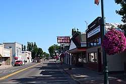
Wisconsin Highway 87
State Trunk Highway 87 (often called Highway 87, STH-87 or WIS 87) is a state highway in the U.S. state of Wisconsin. It runs north–south in northwest Wisconsin from St. Croix Falls to Grantsburg. It was first designated as a state highway in 1924.
| ||||
|---|---|---|---|---|
| Route information | ||||
| Maintained by WisDOT | ||||
| Length | 25.82 mi[1] (41.55 km) | |||
| Major junctions | ||||
| South end | ||||
| North end | ||||
| Location | ||||
| Counties | Polk, Burnett | |||
| Highway system | ||||
| ||||
Route description

The highway begins at an intersection with US Highway 8 (US 8) in St. Croix Falls, just east of the St. Croix River. The highway runs north from the intersection, running along Washington Street in St. Croix. The highway then follows the St. Croix River until it curves to the west. Soon after, the highway swerves a to the west and meets County Trunk Highway I (CTH-I), running north from it. It then passes through Eureka Center and a one-mile (1.6 km) concurrency with CTH-G before reaching Cushing, from where it runs one mile (1.6 km) to the west before continuing north. The highway then passes by a few lakes and the community of Trade River, and then runs east of Fish Lake Wildlife Area. While running east of the Wildlife Area, it runs concurrently with WIS 48. After the Wildlife Area's boundary ends, the highway passes through Branstad before terminating with WIS 48 at WIS 70 in Grantsburg.[2]
History
In 1923, the highway in its entirety was signed as CTH-F.[3] The next year, it was signed as WIS 87 alongside WIS 48, which it runs concurrently with near Grantsburg.[4] The highway was unpaved along its entire route and would stay that way until at least 1956.[5]
Major intersections
| County | Location | mi[2] | km | Destinations | Notes |
|---|---|---|---|---|---|
| Polk | St. Croix Falls | 0.0 | 0.0 | ||
| St. Croix Falls–Eureka line | 4.9 | 7.9 | |||
| Eureka | 9.9 | 15.9 | Southern end of CTH-G concurrency | ||
| Eureka–Sterling– Luck tripoint | 10.9 | 17.5 | Northern end of CTH-G concurrency | ||
| Sterling | 11.9 | 19.2 | |||
| Burnett | Anderson | 18.7 | 30.1 | ||
| 20.7 | 33.3 | ||||
| 22.2 | 35.7 | Southern end of WIS 48 concurrency | |||
| Grantsburg | 26.8 | 43.1 | Northern end of WIS 48 concurrency; WIS 48 ends at this intersection | ||
1.000 mi = 1.609 km; 1.000 km = 0.621 mi
| |||||
References
- Bessert, Chris. "Wisconsin Highways: Highways 80-89 (Highway 87)". Wisconsin Highways. Retrieved March 20, 2007.
- Google (April 11, 2020). "Length and Route of Highway 87" (Map). Google Maps. Google. Retrieved April 11, 2020.
- Wisconsin Motorists Association (1923). Our Own Map of Wisconsin (Map). Scale not given. Milwaukee: Wisconsin Motorists Association. OCLC 318360666. Retrieved April 11, 2020 – via Wisconsin Historical Society.
- Wisconsin Motorists Association (1924). Our Map of Wisconsin (Map). Scale not given. Milwaukee: Wisconsin Motorists Association. OCLC 664274042. Retrieved April 11, 2020 – via Wisconsin Historical Society.
- Wisconsin Highway Commission (1956). "Wisconsin State Atlas 1956 Highway Maps". Madison: Wisconsin Highway Commission. Retrieved April 11, 2020 – via Historic Map Works.
