Wisconsin Highway 161
State Trunk Highway 161 (often called Highway 161, STH 161 or WIS 161) is a 22.42-mile (36.08 km) state highway in Portage and Wuapaca counties in central Wisconsin, United States. It runs in east–west from U.S. Route 10 (northwest of Amherst Junction) via Iola to the junction Wisconsin Highway 22 and Wisconsin Highway 110 (just west of Symco).
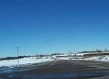
Looking west from the eastern terminus of WIS 161, just west of Symco, February 2001
| ||||
|---|---|---|---|---|
| Route information | ||||
| Maintained by WisDOT | ||||
| Length | 22.42 mi[1] (36.08 km) | |||
| Existed | 1923–present | |||
| Major junctions | ||||
| West end | ||||
| East end | ||||
| Location | ||||
| Counties | ||||
| Highway system | ||||
| ||||

Route description
Major intersections
| County | Location | mi | km | Destinations | Notes |
|---|---|---|---|---|---|
| Portage | | 0.0 | 0.0 | Western terminus | |
| Waupaca | Iola | Western end of concurrency with WIS 49 | |||
| Eastern end of concurrency with WIS 49 | |||||
| | 22.42 | 36.08 | Eastern terminus | ||
1.000 mi = 1.609 km; 1.000 km = 0.621 mi
| |||||
gollark: Or, well, non-university-and-up education.
gollark: I mean, I think most of the education system is pretty much only good at producing conformity and inefficiently doing rote-learning.
gollark: The emu war was a terrible time.
gollark: I would prefer if they did fewer things and took less money as taxes.
gollark: Um. No.
See also
- List of state highways in Wisconsin
References
- Bessert, Chris. "Wisconsin Highways: Highways 160-169 (Highway 161)". Wisconsin Highways. Retrieved 2007-03-20.
This article is issued from Wikipedia. The text is licensed under Creative Commons - Attribution - Sharealike. Additional terms may apply for the media files.