Wisconsin Highway 153
State Trunk Highway 153 (often called Highway 153, STH-153 or WIS 153) is a state highway in the U.S. state of Wisconsin. It runs in east–west in central Wisconsin from Spencer to Tigerton, passing through Mosinee and Stratford. The highway was originally designated in 1925 and was extended sometime between 1948 and 1956.
| ||||
|---|---|---|---|---|
| Route information | ||||
| Maintained by WisDOT | ||||
| Length | 61.25 mi[1] (98.57 km) | |||
| Major junctions | ||||
| West end | ||||
| East end | ||||
| Location | ||||
| Counties | Marathon, Shawano | |||
| Highway system | ||||
| ||||

Route description
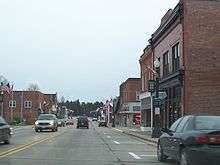
The highway begins at its intersection with WIS 13 and 153rd Road north of Stratford and continues eastward from it. It passes by WIS 97 (North Weber Avenue) in Stratford and various small communities before it enters Moisinee. The highway runs through downtown Mosinee and intersects with County Trunk Highway B (CTH-B, Main Street) and continues east on Main Street before running south on Old Highway 51 for a short distance before continuing east, passing through an interchange with Interstate 39 (I-39) and US Highway 51 (US 51) and by Central Wisconsin Airport. The highway runs south through a short concurrency with CTH-J before running east from it. It later runs north towards Mission Lake Road and continues east along its alignment, intersecting WIS 49 before ending at US 45 in the town of Wittenberg.[2]
History
The WIS 153 designation first appeared on the state highway map in 1925 as an unpaved route from WIS 97 in Stratford to WIS 10 in Mosinee. The section west of WIS 97 was signed as CTH-M.[3] In 1927, the same year WIS 10 was redesignated as US 51, a section east of US 51 was signed as CTH-K.[4] In 1939, a bill proposing an extension of the highway was heard in the Wisconsin Legislature, though this was indefinitely postponed.[5] This extension would end up being built sometime between 1948 and 1956, extending the highway west along the CTH-M (By then CTH-B) alignment to WIS 13 and east along the CTH-K alignment to WIS 49. The original section of the highway was also paved around this time.[6][7]
Major intersections
| County | Location | mi[2] | km | Destinations | Notes |
|---|---|---|---|---|---|
| Marathon | Town of Brighton | 0.0 | 0.0 | ||
| Stratford | 11.3 | 18.2 | |||
| Town of Emmet | 22.8 | 36.7 | |||
| Mosinee | 29.9 | 48.1 | |||
| 31.3 | 50.4 | ||||
| Town of Reid | 42.8 | 68.9 | Northern end of CTH-J concurrency | ||
| Reid–Bevent town line | 43.8 | 70.5 | Southern end of CTH-J concurrency | ||
| Elderon | 54.7 | 88.0 | |||
| Shawano | Town of Wittenberg | 61.1 | 98.3 | ||
1.000 mi = 1.609 km; 1.000 km = 0.621 mi
| |||||
References
- Bessert, Chris. "Wisconsin Highways: Highways 150-159 (Highway 153)". Wisconsin Highways. Retrieved March 20, 2007.
- Google (April 2, 2020). "State Trunk Highway 153 Route" (Map). Google Maps. Google. Retrieved April 2, 2020.
- Wisconsin State Highway Commission (1925). Official Highway Map of Wisconsin: 'The Playground of the Middle West' (Map). 1:1,203,840. Madison: Wisconsin State Highway Commission. OCLC 829937616. Retrieved April 11, 2020 – via Wisconsin Historical Society.
- Wisconsin State Highway Commission (1927). Official Highway Map of Wisconsin: 'The Playground of the Middle West' (Map). 1:950,400. Madison: Wisconsin State Highway Commission. OCLC 671337231. Retrieved April 11, 2020 – via Wisconsin Historical Society.
- Wisconsin Legislature (1939). Final Bulletin of the Proceedings of the Wisconsin Legislature. Madison: Wisconsin Legislature. p. 1033. Retrieved April 11, 2020 – via Google Books.
- Wisconsin State Highway Commission (1948). Preliminary Traffic Map, Showing Annual 24 Hour Average Traffic, State of Wisconsin (Map). c. 1:1,198,000. Madison: Wisconsin State Highway Commission. OCLC 770711221. Retrieved April 11, 2020 – via Wisconsin Historical Society.
- Wisconsin Highway Commission (1956). "Wisconsin State Atlas 1956 Highway Maps". Madison: Wisconsin Highway Commission. Retrieved April 11, 2020 – via Historic Map Works.