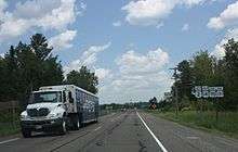
Wisconsin Highway 101
State Trunk Highway 101 (often called Highway 101, STH 101 or WIS 101) is a state highway in the U.S. state of Wisconsin. It runs south–north in northeast Wisconsin from US 8 in Armstrong Creek to WIS 70, US 2 and US 141 in Florence. WIS 101 meets WIS 70 near Keyes Lake, and the two highways run concurrently for 2.4 miles (3.9 km) until their shared terminus. The highway also serves the community of Fence and the areas surrounding the Pine and Popple rivers. WIS 101 is maintained by the Wisconsin Department of Transportation.
| ||||
|---|---|---|---|---|
| Route information | ||||
| Maintained by WisDOT | ||||
| Length | 23.54 mi[1] (37.88 km) | |||
| Major junctions | ||||
| South end | ||||
| North end | ||||
| Location | ||||
| Counties | Forest, Florence | |||
| Highway system | ||||
| ||||
Route description

WIS 101 begins at a junction with US 8 in Armstrong Creek in eastern Forest County. The highway heads north through the Town of Armstrong Creek, intersecting County Highway F near three lakes.[2] From here the route crosses into Florence County, where it meets County Highway C west of the community of Fence. It continues northward through the forested Town of Fence, crossing the Popple River near a wayside. Past the river, the highway enters the Town of Fern. After running through the community of Fern, the route turns to the east near Price Lake. It turns northward again to pass through a forested area with many lakes, intersecting County Highway D in this area. After passing a county park by Keyes Lake, WIS 101 intersects WIS 70 in the Town of Commonwealth, and the two highways head eastward concurrently. The routes turn northeast into the Town of Florence, where they both terminate at US 2 and US 141 in western Florence.[3][4]
Major intersections
| County | Location | mi[4] | km | Destinations | Notes |
|---|---|---|---|---|---|
| Forest | Community of Armstrong Creek | 0.0 | 0.0 | Southern terminus of WIS 101 | |
| Town of Armstrong Creek | 4.2 | 6.8 | |||
| Florence | Town of Fence | 6.4 | 10.3 | ||
| Town of Fern | 19.3 | 31.1 | |||
| Town of Commonwealth | 21.2 | 34.1 | South end of WIS 70 concurrency | ||
| Community of Florence | 23.6 | 38.0 | North end of WIS 70 concurrency; northern terminus of WIS 101; eastern terminus of WIS 70 | ||
1.000 mi = 1.609 km; 1.000 km = 0.621 mi
| |||||
References
| Wikimedia Commons has media related to Wisconsin Highway 101. |
- Bessert, Chris. "Wisconsin Highways: Highways 100-109 (Highway 101)". Wisconsin Highways. Retrieved 2007-03-20.
- Forest County (PDF) (Map). Wisconsin Department of Transportation. 2011. Retrieved December 22, 2011.
- Florence County (PDF) (Map). Wisconsin Department of Transportation. 2011. Retrieved December 22, 2011.
- Google (December 22, 2011). "Overview map of Highway 101" (Map). Google Maps. Google. Retrieved December 22, 2011.
